Wayside shrine
Location: St. Jakob im Rosental
GPS coordinates: 46.54764,14.08801
Latest update: November 20, 2025 10:05
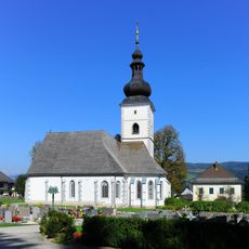
Parish church Maria Elend
2.1 km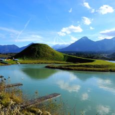
Zikkurat-Drauwelle
1.2 km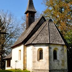
Filialkirche hl. Oswald, St. Jakob i. R.
2.2 km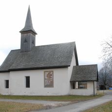
Kath. Filialkirche St. Leonhard zu Selkach
768 m
Pfarrhof Maria Elend
2.1 km
Hemmastock
1.8 km
Wayside cross
1.7 km
Work of art, sculpture
559 m
Scenic viewpoint
1.3 km
Saligensitze
2 km
Teufelskanzel (Racava)
1.9 km
Wayside shrine
1.6 km
Wayside shrine
2.2 km
Wayside shrine
1.7 km
Zikurat Selkach-Želuče
1.2 km
Wayside cross
2.1 km
Skulptur von Marko Pogacnik
1.9 km
Wayside shrine
1.5 km
Macnjakov kriz
2.3 km
Happekreuz
2.1 km
Schimankreuz
1.8 km
Wayside shrine
2.2 km
Catholic church building, wayside cross
584 m
Wayside cross
2 km
Memorial, war memorial
557 m
Wayside shrine
1.1 km
Memorial, memorial stone
1.8 km
Wayside shrine
753 mReviews
Visited this place? Tap the stars to rate it and share your experience / photos with the community! Try now! You can cancel it anytime.
Discover hidden gems everywhere you go!
From secret cafés to breathtaking viewpoints, skip the crowded tourist spots and find places that match your style. Our app makes it easy with voice search, smart filtering, route optimization, and insider tips from travelers worldwide. Download now for the complete mobile experience.

A unique approach to discovering new places❞
— Le Figaro
All the places worth exploring❞
— France Info
A tailor-made excursion in just a few clicks❞
— 20 Minutes