Wayside shrine
Location: Blégiers
Location: Prads-Haute-Bléone
GPS coordinates: 44.16192,6.46584
Latest update: November 11, 2025 07:17
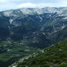
Cheval-Blanc mountain
5.1 km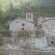
Église Notre-Dame-de-l’Assomption de Beaujeu
8.9 km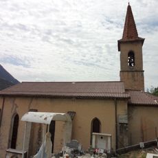
Église Sainte-Anne de Prads
6.7 km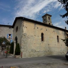
Église Notre-Dame de Blégiers
4.3 km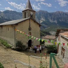
Église Saint-Laurent de Chavailles
385 m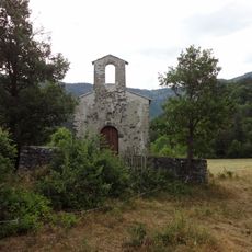
Église Notre-Dame de Beauvezer de Champourçin
6.2 km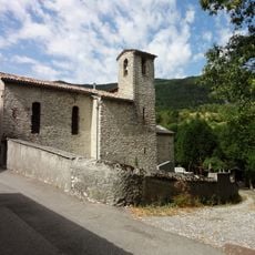
Église Saint-Jean-Baptiste de Chanolles
3.8 km
Sommet de Pompe
6.2 km
L'Isoard
8.5 km
Sommet de Chappe
6.6 km
Sommet de la Colle
2.2 km
Sommet de Denjuan
5.9 km
Sommet de Triey
5.8 km
Memorial
5.3 km
Waterfall
7.2 km
Memorial
2.8 km
Memorial
3.9 km
Wayside cross
8.8 km
Ancienne école
4.2 km
Monument aux morts
6.7 km
Wayside shrine
8.5 km
Waterfall
7.1 km
Waterfall
7.1 km
Waterfall
7.3 km
Waterfall
7.1 km
Waterfall
7.1 km
Waterfall
7.2 km
Waterfall
7.5 kmReviews
Visited this place? Tap the stars to rate it and share your experience / photos with the community! Try now! You can cancel it anytime.
Discover hidden gems everywhere you go!
From secret cafés to breathtaking viewpoints, skip the crowded tourist spots and find places that match your style. Our app makes it easy with voice search, smart filtering, route optimization, and insider tips from travelers worldwide. Download now for the complete mobile experience.

A unique approach to discovering new places❞
— Le Figaro
All the places worth exploring❞
— France Info
A tailor-made excursion in just a few clicks❞
— 20 Minutes