Wayside cross, Catholic church building
Location: Verreries-de-Moussans
GPS coordinates: 43.45263,2.69981
Latest update: November 24, 2025 10:04
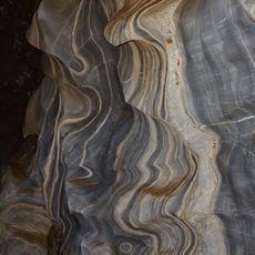
Grottes de la Devèze-Roquebleue
2.6 km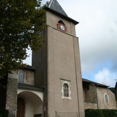
Église de la Nativité-de-Notre-Dame de Courniou
2.5 km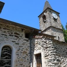
Église Saint-Thomas des Verreries-de-Moussans
1.3 km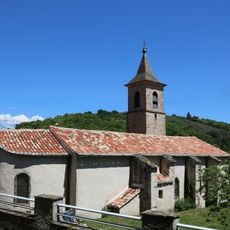
Église Saint-Fabien de Prouilhe
4.9 km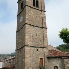
Église Saint-Saturnin-de-Bison de Labastide-Rouairoux
5.3 km
Scenic viewpoint
2.2 km
Table d'orientation
2.8 km
Catholic church building, wayside cross
2.8 km
Memorial, war memorial
5 km
Le Roc
5 km
Memorial, war memorial
5.2 km
Aux martyrs de la Resistance
1.3 km
Memorial
4.6 km
Lautié
1.8 km
Orus The Moon Bird
5.1 km
Statue de la Vierge
3.3 km
Memorial
5.2 km
Wayside cross
735 m
Wayside cross
5.2 km
Archaeological site, megalith, menhir
4.7 km
Wayside cross
4.7 km
Wayside cross
2.6 km
Wayside cross
4.9 km
Monument commémoratif de la Résistance août 1944
1.3 km
Stèle commémorative du 21 août 1944
2.6 km
Balue
2.3 km
La Sagnette
5.1 km
Wayside cross
1.7 kmVisited this place? Tap the stars to rate it and share your experience / photos with the community! Try now! You can cancel it anytime.
Discover hidden gems everywhere you go!
From secret cafés to breathtaking viewpoints, skip the crowded tourist spots and find places that match your style. Our app makes it easy with voice search, smart filtering, route optimization, and insider tips from travelers worldwide. Download now for the complete mobile experience.

A unique approach to discovering new places❞
— Le Figaro
All the places worth exploring❞
— France Info
A tailor-made excursion in just a few clicks❞
— 20 Minutes