High water mark
Location: Monheim am Rhein
Inscription: ca. 10 Tage im Jahr / Pegel Düsseldorf / 6,8 Meter
GPS coordinates: 51.12859,6.89408
Latest update: November 22, 2025 07:54
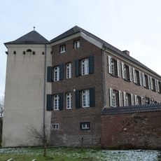
Haus Bürgel
1.5 km
St. Matthäus
1.2 km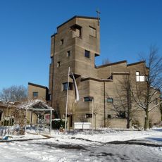
Friedenskirche (Monheim-Baumberg)
1.2 km
St. Hildegardis
1.2 km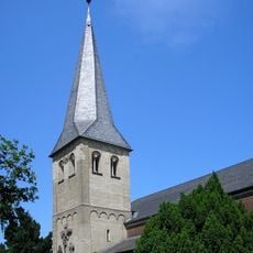
St. Dionysius
1.5 km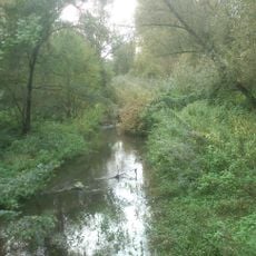
Urdenbacher Altrhein und Baumberger Aue
466 m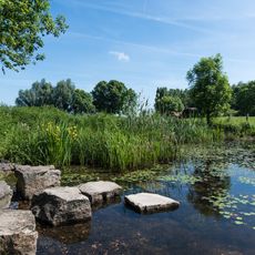
LSG-Urdenbacher Altrhein <Raumeinheit D>
1.5 km
Archäologisches Museum Haus Bürgel
1.5 km
Wayside cross, Christianity
1.4 km
Memorial stone, memorial
1.4 km
Blick in den alten Rhein
277 m
Memorial
1.5 km
Wayside shrine, Christianity
632 m
Obelisk, memorial
1.5 km
Happy-Shop Dalmis
732 m
Baumberger Altstadtviertel
1.6 km
Passionskreuz
1.5 km
Scenic viewpoint
232 m
Gedenkstein 700 Jahre Baumberg
1.5 km
Memorial, war memorial
1.5 km
Wayside cross
1.6 km
Memorial, statue
1 km
High water mark
244 m
High water mark
0 m
Olga Podmariowa
1.2 km
Antonius Kosupskij
1.4 km
Iwan Kosupskij
1.4 km
Tatjana Kosupskij
1.4 kmReviews
Visited this place? Tap the stars to rate it and share your experience / photos with the community! Try now! You can cancel it anytime.
Discover hidden gems everywhere you go!
From secret cafés to breathtaking viewpoints, skip the crowded tourist spots and find places that match your style. Our app makes it easy with voice search, smart filtering, route optimization, and insider tips from travelers worldwide. Download now for the complete mobile experience.

A unique approach to discovering new places❞
— Le Figaro
All the places worth exploring❞
— France Info
A tailor-made excursion in just a few clicks❞
— 20 Minutes