Minecart, vehicle
Location: Nunkirchen
Location: Wadern
GPS coordinates: 49.49011,6.83467
Latest update: November 20, 2025 01:23
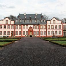
Schloss Münchweiler
1.3 km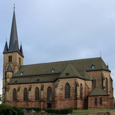
Herz-Jesu-Kirche
576 m
Burg Büschfeld
2.5 km
Zur Schmerzhaften Muttergottes
2.6 km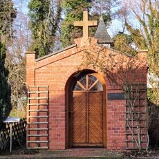
Antoniuskapelle
195 m
Naturschutzgebiet "Prims" (N 6507-301)
2.2 km
Schallenberg
2.4 km
Primsleite Überlosheim / Auschet
2 km
Überlosheimer Hang
1.7 km
Landschaftsschutzgebiet im Landkreis Saarlouis - im Bereich der Gemeinde Schmelz
2.4 km
Schatterberg / Primsaue - Schartenmühle
2.8 km
Wayside cross
1.9 km
Wayside cross
1.5 km
Aussichtspunkt "Auschet"
1.5 km
Golfclub Weiherhof e.V.
2 km
Schartermühle
2.8 km
Wayside cross
2.1 km
Wegkreuz Peter Feller
2 km
Wegkreuz
2.2 km
Wayside cross
1.7 km
Aussichtspunkt "Kälberfels"
2.4 km
Wappenkreuz von Münchweiler
1.6 km
Catholic church building, wayside cross, Christianity
1.8 km
Lourdesgrotte beim Rammenfels
1.8 km
Wayside cross
952 m
Christianity, Catholic church building, wayside cross
671 m
Wayside cross
1.1 km
Catholic church building, wayside cross, Christianity
1.1 kmReviews
Visited this place? Tap the stars to rate it and share your experience / photos with the community! Try now! You can cancel it anytime.
Discover hidden gems everywhere you go!
From secret cafés to breathtaking viewpoints, skip the crowded tourist spots and find places that match your style. Our app makes it easy with voice search, smart filtering, route optimization, and insider tips from travelers worldwide. Download now for the complete mobile experience.

A unique approach to discovering new places❞
— Le Figaro
All the places worth exploring❞
— France Info
A tailor-made excursion in just a few clicks❞
— 20 Minutes