Tour du cap Ferrat, Coastal loop trail in Saint-Jean-Cap-Ferrat, France.
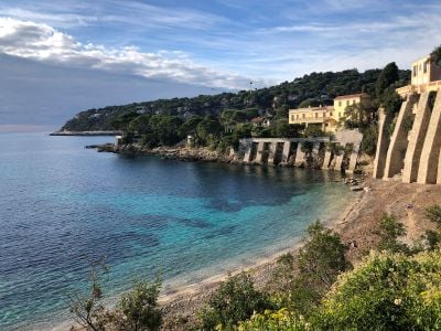
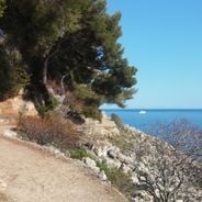
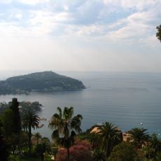
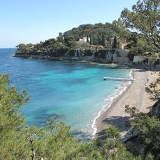
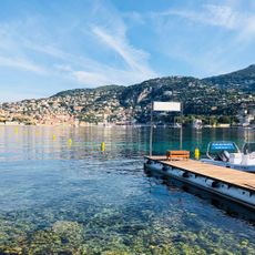
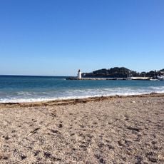
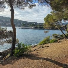
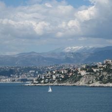
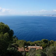
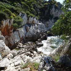
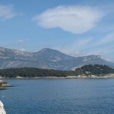
This circular route extends approximately six to ten kilometers along the Mediterranean coastline, passing rocky cliffs, small beaches, and Mediterranean vegetation while offering views of the sea and surrounding bays.
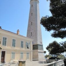
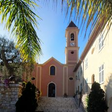
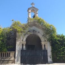
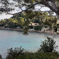
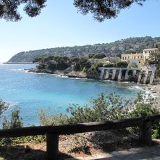
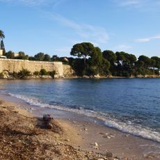
The peninsula has been inhabited since ancient times, with archaeological evidence of Roman settlements, and later became a retreat for European nobility during the twentieth century, hosting several historic villas.
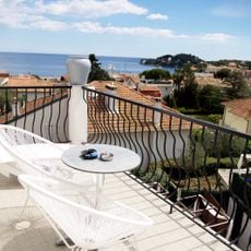
The area reflects traditional Mediterranean architecture with terracotta roofs and stone facades, and local communities maintain fishing traditions and celebrate festivals highlighting regional cuisine and maritime heritage.
The trail begins at Chemin des Douaniers or near Plage des Fossettes, with parking available in Saint-Jean-Cap-Ferrat, and walkers should wear sturdy footwear due to uneven terrain and carry water and sun protection.
The route provides access to hidden coves and lookout points where visitors can observe seabirds nesting on cliffs and enjoy the varying shades of blue and turquoise in the clear Mediterranean waters.
Location: Saint-Jean-Cap-Ferrat
Reference: 49
Operator: Département des Alpes-Maritimes
Address: 99 Chem. des Douaniers, 06230 Saint-Jean-Cap-Ferrat, France 06230 Saint-Jean-Cap-Ferrat
Website: https://randoxygene.departement06.fr/littoral/tour-du-cap-ferrat-9335.html
GPS coordinates: 43.68416,7.32782
Latest update: November 24, 2025 07:56
Between Nice and Monaco, coastal trails provide the opportunity to explore the Mediterranean coastline through various routes. The Cap d'Ail Coastal Path, Nietzsche's Path in Èze with 400 meters of elevation gain, and the Mont Boron Park in Nice with its 11 kilometers of marked trails allow exploration of the region from different perspectives. These routes alternate between seaside sections and uphill segments, offering views over the coast and inland areas. The geological diversity of the region is evident in the limestone cliffs lining the Route des Crêtes between La Ciotat and Cassis, the rock formations of Cap d'Ail, and the red rocks of the Esterel Massif. Further inland, the Verdon Gorges feature a canyon 700 meters deep, while the Mercantour National Park houses the Sentier des Géants within its ancient forest. The historical heritage marks these routes: the Nice Observatory on Mont Gros dates from the 19th century, Fort La Revere overlooks the coast from 696 meters altitude, and Saint-Honorat Island preserves its active monastery. These trails serve as direct accesses to the nature and history of the French Riviera.
Grand-Hôtel du Cap-Ferrat
911 m
Propriété Santo Sospir
857 m
Jardin botanique "Les Cèdres"
839 m
Villa Fiorentina
387 m
Plage de Passable
1.1 km
Cap Ferrat Phare
989 m
Villa La Ligne Droite
1 km
Cros dei Pin beach
1 km
Église Saint-Jean-Baptiste
847 m
Coexist Fountain
989 m
Scenic viewpoint
962 m
Chapelle de la Pointe de la Rascasse
1.7 km
Scenic viewpoint
264 m
Plage des fossettes
965 m
Paloma beach
1.2 km
Scenic viewpoint
372 m
Scenic viewpoint
980 m
Plage des fosses
673 m
Scenic viewpoint
788 m
Scenic viewpoint
523 m
Scenic viewpoint
443 m
Plage de la Gavinette
534 m
Plage des Fosses
780 m
Snack Deï Pin
959 m
Butt
987 m
Statue, Work of art
961 m
Léopold II
536 m
Memorial
1.8 kmReviews
Visited this place? Tap the stars to rate it and share your experience / photos with the community! Try now! You can cancel it anytime.
Discover hidden gems everywhere you go!
From secret cafés to breathtaking viewpoints, skip the crowded tourist spots and find places that match your style. Our app makes it easy with voice search, smart filtering, route optimization, and insider tips from travelers worldwide. Download now for the complete mobile experience.
A unique approach to discovering new places❞
— Le Figaro
All the places worth exploring❞
— France Info
A tailor-made excursion in just a few clicks❞
— 20 Minutes