Enable Location

We need your location to show you interesting places around you

Discover nearby places

Find interesting locations and hidden gems around you

Precise directions

Get accurate directions and distances to places

Your location is never shared with other users. It's only used when you tap the location button.

Blatenský vrch

Log in to your account

Start exploring — it's free

Trusted by 62,374 travelers worldwide

Continue with Google
Continue with Apple
or

We will send you a code to connect

By continuing, you accept our Terms and Conditions and our Privacy Policy

Check your inbox

We've sent a pincode in your inbox. Please enter the code below.

Blatenský vrch

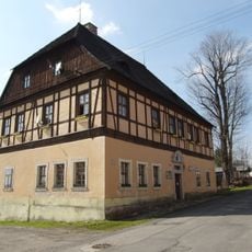
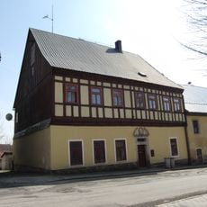
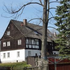
Blatenský vrch, Mountain and observation tower in Potůčky, Czech Republic.

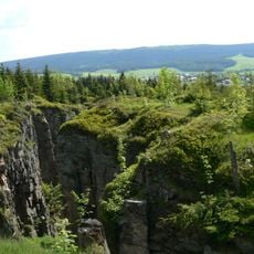
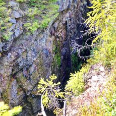
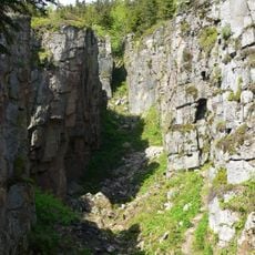
Blatenský vrch is a granite mountain reaching about 1,043 meters in the Ore Mountains, topped with a television tower and observation platform at its summit. The structure commands views of the surrounding landscape and serves as a key landmark for visitors exploring the region.

Construction of the observation tower started in 1912 and was completed in 1913, with the original name honoring Austro-Hungarian royalty. The structure represents early 20th century engineering in this border region.

The tower's original name reflects the Austro-Hungarian period when the region was part of that empire. Today it draws visitors who appreciate both the views and the local connection to that historical identity.

The tower is open daily from April to October and on weekends during winter months. Visitors should wear proper footwear since accessing the platform involves climbing steps.

Three different hiking trails reach the summit, ranging from about 5 to 19 kilometers, each suited to different fitness levels. These varied routes let visitors choose an experience matching their time and ability.

The community of curious travelers

AroundUs brings together thousands of curated places, local tips, and hidden gems, enriched daily by 60,000 contributors worldwide.

Start exploring
Location
Elevation above the sea
1,043 m
Made from material
granite
GPS coordinates
50.40021,12.78167
Latest update
December 12, 2025 09:08
Around this place
Vlčí jámy
Czech Republic

Vlčí jámy

289 m
Zuzana mine
Czech Republic

Zuzana mine

1.4 km
Saint Lawrence church in Horní Blatná
Czech Republic

Saint Lawrence church in Horní Blatná

1.4 km
Vlčí jámy
Czech Republic

Vlčí jámy

273 m
Muzeum (Horní Blatná, Česko)
Czech Republic

Muzeum (Horní Blatná, Česko)

1.3 km
Kobaltový mlýn
Czech Republic

Kobaltový mlýn

1.7 km
Saint Cross chapel in Horní Blatná
Czech Republic

Saint Cross chapel in Horní Blatná

1.6 km
Evangelical church
Czech Republic

Evangelical church

1.2 km
Chapel of Saint Michael
Czech Republic

Chapel of Saint Michael

1.5 km
Statue of Saint Joseph in Horní Blatná
Czech Republic

Statue of Saint Joseph in Horní Blatná

1.4 km
Townhouse Nr.127 in Horní Blatná
Czech Republic

Townhouse Nr.127 in Horní Blatná

1.3 km
Statue of Saint Adalbert in Horní Blatná
Czech Republic

Statue of Saint Adalbert in Horní Blatná

1.4 km
Rectory in Horní Blatná
Czech Republic

Rectory in Horní Blatná

1.3 km
Townhouse Nr.6 in Horní Blatná
Czech Republic

Townhouse Nr.6 in Horní Blatná

1.4 km
Townhouse Nr.113 in Horní Blatná
Czech Republic

Townhouse Nr.113 in Horní Blatná

1.3 km
Chapel of Holy Cross
Czech Republic

Chapel of Holy Cross

1.4 km
Sousoší Piety
Czech Republic

Sousoší Piety

1.6 km
Statue of John of Nepomuk in Horní Blatná
Czech Republic

Statue of John of Nepomuk in Horní Blatná

1.3 km
Townhouse Nr.28 in Horní Blatná
Czech Republic

Townhouse Nr.28 in Horní Blatná

1.6 km
Townhouse Nr.29 in Horní Blatná
Czech Republic

Townhouse Nr.29 in Horní Blatná

1.5 km
Townhouse Nr.4 in Horní Blatná
Czech Republic

Townhouse Nr.4 in Horní Blatná

1.4 km
Památník vzniku první republiky v Horní Blatné
Czech Republic

Památník vzniku první republiky v Horní Blatné

1.4 km
Kašna na Náměstí svatého Vavřince v Horní Blatné
Czech Republic

Kašna na Náměstí svatého Vavřince v Horní Blatné

1.3 km
Meteorological column in Horní Blatná
Czech Republic

Meteorological column in Horní Blatná

1.3 km
Hřbitovní kaple v Horní Blatné
Czech Republic

Hřbitovní kaple v Horní Blatné

1.6 km
Chapel of Saint Anne
Czech Republic

Chapel of Saint Anne

1.3 km
Kříž na rozcestí Bezručovy a Tovární ulice v Horní Blatné
Czech Republic

Kříž na rozcestí Bezručovy a Tovární ulice v Horní Blatné

1.1 km
Pamětní deska Adalberta Hahna na kapli svatého Kříže v Horní Blatné
Czech Republic

Pamětní deska Adalberta Hahna na kapli svatého Kříže v Horní Blatné

1.6 km
Show the full map
« Blatenský vrch - Mountain and observation tower in Potůčky, Czech Republic » is provided by Around Us (aroundus.com). Images and texts are derived from Wikimedia project under a Creative Commons license. You are allowed to copy, distribute, and modify copies of this page, under the conditions set by the license, as long as this note is clearly visible.

Discover hidden gems everywhere you go!

From secret cafés to breathtaking viewpoints, skip the crowded tourist spots and find places that match your style. Our app makes it easy with voice search, smart filtering, route optimization, and insider tips from travelers worldwide. Download now for the complete mobile experience.

Around Us App Screenshot

A unique approach to discovering new places

Le Figaro

All the places worth exploring

France Info

A tailor-made excursion in just a few clicks

20 Minutes

Around Us
Travel Guide & Maps
Download

Send to your phone

QR Code
1

Open the camera app on your mobile.

2

Point at the QR code with your camera. A notification will appear.

3

Tap the notification to open the link.