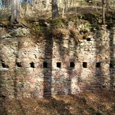
Příběnice, Gothic castle ruin near River Lužnice, Czech Republic
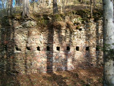
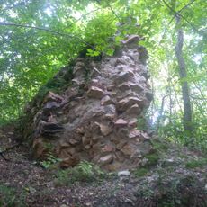
Příběnice is a castle ruin from the Gothic period sitting on a steep rocky point above the Lužnice River. The remains include fragments of an octagonal tower, palace foundations, and defensive walls that show how the building was laid out.
The castle was founded in the 13th century by the Rožmberk family as a regional stronghold. In 1420 it was taken by Hussite forces, and later it was destroyed following agreements tied to Emperor Sigismund's rule.
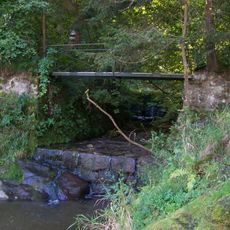
The site reflects how medieval people built defensive strongholds in natural settings, choosing the riverside promontory for protection and control. The placement shows practical thinking about land and water resources that mattered to those living here.
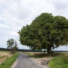
The site is best reached on foot by following the river path from the Tábor area. The terrain is steep and rocky, so sturdy shoes and care are needed when walking around the ruins.
The castle has an elongated shape deliberately designed to fit the rocky promontory and provide defensive positions along its length. Hidden beneath the surface, the foundations reveal evidence of a small internal courtyard, showing how cleverly the space was used.
Location: Malšice
Founders: Witiko von Prčice und Blankenberg, Vok I of Rožmberk
Architectural style: Gothic architecture
GPS coordinates: 49.39292,14.56154
Latest update: December 8, 2025 19:49
Příběničky
361 m
Vlásenický potok
2.5 km
Holy Trinity Church in Malšice
3.6 km
Korandův smrk
142 m
Ruins of Příběnice lower settlement
227 m
Lávka přes ústí Slapského potoka do Lužnice
3.4 km
Pomník obětem I. odboje
3.6 km
Krucifix
3.7 km
Kaplička
3.5 km
Hrad Příběnice a hradní městečko, hrad Příběničky, zřícenina a archeologické stopy
0 m
Socha svatého Jana Nepomuckého v Malšicích
3.5 km
Dům čp. 2
4.2 km
Propustek pro bezjmenný potok u če. 38 v Dobřejicích
3.3 km
Lávka turistické stezky podél Lužnice přes Příběnický potok
914 m
Kovárna s chlévem
1.3 km
Usedlost čp. 10
3.4 km
Usedlost čp. 14
3.4 km
Usedlost čp. 42
3.6 km
Kříž západně od Dobřejic
4 km
Boží muka východně od Dobřejic
3.9 km
Kříž před kostelem v Malšicích
3.6 km
Boží muka při silnici mezi Hájky a Stádlcem
4.1 km
Kříž u Suchomelova mlýna východně od Slavňovic
2.8 km
Kotrbova kaplička
4.1 km
Kaple v Hájcích
3.9 km
Rectory
3.6 km
Matoušovský
3.4 km
Lávka turistické stezky podél Lužnice přes potok pod Hlavinami
2.8 kmVisited this place? Tap the stars to rate it and share your experience / photos with the community! Try now! You can cancel it anytime.
Discover hidden gems everywhere you go!
From secret cafés to breathtaking viewpoints, skip the crowded tourist spots and find places that match your style. Our app makes it easy with voice search, smart filtering, route optimization, and insider tips from travelers worldwide. Download now for the complete mobile experience.
A unique approach to discovering new places❞
— Le Figaro
All the places worth exploring❞
— France Info
A tailor-made excursion in just a few clicks❞
— 20 Minutes