Enable Location

We need your location to show you interesting places around you

Discover nearby places

Find interesting locations and hidden gems around you

Precise directions

Get accurate directions and distances to places

Your location is never shared with other users. It's only used when you tap the location button.

Veselí nad Lužnicí

Log in to your account

Start exploring — it's free

Trusted by 63,340 travelers worldwide

Continue with Google
Continue with Apple
or

We will send you a code to connect

By continuing, you accept our Terms and Conditions and our Privacy Policy

Check your inbox

We've sent a pincode in your inbox. Please enter the code below.

Discussion Reviews 1 Photos
11k Popularity

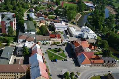
Veselí nad Lužnicí, Municipal town at the confluence of Lužnice and Nežárka rivers, Czech Republic

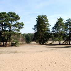
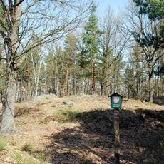
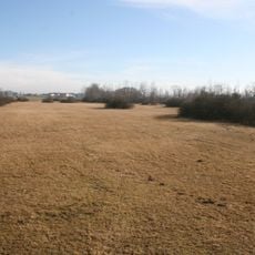
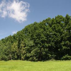
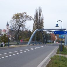
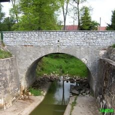
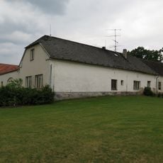
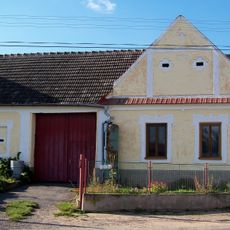
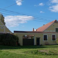
Veselí nad Lužnicí is a town situated where the Lužnice and Nežárka rivers meet, blending urban structures with pine forests and man-made lakes. The landscape shows how buildings and natural spaces coexist, with water features playing a key role in the town's layout.

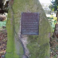
The settlement developed at a strategic point where two rivers meet and suffered severe destruction during the Thirty Years' War. The population dropped dramatically but gradually recovered over subsequent centuries.

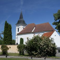
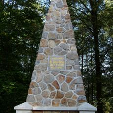
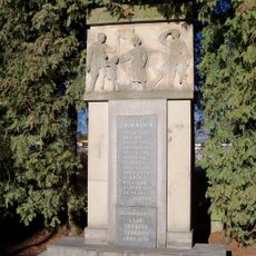
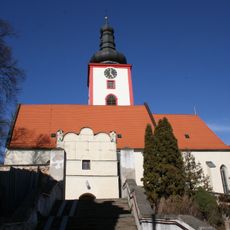
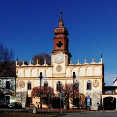
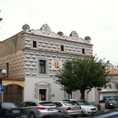
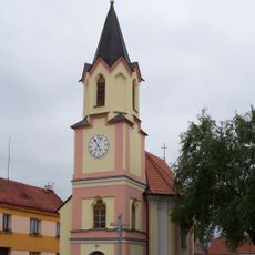
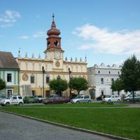
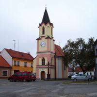
The Old Town Hall from 1616 and the Church of the Exaltation of the Holy Cross represent the primary architectural heritage of the municipality.

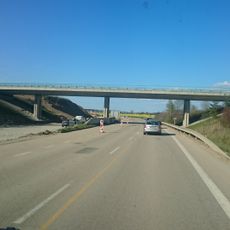
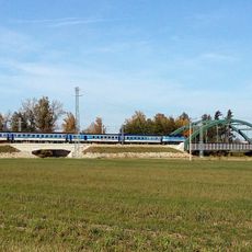
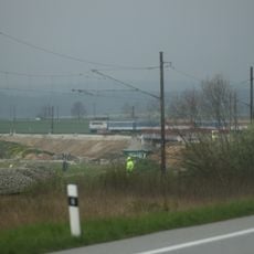
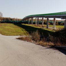
The town is well connected by rail to larger cities and functions as a regional transport hub for South Bohemia. Visitors can easily access nature and recreational facilities nearby.

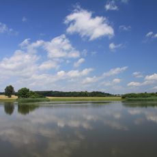
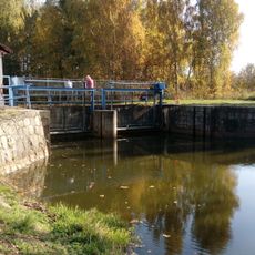
Several artificial lakes created between 1952 and 1986 now define the landscape, with one being the second-largest pond in the country. These water bodies have become key spots for recreation and leisure for both residents and visitors.

The community of curious travelers

AroundUs brings together thousands of curated places, local tips, and hidden gems, enriched daily by 60,000 contributors worldwide.

Start exploring
Location
Elevation above the sea
407 m
Shares border with
Vlkov, Ponědrážka, Bošilec, Sviny, Řípec, Zlukov, Žíšov, Drahov
GPS coordinates
49.18437,14.69736
Latest update
December 8, 2025 13:43
Around this place
Písečný přesyp u Vlkova
Czech Republic

Písečný přesyp u Vlkova

3 km
Church of Saint Martin in Bošilec
Czech Republic

Church of Saint Martin in Bošilec

5.1 km
Kozí vršek
Czech Republic

Kozí vršek

3.6 km
Horusická blata
Czech Republic

Horusická blata

4.4 km
Doubí u Žíšova
Czech Republic

Doubí u Žíšova

2.5 km
Farářský rybník
Czech Republic

Farářský rybník

3.4 km
Most přes dálnici D3 na exitu 107 ve Veselí nad Lužnicí
Czech Republic

Most přes dálnici D3 na exitu 107 ve Veselí nad Lužnicí

1.9 km
Bridge of railway line 220 over the Nežárka in Veselí nad Lužnicí
Czech Republic

Bridge of railway line 220 over the Nežárka in Veselí nad Lužnicí

1.1 km
Lávka za stavidlem na začátku Degárky
Czech Republic

Lávka za stavidlem na začátku Degárky

869 m
Most třídy Čs. armády přes Nežárku ve Veselí nad Lužnicí
Czech Republic

Most třídy Čs. armády přes Nežárku ve Veselí nad Lužnicí

460 m
Železniční most přes Bukovský potok u Bošilce
Czech Republic

Železniční most přes Bukovský potok u Bošilce

4.7 km
Monument to Jan Hus in Veselí nad Lužnicí
Czech Republic

Monument to Jan Hus in Veselí nad Lužnicí

532 m
Most Hamerské ulice přes přeloženou železniční trať ve Veselí nad Lužnicí
Czech Republic

Most Hamerské ulice přes přeloženou železniční trať ve Veselí nad Lužnicí

989 m
Pomník padlým I. a II. světové války
Czech Republic

Pomník padlým I. a II. světové války

1.1 km
Church of the Exaltation of the Holy Cross in Veselí nad Lužnicí
Czech Republic

Church of the Exaltation of the Holy Cross in Veselí nad Lužnicí

6 m
Bridge in Bošilec
Czech Republic

Bridge in Bošilec

5.1 km
Pomník Karla Weisse
Czech Republic

Pomník Karla Weisse

545 m
T. G. Masaryka Square No 110
Czech Republic

T. G. Masaryka Square No 110

366 m
Usedlost čp. 9
Czech Republic

Usedlost čp. 9

5.4 km
Muzeum
Czech Republic

Muzeum

372 m
Usedlost čp. 8
Czech Republic

Usedlost čp. 8

5.4 km
Usedlost čp. 22
Czech Republic

Usedlost čp. 22

3 km
Bridge of road I/24 over the Zlatá stoka nearby Podhrázský mlýn
Czech Republic

Bridge of road I/24 over the Zlatá stoka nearby Podhrázský mlýn

2.6 km
Chapel of Saint Florian in Veselí nad Lužnicí
Czech Republic

Chapel of Saint Florian in Veselí nad Lužnicí

675 m
Chapel of Saint Mark
Czech Republic

Chapel of Saint Mark

466 m
Usedlost čp. 12
Czech Republic

Usedlost čp. 12

3 km
Usedlost čp. 19
Czech Republic

Usedlost čp. 19

3.1 km
Usedlost čp. 7
Czech Republic

Usedlost čp. 7

2.9 km
Show the full map
Reviews
Share your experience

No review yet

Discussions
Start a discussion...

No discussion yet

« Veselí nad Lužnicí - Municipal town at the confluence of Lužnice and Nežárka rivers, Czech Republic » is provided by Around Us (aroundus.com). Images and texts are derived from Wikimedia project under a Creative Commons license. You are allowed to copy, distribute, and modify copies of this page, under the conditions set by the license, as long as this note is clearly visible.

Discover hidden gems everywhere you go!

From secret cafés to breathtaking viewpoints, skip the crowded tourist spots and find places that match your style. Our app makes it easy with voice search, smart filtering, route optimization, and insider tips from travelers worldwide. Download now for the complete mobile experience.

Around Us App Screenshot

A unique approach to discovering new places

Le Figaro

All the places worth exploring

France Info

A tailor-made excursion in just a few clicks

20 Minutes

Around Us
Travel Guide & Maps
Download

Send to your phone

QR Code
1

Open the camera app on your mobile.

2

Point at the QR code with your camera. A notification will appear.

3

Tap the notification to open the link.