Chest opened
+${chestReward.xp} XP
Explorer
NOUVEAU ×${chestReward.collectible.quantity}
tapez pour fermer
Chest locked

Open chests in the app

Around Us is built for your phone — chests unlock when you walk, explore and capture nearby places.

Enable Location

We need your location to show you interesting places around you

Discover nearby places

Find interesting locations and hidden gems around you

Precise directions

Get accurate directions and distances to places

Your location is never shared with other users. It's only used when you tap the location button.

Jihlava

Log in to your account

Start exploring — it's free

Trusted by 72,891 travelers worldwide

Continue with Google
Continue with Apple
or

We will send you a code to connect

By continuing, you accept our Terms and Conditions and our Privacy Policy

Check your inbox

We've sent a pincode in your inbox. Please enter the code below.

Jihlava
Discussion Reviews 1 Photos
11.8k Popularity

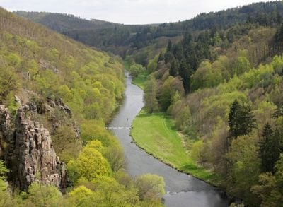
Jihlava, River system in Vysočina Region, Czech Republic

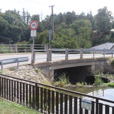
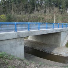
The Jihlava is a river in the Vysočina Region that flows through the Czech landscape, connecting multiple areas as it travels. The waterway winds through forests and valleys before merging with another river system downstream.

The river appeared in written records from monasteries dating back to the early 1200s, showing its long presence in the region. These early documents reveal that the waterway has held importance in the landscape for roughly eight centuries.

The name Jihlava has roots in older languages, possibly relating to water or movement through the landscape. Today, locals use the river for recreation and it shapes how people experience the region.

The river has several access points for water activities, particularly when water levels and seasonal conditions are favorable. Visitors can best explore different sections from the shore or join guided tours to experience the area properly.

A hydroelectric facility on this river uses two large reservoirs and supplies power to the region. The system shows how modern infrastructure shapes the traditional landscape today.

The community of curious travelers

AroundUs brings together thousands of curated places, local tips, and hidden gems, enriched daily by 60,000 contributors worldwide.

Start exploring
GPS coordinates
49.21275,15.94376
Latest update
December 7, 2025 20:49
Around this place
Hluboček
Czech Republic

Hluboček

372 m
Památník Jaromíra Kučery
Czech Republic

Památník Jaromíra Kučery

2 km
Zvonice sv. Kryštofa v Pozďátkách
Czech Republic

Zvonice sv. Kryštofa v Pozďátkách

1.5 km
Kříž u silnice východně od Pozďátek
Czech Republic

Kříž u silnice východně od Pozďátek

1.3 km
Socha svatého Jana Nepomuckého
Czech Republic

Socha svatého Jana Nepomuckého

2.1 km
Kříž u cesty východně od Kožichovic
Czech Republic

Kříž u cesty východně od Kožichovic

968 m
Pamětní deska k 30. výročí spojení obcí Slavičky, Okrašovice, Pozďátky a Dobrá Voda
Czech Republic

Pamětní deska k 30. výročí spojení obcí Slavičky, Okrašovice, Pozďátky a Dobrá Voda

1.6 km
Most silnice III/35125 přes Markovku v Kožichovicích
Czech Republic

Most silnice III/35125 přes Markovku v Kožichovicích

2.1 km
Památník obětem 1. sv. války v Kožichovicích
Czech Republic

Památník obětem 1. sv. války v Kožichovicích

2.1 km
Kříž Pilerovy rodiny u Hostákova
Czech Republic

Kříž Pilerovy rodiny u Hostákova

2 km
Bridge of road I/23 over the Klapovský potok
Czech Republic

Bridge of road I/23 over the Klapovský potok

648 m
Cross 1932-Jan and Františka Mrňovi
Czech Republic

Cross 1932-Jan and Františka Mrňovi

1.9 km
Kříž rodiny Vlčanovy u Hostákova
Czech Republic

Kříž rodiny Vlčanovy u Hostákova

611 m
Kříž v Pozďátkách
Czech Republic

Kříž v Pozďátkách

1.6 km
Svatý obrázek v Pozďátkách
Czech Republic

Svatý obrázek v Pozďátkách

1.6 km
Kříž nad Dobrou Vodou
Czech Republic

Kříž nad Dobrou Vodou

854 m
Rozcestník Hluboček - rozc.
Czech Republic

Rozcestník Hluboček - rozc.

1.6 km
Kříž u železniční tratě u Vladislavi
Czech Republic

Kříž u železniční tratě u Vladislavi

2.1 km
Kříž u Táborského Mlýna
Czech Republic

Kříž u Táborského Mlýna

1.1 km
Kříž Tomáše Mejzlíka u Hostákova
Czech Republic

Kříž Tomáše Mejzlíka u Hostákova

1.6 km
Miloš Hassek Wayside cross
Czech Republic

Miloš Hassek Wayside cross

1.9 km
Kříž východně od Pozďátek
Czech Republic

Kříž východně od Pozďátek

2 km
Chapel of Saints Cyril and Methodius
Czech Republic

Chapel of Saints Cyril and Methodius

2.2 km
Kříž na východním okraji Kožichovic
Czech Republic

Kříž na východním okraji Kožichovic

1.7 km
Kříž rodiny Zezulovy u Hostákova
Czech Republic

Kříž rodiny Zezulovy u Hostákova

1.6 km
Kaplička Panny Marie Sedmibolestné
Czech Republic

Kaplička Panny Marie Sedmibolestné

1.1 km
Chapel of Saints Cyril and Methodius
Czech Republic

Chapel of Saints Cyril and Methodius

2.1 km
Limnigraph in Ptáčov
Czech Republic

Limnigraph in Ptáčov

696 m
Show the full map
Reviews
Share your experience

No review yet

Discussions
Start a discussion...

No discussion yet

« Jihlava - River system in Vysočina Region, Czech Republic » is provided by Around Us (aroundus.com). Images and texts are derived from Wikimedia project under a Creative Commons license. You are allowed to copy, distribute, and modify copies of this page, under the conditions set by the license, as long as this note is clearly visible.

Discover hidden gems everywhere you go!

From secret cafés to breathtaking viewpoints, skip the crowded tourist spots and find places that match your style. Our app makes it easy with voice search, smart filtering, route optimization, and insider tips from travelers worldwide. Download now for the complete mobile experience.

Around Us App Screenshot

A unique approach to discovering new places

Le Figaro

All the places worth exploring

France Info

A tailor-made excursion in just a few clicks

20 Minutes

Around Us
Travel Guide & Maps
Download

Send to your phone

QR Code
1

Open the camera app on your mobile.

2

Point at the QR code with your camera. A notification will appear.

3

Tap the notification to open the link.