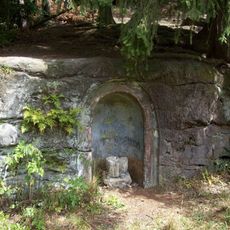
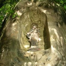
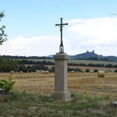
Podtrosecká údolí, Nature reserve in Český ráj, Czech Republic.
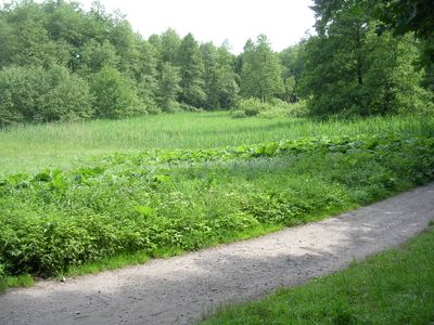
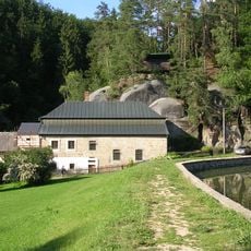
Podtrosecká údolí is a nature reserve in Český ráj comprising eight ponds surrounded by sandstone cliffs. The landscape is shaped by Želejovský stream and Žehrovka River, forming a network of wetlands and meadows throughout the area.
This nature reserve evolved from a pond system created in the 16th century by local inhabitants for agricultural and economic purposes. The eight ponds reflect centuries of human management of the landscape to support farming and water management needs.
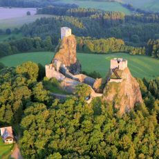
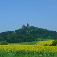
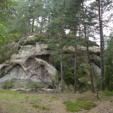
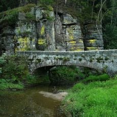
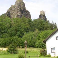
The sandstone cliffs near Věžák pond served as filming locations for scenes from the movie 'Jak dostat tatínka do polepšovny'. These distinctive rock formations continue to shape how visitors experience the landscape today.
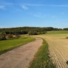
Visitors can explore the reserve through marked trails that connect the different ponds and surrounding areas. A bird watching station at Rokytňák pond offers good opportunities to observe wildlife without disturbing the habitat.
The Vidlák Peat Bog lies between two ponds and hosts rare plant species such as marsh helleborine and round-leaved sundew. These specialized plants are difficult to spot and demonstrate the ecological value of this part of the reserve.
Location: Hrubá Skála
Location: Dobšice
Location: Malechovice
Location: Rytířova Lhota
Location: Roveň u Sobotky
Location: Troskovice
Location: Vyskeř
Inception: June 15, 1999
GPS coordinates: 50.51444,15.20111
Latest update: December 14, 2025 13:02
Trosky Castle
2.1 km
Trosky
2.1 km
Apolena
2.4 km
Tachovský vodopád
1.3 km
Mlýn Nebákov
1.3 km
Libuňka
3 km
Podsemínský most
1.4 km
Hůra
3 km
Penitence cross 0851
2.6 km
Podstavec ve výklenku u rybníka Doly
2.7 km
Socha Svatého Jana Nepomuckého ve skalním výklenku u Nebákovského mlýna
1.3 km
Statue of John of Nepomuk in Malechovice
2.4 km
Wayside cross in Rokytnice
1.6 km
Kříž na rozcestí severně od Troskovic
1.6 km
Krčkovice 14
1.5 km
Tis na Rovni
2.1 km
Socha Panny Marie v Borku pod Troskami
3.3 km
Hrádek Nebákov
1.4 km
Brána usedlosti čp. 44
3.3 km
Ktová railway bridge
3.2 km
Jasan U matičky
3.4 km
Kamenný kříž na východním okraji obce Roveň u Sobotky
2.5 km
Kříž severovýchodně od Libošovic
2.9 km
Kříž na rozcestí k osadě Podhůra
2.8 km
Kaplička na rozcestí do Kabátů v Ktové
3.4 km
Kovová plastika čerta na hradě Trosky
2.1 km
Podsemín
1.3 km
Zvonička u turistického informačního centra pod hradem Trosky
1.9 kmVisited this place? Tap the stars to rate it and share your experience / photos with the community! Try now! You can cancel it anytime.
Discover hidden gems everywhere you go!
From secret cafés to breathtaking viewpoints, skip the crowded tourist spots and find places that match your style. Our app makes it easy with voice search, smart filtering, route optimization, and insider tips from travelers worldwide. Download now for the complete mobile experience.
A unique approach to discovering new places❞
— Le Figaro
All the places worth exploring❞
— France Info
A tailor-made excursion in just a few clicks❞
— 20 Minutes