Enable Location

We need your location to show you interesting places around you

Discover nearby places

Find interesting locations and hidden gems around you

Precise directions

Get accurate directions and distances to places

Your location is never shared with other users. It's only used when you tap the location button.

Lipska Hora

Log in to your account

Start exploring — it's free

Trusted by 61,908 travelers worldwide

Continue with Google
Continue with Apple
or

We will send you a code to connect

By continuing, you accept our Terms and Conditions and our Privacy Policy

Check your inbox

We've sent a pincode in your inbox. Please enter the code below.

Lipska Hora

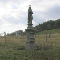
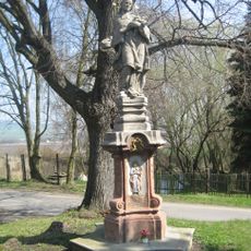
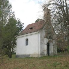
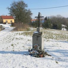
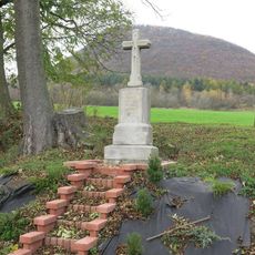
Lipska Hora, Summit in České středohoří, Czech Republic.

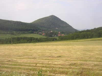
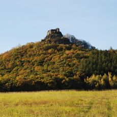
Lippenberg rises to 689 meters with a distinctive cone shape defined by trachyte rock formations and frost cliffs cutting into its slopes. The peak sits within the České středohoří mountains and offers defined routes to the summit.

The mountain received natural reserve status in 1951 to protect its geological formations and rare plant communities. This designation marked the beginning of managed conservation efforts for the area.

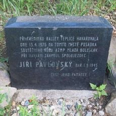
The peak holds a summit register where hikers document their visits, continuing a tradition shared among Czech mountaineers who value recording their mountain experiences. This practice reflects how local climbers connect with the mountain and each other.

Two marked red hiking trails lead to the summit, with the shorter route starting from the village of Lhota covering about 1.2 km. This village offers a convenient starting point for both easy and longer ascent options.

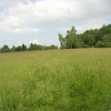
The southern slopes shelter heat-loving plant species more typical of warmer regions, creating an unusual botanical pocket within the cooler Czech mountains. This surprising combination makes the location valuable for studying plants that thrive in specific microclimates.

The community of curious travelers

AroundUs brings together thousands of curated places, local tips, and hidden gems, enriched daily by 60,000 contributors worldwide.

Start exploring
GPS coordinates
50.51253,13.91292
Latest update
December 12, 2025 16:40
Around this place
Oltářík
Czech Republic

Oltářík

2.6 km
Hradišťanská louka
Czech Republic

Hradišťanská louka

3 km
Church of Saint Bartholomew
Czech Republic

Church of Saint Bartholomew

839 m
Church of Saint Nicholas
Czech Republic

Church of Saint Nicholas

1 km
Římskokatolická farnost Radovesice
Czech Republic

Římskokatolická farnost Radovesice

2.6 km
Medvědice
Czech Republic

Medvědice

1.1 km
Chapel of Saint John of Nepomuk (Děkovka)
Czech Republic

Chapel of Saint John of Nepomuk (Děkovka)

2.7 km
Socha svatého Prokopa
Czech Republic

Socha svatého Prokopa

2.1 km
Socha svatého Antonína Paduánského
Czech Republic

Socha svatého Antonína Paduánského

2.9 km
Pomník osvobození v Mrsklesech
Czech Republic

Pomník osvobození v Mrsklesech

1 km
Socha svatého Jana Nepomuckého
Czech Republic

Socha svatého Jana Nepomuckého

862 m
Pomník nejasného účelu ve Skalici u Lovosic
Czech Republic

Pomník nejasného účelu ve Skalici u Lovosic

2.5 km
Pomník  Jiřího Pavlovského u silnice z Milešova do Lukova
Czech Republic

Pomník Jiřího Pavlovského u silnice z Milešova do Lukova

2.8 km
Chapel of Saint John of Nepomuk
Czech Republic

Chapel of Saint John of Nepomuk

2.9 km
Kaplička u pramene poblíž Pnětlucké hájovny
Czech Republic

Kaplička u pramene poblíž Pnětlucké hájovny

1.7 km
Špýchar usedlosti čp. 21
Czech Republic

Špýchar usedlosti čp. 21

907 m
Kaple na návsi v Mrsklesech
Czech Republic

Kaple na návsi v Mrsklesech

1.1 km
Pomník padlým u kostela v osadě Lipá
Czech Republic

Pomník padlým u kostela v osadě Lipá

851 m
Pomník padlým v Lukově
Czech Republic

Pomník padlým v Lukově

2.6 km
Kříž na východním okraji Lukova
Czech Republic

Kříž na východním okraji Lukova

2.5 km
Kříž v osadě Děkovka
Czech Republic

Kříž v osadě Děkovka

2.7 km
Kaple na návsi v Kocourově
Czech Republic

Kaple na návsi v Kocourově

2.4 km
Zvonice u kostela v osadě Lipá
Czech Republic

Zvonice u kostela v osadě Lipá

848 m
Kříž na rozcestí v Mrsklesech
Czech Republic

Kříž na rozcestí v Mrsklesech

955 m
Kaple ve Lhotě u Medvědic
Czech Republic

Kaple ve Lhotě u Medvědic

905 m
Kaple svatého Antonína Paduánského v Lukově
Czech Republic

Kaple svatého Antonína Paduánského v Lukově

2.6 km
Kaple svatého Prokopa ve Skalici u Lovosic
Czech Republic

Kaple svatého Prokopa ve Skalici u Lovosic

2.4 km
Kříž na západním okraji Skalice u Lovosic
Czech Republic

Kříž na západním okraji Skalice u Lovosic

2.7 km
Show the full map
« Lipska Hora - Summit in České středohoří, Czech Republic » is provided by Around Us (aroundus.com). Images and texts are derived from Wikimedia project under a Creative Commons license. You are allowed to copy, distribute, and modify copies of this page, under the conditions set by the license, as long as this note is clearly visible.

Discover hidden gems everywhere you go!

From secret cafés to breathtaking viewpoints, skip the crowded tourist spots and find places that match your style. Our app makes it easy with voice search, smart filtering, route optimization, and insider tips from travelers worldwide. Download now for the complete mobile experience.

Around Us App Screenshot

A unique approach to discovering new places

Le Figaro

All the places worth exploring

France Info

A tailor-made excursion in just a few clicks

20 Minutes

Around Us
Travel Guide & Maps
Download

Send to your phone

QR Code
1

Open the camera app on your mobile.

2

Point at the QR code with your camera. A notification will appear.

3

Tap the notification to open the link.