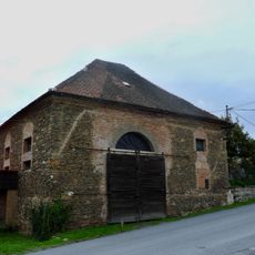
Úterský potok, Brook in Plzeňský kraj, Czech Republic
The Úterský potok is a 34.1 km brook in the Plzeňský kraj that rises east of Nežichov below the Třebouňský vrch and flows into the Hracholusky reservoir on the Mže. Its upper course passes the ruined church of St. Blasius and the Blažejský rybník pond, then cuts a deep valley past the Nový Dvůr monastery and the town of Úterý. The lower course from Bezdružice runs through the Úterský potok Nature Park.
The brook historically powered several watermills that operated for generations along its course in the region. The remains and sites of these mills still mark the industrial past of the valley.
The lower section of the brook received protection as Úterský potok Nature Park in 1997, covering an area of 1,805 hectares.
The brook rises east of Nežichov in the Teplá Highlands and runs 34.1 km to the Hracholusky reservoir on the Mže. Its lower course from Bezdružice lies within the Úterský potok Nature Park; the valley is thinly settled, with Úterý the only larger town directly on the water.
Below Hlaváčkův Mlýn, light fortification lines of the Czechoslovak Wall run along the left bank of the brook. Near Šipín, a rich population of ostrich fern has been protected since 1965 as the Pod Šipínem natural monument, on an area of 0.17 ha.
The community of curious travelers
AroundUs brings together thousands of curated places, local tips, and hidden gems, enriched daily by 94,417 contributors worldwide.