Chest opened
+${chestReward.xp} XP
Explorer
NOUVEAU ×${chestReward.collectible.quantity}
tapez pour fermer
Chest locked

Open chests in the app

Around Us is built for your phone — chests unlock when you walk, explore and capture nearby places.

Enable Location

We need your location to show you interesting places around you

Discover nearby places

Find interesting locations and hidden gems around you

Precise directions

Get accurate directions and distances to places

Your location is never shared with other users. It's only used when you tap the location button.

Płyta Środkowoczeska

Log in to your account

Start exploring — it's free

Trusted by 73,010 travelers worldwide

Continue with Google
Continue with Apple
or

We will send you a code to connect

By continuing, you accept our Terms and Conditions and our Privacy Policy

Check your inbox

We've sent a pincode in your inbox. Please enter the code below.

Płyta Środkowoczeska
Discussion Reviews 1 Photos
2.1k Popularity

Płyta Środkowoczeska, Geomorphological region in Central Czech Republic.

The Płyta Środkowoczeska is a geological region in the Czech Republic made up of sandstone, mudstone, and claystone layers from the Upper Cretaceous period. Rolling terrain here connects to walking routes that pass through varied landscapes.

This region formed through tectonic movements during the Hercynian mountain-building period and became a fundamental part of the Czech Massif structure. These geological changes shaped the landscape we see today.

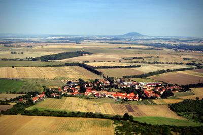
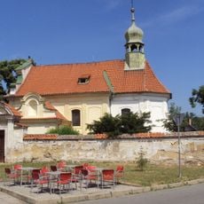
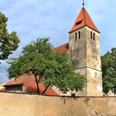
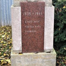
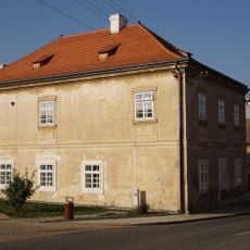
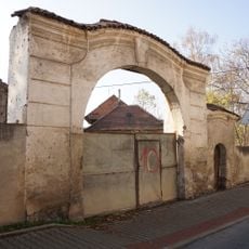
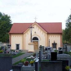
Local communities developed here because of the fertile soil, creating farms and trade paths that shaped the region for centuries. Small towns and villages still reflect these historical settlement patterns today.

A network of walking routes crosses this area and connects to major transport links. The best time to explore is from May to October, when conditions are dry and mild.

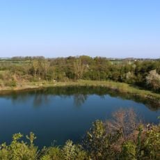
Isolated basalt outcrops and volcanic formations from the Tertiary period appear here, creating surprising geological features within the sedimentary rocks. These volcanic structures stand out visibly in the landscape.

The community of curious travelers

AroundUs brings together thousands of curated places, local tips, and hidden gems, enriched daily by 60,000 contributors worldwide.

Start exploring
Part of
Чешка равнина
GPS coordinates
50.23333,14.51667
Latest update
December 14, 2025 09:45
Around this place
Church of the Assumption of the Virgin Mary
Czech Republic

Church of the Assumption of the Virgin Mary

2.4 km
Church of Saint Vitus in Kojetice
Czech Republic

Church of Saint Vitus in Kojetice

715 m
Pomník Pavla Kopřivy u silnice východně od Předboje
Czech Republic

Pomník Pavla Kopřivy u silnice východně od Předboje

2 km
Pomník obětem okupace 1938-45 ve Zloníně
Czech Republic

Pomník obětem okupace 1938-45 ve Zloníně

1.9 km
Fara
Czech Republic

Fara

734 m
Brána s brankou usedlosti čp. 10
Czech Republic

Brána s brankou usedlosti čp. 10

846 m
Lom Kojetice
Czech Republic

Lom Kojetice

823 m
Socha matky s dcerou u školky v ulici OSN v Neratovicích
Czech Republic

Socha matky s dcerou u školky v ulici OSN v Neratovicích

2.1 km
Lípa v Lobkovicích 1
Czech Republic

Lípa v Lobkovicích 1

2.5 km
Pomník padlým v parku u kostela v Lobkovicích
Czech Republic

Pomník padlým v parku u kostela v Lobkovicích

2.4 km
Dub u Lobkovic
Czech Republic

Dub u Lobkovic

2.6 km
Bell tower in Lobkovice
Czech Republic

Bell tower in Lobkovice

2.4 km
Kaple svatého Václava na hřbitově v Kojeticích
Czech Republic

Kaple svatého Václava na hřbitově v Kojeticích

759 m
Vodojem Kojetice
Czech Republic

Vodojem Kojetice

975 m
Kaplička na rozcestí na jižním okraji Čakoviček
Czech Republic

Kaplička na rozcestí na jižním okraji Čakoviček

1.3 km
Kříž na rozcestí v Zloníně
Czech Republic

Kříž na rozcestí v Zloníně

1.7 km
Zvonička na návsi v Čakovičkách
Czech Republic

Zvonička na návsi v Čakovičkách

1.1 km
Kaple na návsi v Nové Vsi
Czech Republic

Kaple na návsi v Nové Vsi

2.1 km
Stone Book in Lobkovice
Czech Republic

Stone Book in Lobkovice

2.6 km
Kříž u domu 31 v Nové Vsi
Czech Republic

Kříž u domu 31 v Nové Vsi

2.1 km
Pomník padlým v 1. světové válce v Čakovičkách
Czech Republic

Pomník padlým v 1. světové válce v Čakovičkách

1.1 km
Pomník padlým na rozcestí u kostela v Kojeticích
Czech Republic

Pomník padlým na rozcestí u kostela v Kojeticích

687 m
Kříž v parku u kostela v Kojeticích
Czech Republic

Kříž v parku u kostela v Kojeticích

742 m
Kaplička u silnice na západním okraji Čakoviček
Czech Republic

Kaplička u silnice na západním okraji Čakoviček

656 m
Kříž u železniční zastávky Lobkovice
Czech Republic

Kříž u železniční zastávky Lobkovice

2.2 km
Cemetery Lobkovice
Czech Republic

Cemetery Lobkovice

2.4 km
Kříž u domu 55 v Nové Vsi
Czech Republic

Kříž u domu 55 v Nové Vsi

2.3 km
Kříž u domu 283 v Kojeticích
Czech Republic

Kříž u domu 283 v Kojeticích

1.3 km
Show the full map
Reviews
Share your experience

No review yet

Discussions
Start a discussion...

No discussion yet

« Płyta Środkowoczeska - Geomorphological region in Central Czech Republic » is provided by Around Us (aroundus.com). Images and texts are derived from Wikimedia project under a Creative Commons license. You are allowed to copy, distribute, and modify copies of this page, under the conditions set by the license, as long as this note is clearly visible.

Discover hidden gems everywhere you go!

From secret cafés to breathtaking viewpoints, skip the crowded tourist spots and find places that match your style. Our app makes it easy with voice search, smart filtering, route optimization, and insider tips from travelers worldwide. Download now for the complete mobile experience.

Around Us App Screenshot

A unique approach to discovering new places

Le Figaro

All the places worth exploring

France Info

A tailor-made excursion in just a few clicks

20 Minutes

Around Us
Travel Guide & Maps
Download

Send to your phone

QR Code
1

Open the camera app on your mobile.

2

Point at the QR code with your camera. A notification will appear.

3

Tap the notification to open the link.