Chest opened
+${chestReward.xp} XP
Explorer
NOUVEAU ×${chestReward.collectible.quantity}
tapez pour fermer
Chest locked

Open chests in the app

Around Us is built for your phone — chests unlock when you walk, explore and capture nearby places.

Enable Location

We need your location to show you interesting places around you

Discover nearby places

Find interesting locations and hidden gems around you

Precise directions

Get accurate directions and distances to places

Your location is never shared with other users. It's only used when you tap the location button.

Log in to your account

Start exploring — it's free

Trusted by 72,992 travelers worldwide

Continue with Google
Continue with Apple
or

We will send you a code to connect

By continuing, you accept our Terms and Conditions and our Privacy Policy

Check your inbox

We've sent a pincode in your inbox. Please enter the code below.

Podkrušnohorská pánev
Discussion Reviews Photo
1.4k Popularity

Podkrušnohorská pánev, Geological basin in northwestern Czech Republic.

Podkrušnohorská pánev is a geological basin in northwestern Czech Republic that stretches from Cheb to Česká Lípa with tectonic depressions and volcanic formations. The structure shows distinct sections shaped by geological forces along the Krušné hory mountains.

Mining activities transformed the basin since the industrial era, particularly for brown coal extraction. These operations became central to energy production across Central Europe.

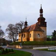
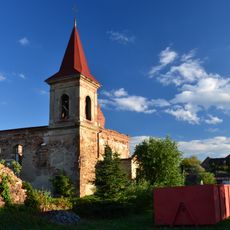
The region reflects its industrial roots through how people live and what shapes local traditions today. Cities like Cheb and Sokolov show this connection between work and daily life in how they look and function.

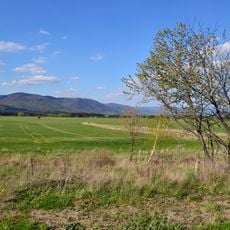
The basin divides into several main sections, each with its own character and geological features to explore. Visitors should expect ongoing mining and restoration work that shapes how the landscape appears.

Natural carbon dioxide springs bubble up throughout the area and supply mineral water sources for famous thermal spas like Františkovy Lázně and Karlovy Vary. This flow comes from the basin's unique geological makeup.

The community of curious travelers

AroundUs brings together thousands of curated places, local tips, and hidden gems, enriched daily by 60,000 contributors worldwide.

Start exploring
GPS coordinates
50.48156,13.52097
Latest update
December 14, 2025 16:45
Around this place
Church of Saint Wenceslaus
Czech Republic

Church of Saint Wenceslaus

1.5 km
Maják u Strupčic
Czech Republic

Maják u Strupčic

1.6 km
Church of Saint Michael (Všestudy)
Czech Republic

Church of Saint Michael (Všestudy)

2.9 km
Jirkovská pánev
Czech Republic

Jirkovská pánev

1.1 km
Saint Nicholas church
Czech Republic

Saint Nicholas church

2.9 km
Kostel svatého Petra a Pavla
Czech Republic

Kostel svatého Petra a Pavla

3 km
Socha Panny Marie
Czech Republic

Socha Panny Marie

1.4 km
Socha svatého Václava
Czech Republic

Socha svatého Václava

1.3 km
Statue of Saint Anne
Czech Republic

Statue of Saint Anne

3.1 km
Socha svatého Jana Nepomuckého
Czech Republic

Socha svatého Jana Nepomuckého

1.9 km
Socha Ježíše na kříži ve Vrskmani
Czech Republic

Socha Ježíše na kříži ve Vrskmani

2 km
Socha svatého Jana Nepomuckého
Czech Republic

Socha svatého Jana Nepomuckého

1.5 km
Smírčí kříž
Czech Republic

Smírčí kříž

1.5 km
Pomník osvobození ve Všestudech
Czech Republic

Pomník osvobození ve Všestudech

2.7 km
Penitence crosses in Vrskmaň
Czech Republic

Penitence crosses in Vrskmaň

2 km
Soška svatého Václava ve výklenku kostela ve Strupčicích
Czech Republic

Soška svatého Václava ve výklenku kostela ve Strupčicích

1.5 km
Smírčí kříž
Czech Republic

Smírčí kříž

1.5 km
Socha Piety v Kostelní ulici v Strupčicích
Czech Republic

Socha Piety v Kostelní ulici v Strupčicích

1.5 km
Smírčí kříž
Czech Republic

Smírčí kříž

1.6 km
Kaplička Panny Marie u polní cesty jižně od Strupčic
Czech Republic

Kaplička Panny Marie u polní cesty jižně od Strupčic

2.4 km
Sloup s Pietou u hřbitova ve Strupčicích
Czech Republic

Sloup s Pietou u hřbitova ve Strupčicích

1.6 km
Mariánský sloup na návsi ve Vrskmani
Czech Republic

Mariánský sloup na návsi ve Vrskmani

1.9 km
Sloup s Pietou v Kostelní ulici v Strupčicích
Czech Republic

Sloup s Pietou v Kostelní ulici v Strupčicích

1.4 km
Pomník padlým u hřbitova ve Strupčicích
Czech Republic

Pomník padlým u hřbitova ve Strupčicích

1.5 km
Povalený podstavec s ulomeným křížem u silnice západně od Hošnic
Czech Republic

Povalený podstavec s ulomeným křížem u silnice západně od Hošnic

2.8 km
Boží muka v Kostelní ulici v Strupčicích
Czech Republic

Boží muka v Kostelní ulici v Strupčicích

1.5 km
Kříž na návsi v Zaječicích
Czech Republic

Kříž na návsi v Zaječicích

2.8 km
Sloup Nejsvětější Trojice na návsi v Okoříně
Czech Republic

Sloup Nejsvětější Trojice na návsi v Okoříně

1.6 km
Show the full map
Reviews
Share your experience

No review yet

Discussions
Start a discussion...

No discussion yet

« Podkrušnohorská pánev - Geological basin in northwestern Czech Republic » is provided by Around Us (aroundus.com). Images and texts are derived from Wikimedia project under a Creative Commons license. You are allowed to copy, distribute, and modify copies of this page, under the conditions set by the license, as long as this note is clearly visible.

Discover hidden gems everywhere you go!

From secret cafés to breathtaking viewpoints, skip the crowded tourist spots and find places that match your style. Our app makes it easy with voice search, smart filtering, route optimization, and insider tips from travelers worldwide. Download now for the complete mobile experience.

Around Us App Screenshot

A unique approach to discovering new places

Le Figaro

All the places worth exploring

France Info

A tailor-made excursion in just a few clicks

20 Minutes

Around Us
Travel Guide & Maps
Download

Send to your phone

QR Code
1

Open the camera app on your mobile.

2

Point at the QR code with your camera. A notification will appear.

3

Tap the notification to open the link.