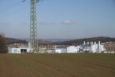
Podzemní zásobník plynu Háje, Underground gas storage facility in Příbram, Czech Republic
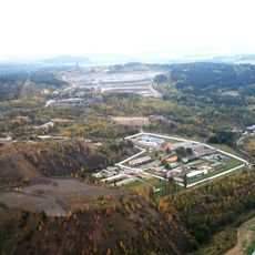
Podzemní zásobník plynu Háje is an underground natural gas storage facility located near Příbram at a depth of about 950 meters within granodiorite rock formations. The storage complex consists of interconnected chambers capable of holding approximately 72 million cubic meters of gas, accessed through five production wells.
Construction of this storage facility began in 1992 when engineers recognized that Prague needed strategic buffer capacity for natural gas supplies. The project leveraged the geological properties of the site to create a secure, long-term storage solution.
The establishment of the Háje facility represents Czech engineering advancement in natural gas storage technologies within crystalline geological structures.
The site is not open to public visitors as it is an active industrial facility with strict operational security requirements. Information about the facility can be obtained through official channels with the operators.
The facility employs specialized steel-reinforced concrete seals to manage the extreme pressures at this depth. A network of seven seismic monitoring stations continuously tracks the stability of the rock formations and underground structures.
The community of curious travelers
AroundUs brings together thousands of curated places, local tips, and hidden gems, enriched daily by 60,000 contributors worldwide.