Czech Republic–Germany–Poland tripoint
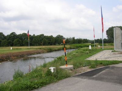
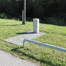
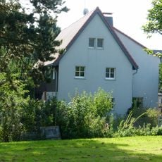
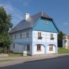
Czech Republic–Germany–Poland tripoint, International tripoint at Hrádek nad Nisou, Czech Republic.
The Czech Republic-Germany-Poland tripoint is the precise location where the borders of all three countries converge at the junction of the Neisse River and Ullersforfer Creek. It sits near Hrádek nad Nisou and marks the exact meeting point of the three territories.
The borders of these three nations were redrawn in 1945 following the Potsdam Agreement after World War II ended. This specific location became a tripoint where the three new boundaries came together following postwar territorial reorganization.
Three separate border markers and flags from each nation stand at this meeting point. They show how close the countries are to one another and mark the importance of this location in their shared border.
Walking paths connect to the tripoint from each of the three countries, with parking available near the Porajów-Zittau border crossing. The location is easy to reach on foot and offers good access for visitors exploring the area.
The three neighboring towns organize annual folk celebrations where residents float messages in bottles down the Neisse River. This tradition represents the connection between neighbors living on opposite sides of the border.
Location: Hrádek nad Nisou
Part of: Czech Republic–Germany border, Czech Republic–Poland border, Germany–Poland border
GPS coordinates: 50.87057,14.82402
Latest update: December 9, 2025 20:23
Chrám Pokoje
2.2 km
Kościół ewangelicki, ob. rzym.-kat. św. Józefa Oblubieńca
2 km
Socha svatého Vavřince v Oldřichovské ulici v Hrádku nad Nisou
2.1 km
Socha svatého Josefa v Žitavské ulici v Hrádku nad Nisou
1.7 km
Dům čp. 86
2.2 km
Obere Dorfstraße 44
1.9 km
Grösselova kaple
2.1 km
Pomník padlému Rudolfu Zárybnickému ve Větrné ulici v Hrádku nad Nisou
1.7 km
Cemetery in Kopaczów
2 km
Richterův kříž
2 km
Dům čp. 93
2.1 km
Dům čp. 85
2.2 km
Obere Dorfstraße 31
1.9 km
Podstávkový dům Hrádek nad Nisou 215
2 km
Obere Dorfstraße 8
1.3 km
Fishing border stone
894 m
Obere Dorfstraße 27
1.9 km
Sowjetisches Ehrenmal
1.2 km
Plastika svaté Zdislavy u domu Žitavská 670 v Hrádku nad Nisou
2 km
Röhrhäusel Hartau
2.2 km
Untere Dorfstraße 3
957 m
Untere Dorfstraße 15
886 m
Untere Dorfstraße 39
1.2 km
Untere Dorfstraße 13
844 m
Posthalterei Martin-Wehnert-Platz 12; 18
2.2 km
Untere Dorfstraße 6
952 m
Obere Dorfstraße 11
1.5 km
Kříž u cesty mezi ulicemi Okružní a U Lávky v Hrádku nad Nisou
2.2 kmVisited this place? Tap the stars to rate it and share your experience / photos with the community! Try now! You can cancel it anytime.
Discover hidden gems everywhere you go!
From secret cafés to breathtaking viewpoints, skip the crowded tourist spots and find places that match your style. Our app makes it easy with voice search, smart filtering, route optimization, and insider tips from travelers worldwide. Download now for the complete mobile experience.
A unique approach to discovering new places❞
— Le Figaro
All the places worth exploring❞
— France Info
A tailor-made excursion in just a few clicks❞
— 20 Minutes