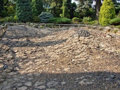
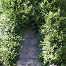
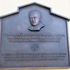
Geological map, Cultural monument and raised-relief map in Zahrady, Czech Republic.
The geological map in Zahrady is a raised-relief model that depicts rock formations, elevation changes, and surface features through embossed structures. The work functions as a three-dimensional representation where different materials and textures mark various rock types and landscape characteristics of the region.
The map was created as a scientific tool to preserve information about the geological layers and ground structures of the Czech landscape. Its designation as a cultural monument shows that the nation has deemed this form of geological documentation important enough to protect as significant heritage.
This monument reflects how communities value and document the natural world beneath their feet. The tactile surface invites people to experience geological features through touch, making earth science tangible and personal.
The monument is located outdoors and is easily accessible to visitors wishing to explore the area. The raised structures allow people of different backgrounds to gather geological information either visually or through touch.
The surface patterns were designed to use texture and material as a medium to distinguish different rock types. This sensory approach to presenting science makes the monument equally informative for visually impaired people as for others.
The community of curious travelers
AroundUs brings together thousands of curated places, local tips, and hidden gems, enriched daily by 60,000 contributors worldwide.