Enable Location

We need your location to show you interesting places around you

Discover nearby places

Find interesting locations and hidden gems around you

Precise directions

Get accurate directions and distances to places

Your location is never shared with other users. It's only used when you tap the location button.

Log in to your account

Start exploring — it's free

Trusted by 62,558 travelers worldwide

Continue with Google
Continue with Apple
or

We will send you a code to connect

By continuing, you accept our Terms and Conditions and our Privacy Policy

Check your inbox

We've sent a pincode in your inbox. Please enter the code below.

Správní obvod obce s rozšířenou působností Tábor

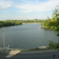
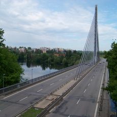
Správní obvod obce s rozšířenou působností Tábor, Administrative district with extended powers in South Bohemia, Czech Republic.

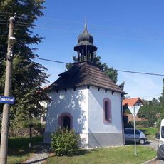
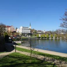
The administrative district of Tábor is a territorial division in South Bohemia that brings together several municipalities under one governance structure. This area functions as a central administrative hub serving the surrounding region.

The district was created in 2003 as part of a nationwide restructuring of local administration in the Czech Republic. This reform changed how municipalities coordinate and manage regional affairs together.

This administrative region coordinates educational and healthcare services among its municipalities, fostering cooperation between local communities and institutions.

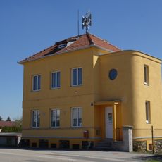
The district office is located in Tábor and serves as the main contact point for administrative matters in the region. Visitors can reach out to obtain information about local governance and administrative procedures.

Located at coordinates 49.433333°N and 14.666667°E, the district maintains statistical records and administrative functions separate from traditional territorial districts.

The community of curious travelers

AroundUs brings together thousands of curated places, local tips, and hidden gems, enriched daily by 60,000 contributors worldwide.

Start exploring
Location
Inception
January 1, 2003
Capital city
Tábor
GPS coordinates
49.43333,14.66667
Latest update
December 14, 2025 18:43
Around this place
Jordán
Czech Republic

Jordán

1.3 km
Bridge over Jordán, Tábor
Czech Republic

Bridge over Jordán, Tábor

721 m
Malý Jordán
Czech Republic

Malý Jordán

255 m
New Jewish cemetery in Tábor
Czech Republic

New Jewish cemetery in Tábor

1.6 km
Most přes výpusť z Malého Jordánu
Czech Republic

Most přes výpusť z Malého Jordánu

131 m
Železniční most přes silnici I/19 u Tábora
Czech Republic

Železniční most přes silnici I/19 u Tábora

719 m
Most Jordánské ulice přes Tismenický potok
Czech Republic

Most Jordánské ulice přes Tismenický potok

2 km
Nacistické popraviště – pomník obětí okupace s parkem
Czech Republic

Nacistické popraviště – pomník obětí okupace s parkem

1.6 km
Práce a život
Czech Republic

Práce a život

1.9 km
Měšťanský dům
Czech Republic

Měšťanský dům

2 km
Blanický most
Czech Republic

Blanický most

2 km
Chapel in Náchod
Czech Republic

Chapel in Náchod

476 m
Sousoší hrochů v parku v Táboře
Czech Republic

Sousoší hrochů v parku v Táboře

1.8 km
Jordánský vodopád
Czech Republic

Jordánský vodopád

1.9 km
Plastika v parku v Táboře
Czech Republic

Plastika v parku v Táboře

1.6 km
Památník na konec druhé světové války v Táboře
Czech Republic

Památník na konec druhé světové války v Táboře

1.8 km
Kašna v parku v Táboře
Czech Republic

Kašna v parku v Táboře

1.7 km
Most přes Tismenický potok pod Jordánským vodopádem
Czech Republic

Most přes Tismenický potok pod Jordánským vodopádem

1.9 km
Pomník padlým v Čekanicích
Czech Republic

Pomník padlým v Čekanicích

1.4 km
Benešovská čp. 52
Czech Republic

Benešovská čp. 52

632 m
Kaplička v Čekanicích
Czech Republic

Kaplička v Čekanicích

1.4 km
Kříž u kaple v Čekanicích
Czech Republic

Kříž u kaple v Čekanicích

1.2 km
Kříž jižně od Náchoda nedaleko Harfového mostu
Czech Republic

Kříž jižně od Náchoda nedaleko Harfového mostu

667 m
Kříž severovýchodně od Čekanic
Czech Republic

Kříž severovýchodně od Čekanic

1.6 km
Kaple v Čekanicích
Czech Republic

Kaple v Čekanicích

1.2 km
Most silnice I/19 přes silnici III/00346 v Táboře-Čekanicích
Czech Republic

Most silnice I/19 přes silnici III/00346 v Táboře-Čekanicích

1.6 km
Plastika na sídlišti v Táboře
Czech Republic

Plastika na sídlišti v Táboře

1.8 km
Jordánské nábřeží
Czech Republic

Jordánské nábřeží

2 km
Show the full map
« Správní obvod obce s rozšířenou působností Tábor - Administrative district with extended powers in South Bohemia, Czech Republic » is provided by Around Us (aroundus.com). Images and texts are derived from Wikimedia project under a Creative Commons license. You are allowed to copy, distribute, and modify copies of this page, under the conditions set by the license, as long as this note is clearly visible.

Discover hidden gems everywhere you go!

From secret cafés to breathtaking viewpoints, skip the crowded tourist spots and find places that match your style. Our app makes it easy with voice search, smart filtering, route optimization, and insider tips from travelers worldwide. Download now for the complete mobile experience.

Around Us App Screenshot

A unique approach to discovering new places

Le Figaro

All the places worth exploring

France Info

A tailor-made excursion in just a few clicks

20 Minutes

Around Us
Travel Guide & Maps
Download

Send to your phone

QR Code
1

Open the camera app on your mobile.

2

Point at the QR code with your camera. A notification will appear.

3

Tap the notification to open the link.