Chest opened
+${chestReward.xp} XP
Explorer
NOUVEAU ×${chestReward.collectible.quantity}
tapez pour fermer
Chest locked

Open chests in the app

Around Us is built for your phone — chests unlock when you walk, explore and capture nearby places.

Enable Location

We need your location to show you interesting places around you

Discover nearby places

Find interesting locations and hidden gems around you

Precise directions

Get accurate directions and distances to places

Your location is never shared with other users. It's only used when you tap the location button.

Log in to your account

Start exploring — it's free

Trusted by 72,876 travelers worldwide

Continue with Google
Continue with Apple
or

We will send you a code to connect

By continuing, you accept our Terms and Conditions and our Privacy Policy

Check your inbox

We've sent a pincode in your inbox. Please enter the code below.

Žďár
Discussion Reviews Photo
1.3k Popularity

Žďár, Ruins and fortified house in Czech Republic.

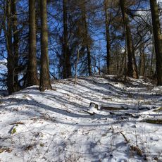
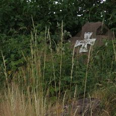
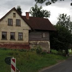
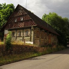
Žďár is a fortified house ruin located on elevated terrain in the Czech Republic. The remaining walls display medieval defensive features and construction methods that reflect the building needs of that period.

This fortification was built in medieval times to watch over trade routes and maintain control of the surrounding valleys. Over the centuries it lost its strategic importance and gradually fell into decay.

The site attracts hikers today who explore the remaining structures as part of their outdoor activities. For locals, it represents a connection to the area's past and serves as a gathering point for walks through the countryside.

The site is reachable via marked hiking trails with parking available nearby. The best time to visit is during warmer months when the paths are in good condition.

Beneath the visible remains lies an underground chamber that served as a refuge space. This hidden structure reveals how occupants prepared for sudden threats.

The community of curious travelers

AroundUs brings together thousands of curated places, local tips, and hidden gems, enriched daily by 60,000 contributors worldwide.

Start exploring
Location
GPS coordinates
50.53357,15.51576
Latest update
December 14, 2025 17:40
Around this place
Hradiště
Czech Republic

Hradiště

819 m
All Saints church
Czech Republic

All Saints church

1.5 km
Socha svatého Josefa u kostela v Levínské Olešnici
Czech Republic

Socha svatého Josefa u kostela v Levínské Olešnici

1.5 km
Socha svaté Maří Magdaleny u kostela v Levínské Olešnici
Czech Republic

Socha svaté Maří Magdaleny u kostela v Levínské Olešnici

1.5 km
Socha svaté Anny u kostela v Levínské Olešnici
Czech Republic

Socha svaté Anny u kostela v Levínské Olešnici

1.5 km
Socha Panny Marie v Levínské Olešnici
Czech Republic

Socha Panny Marie v Levínské Olešnici

1.5 km
Socha svatého Jana Nepomuckého u kostela v Levínské Olešnici
Czech Republic

Socha svatého Jana Nepomuckého u kostela v Levínské Olešnici

1.5 km
Sousoší Nejsvětější Trojice
Czech Republic

Sousoší Nejsvětější Trojice

1.6 km
Kříž
Czech Republic

Kříž

2 km
Venkovský dům
Czech Republic

Venkovský dům

1.5 km
Socha svatého Václava u kostela v Levínské Olešnici
Czech Republic

Socha svatého Václava u kostela v Levínské Olešnici

1.5 km
Venkovský dům
Czech Republic

Venkovský dům

1.7 km
Crucifix in Podlevín
Czech Republic

Crucifix in Podlevín

2.2 km
Smírčí kříž
Czech Republic

Smírčí kříž

2.5 km
Chapel-shrine in Levínská Olešnice
Czech Republic

Chapel-shrine in Levínská Olešnice

2.2 km
Krucifix
Czech Republic

Krucifix

206 m
Socha Krista Vítězného u kostela v Levínské Olešnici
Czech Republic

Socha Krista Vítězného u kostela v Levínské Olešnici

1.5 km
Sousoší Korunování Panny Marie
Czech Republic

Sousoší Korunování Panny Marie

2.7 km
Usedlost čp. 29
Czech Republic

Usedlost čp. 29

2.7 km
Venkovský dům - bývalý hostinec
Czech Republic

Venkovský dům - bývalý hostinec

1.6 km
Pomník padlým v 1. světové válce v Levínské Olešnici
Czech Republic

Pomník padlým v 1. světové válce v Levínské Olešnici

1.5 km
Pomník padlým v květnu 1945 u silnice jižně od Roztok u Jilemnice
Czech Republic

Pomník padlým v květnu 1945 u silnice jižně od Roztok u Jilemnice

2.8 km
Levínská Olešnice municipal office
Czech Republic

Levínská Olešnice municipal office

1.5 km
Kamenný kříž u kostela v Levínské Olešnici
Czech Republic

Kamenný kříž u kostela v Levínské Olešnici

1.5 km
Kříž u rozcestí západně od osady Smitecko
Czech Republic

Kříž u rozcestí západně od osady Smitecko

1.9 km
Kříž na rozcestí jižně od Roztok u Jilemnice
Czech Republic

Kříž na rozcestí jižně od Roztok u Jilemnice

2.4 km
Bell tower in Podlevín
Czech Republic

Bell tower in Podlevín

2.2 km
Viadukt
Czech Republic

Viadukt

2.7 km
Show the full map
Reviews
Share your experience

No review yet

Discussions
Start a discussion...

No discussion yet

« Žďár - Ruins and fortified house in Czech Republic » is provided by Around Us (aroundus.com). Images and texts are derived from Wikimedia project under a Creative Commons license. You are allowed to copy, distribute, and modify copies of this page, under the conditions set by the license, as long as this note is clearly visible.

Discover hidden gems everywhere you go!

From secret cafés to breathtaking viewpoints, skip the crowded tourist spots and find places that match your style. Our app makes it easy with voice search, smart filtering, route optimization, and insider tips from travelers worldwide. Download now for the complete mobile experience.

Around Us App Screenshot

A unique approach to discovering new places

Le Figaro

All the places worth exploring

France Info

A tailor-made excursion in just a few clicks

20 Minutes

Around Us
Travel Guide & Maps
Download

Send to your phone

QR Code
1

Open the camera app on your mobile.

2

Point at the QR code with your camera. A notification will appear.

3

Tap the notification to open the link.