Enable Location

We need your location to show you interesting places around you

Discover nearby places

Find interesting locations and hidden gems around you

Precise directions

Get accurate directions and distances to places

Your location is never shared with other users. It's only used when you tap the location button.

Naučná stezka Koutské a Zábřežské louky

Log in to your account

Start exploring — it's free

Trusted by 63,517 travelers worldwide

Continue with Google
Continue with Apple
or

We will send you a code to connect

By continuing, you accept our Terms and Conditions and our Privacy Policy

Check your inbox

We've sent a pincode in your inbox. Please enter the code below.

Naučná stezka Koutské a Zábřežské louky
Discussion Reviews 1 Photos
1.8k Popularity

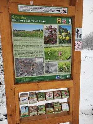
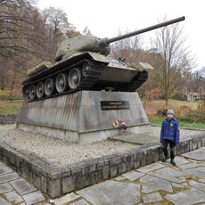
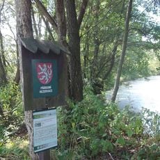
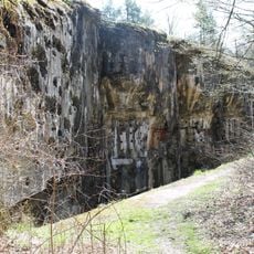
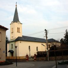
Naučná stezka Koutské a Zábřežské louky, Educational nature trail in Opava District, Czech Republic.

The Koutské and Zábřežské Meadows trail is an educational pathway that winds through wetlands, meadows, and floodplain forests containing numerous ponds and oxbow lakes. The route connects varied habitats and displays the diverse plant and animal life found across these different ecosystems.

The area originated from traditional agricultural landscapes that shaped the Moravian-Silesian region over centuries through careful land use and farming practices. This long history of management created the meadow ecosystems seen here today.

The site functions as an outdoor classroom where students from nearby schools observe nature and participate in environmental learning programs.

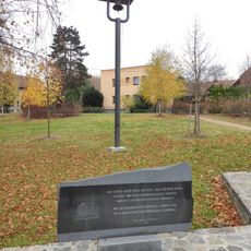
The trail is freely accessible with informational panels along the route explaining local plants, animals, and geological features in Czech. Visitors should wear sturdy footwear as conditions underfoot can be wet and muddy, especially during wetter seasons.

The meadows serve as a crucial stopover for migratory birds traveling long distances and provide shelter for several bat species. Visitors can observe rare bird species particularly during spring and autumn migrations when the area comes alive with activity.

The community of curious travelers

AroundUs brings together thousands of curated places, local tips, and hidden gems, enriched daily by 60,000 contributors worldwide.

Start exploring
Location
GPS coordinates
49.91703,18.06113
Latest update
December 14, 2025 11:20
Around this place
Smolkov
Czech Republic

Smolkov

2.7 km
Národní památník války
Czech Republic

Národní památník války

3.4 km
Jez Smolkov
Czech Republic

Jez Smolkov

1.2 km
Jez Háj ve Slezsku
Czech Republic

Jez Háj ve Slezsku

2.6 km
Silesian Museum - National Monument II. World war II
Czech Republic

Silesian Museum - National Monument II. World war II

3.5 km
Tank T-34 in Smolkov
Czech Republic

Tank T-34 in Smolkov

2.2 km
Church of Saint Valentine
Czech Republic

Church of Saint Valentine

3.6 km
Koutské a Zábřežské louky
Czech Republic

Koutské a Zábřežské louky

380 m
Chapel of the Holy Cross
Czech Republic

Chapel of the Holy Cross

3.2 km
MO-Sm-S 39 U trigonometru casemate
Czech Republic

MO-Sm-S 39 U trigonometru casemate

2.6 km
Church of Saint John the Baptist
Czech Republic

Church of Saint John the Baptist

2.6 km
Pomník Vladislava Vančury
Czech Republic

Pomník Vladislava Vančury

2.9 km
Socha svatého Jana Nepomuckého
Czech Republic

Socha svatého Jana Nepomuckého

3.5 km
Chapel of Saint Florian
Czech Republic

Chapel of Saint Florian

3.3 km
Kaple svaté Maří Magdalény
Czech Republic

Kaple svaté Maří Magdalény

3.6 km
Zvonička ve Smolkově na náměstíčku ve středu obce
Czech Republic

Zvonička ve Smolkově na náměstíčku ve středu obce

1.8 km
Kříž v Háji ve Slezsku v ulici Antonína Vaška
Czech Republic

Kříž v Háji ve Slezsku v ulici Antonína Vaška

3.1 km
Památník Petra Bezruče v Háji ve Slezsku v Bezručově ulici
Czech Republic

Památník Petra Bezruče v Háji ve Slezsku v Bezručově ulici

2.9 km
Church of Saint John of Nepomuk in Lhota
Czech Republic

Church of Saint John of Nepomuk in Lhota

1.3 km
Pomník padlým v Chabičově ve Slezsku
Czech Republic

Pomník padlým v Chabičově ve Slezsku

3.6 km
Hřbitov Dolní Benešov
Czech Republic

Hřbitov Dolní Benešov

3.4 km
Kříž ve Štítině na křižovatce ulic Palackého a Havlíčkova
Czech Republic

Kříž ve Štítině na křižovatce ulic Palackého a Havlíčkova

3.1 km
MO-Sm-S 42 Nad Hájem casemate
Czech Republic

MO-Sm-S 42 Nad Hájem casemate

2.7 km
MO-Sm-S 41 Nad Valchou casemate
Czech Republic

MO-Sm-S 41 Nad Valchou casemate

3.1 km
MO-Sm-S 38 V lese casemate
Czech Republic

MO-Sm-S 38 V lese casemate

2.7 km
MO-S 37 Cukrovar casemate
Czech Republic

MO-S 37 Cukrovar casemate

2.6 km
MO-S 36 U Opavice casemate
Czech Republic

MO-S 36 U Opavice casemate

3.4 km
Kaple Panny Marie v Háji ve Slezsku v ulici Antonína Vaška
Czech Republic

Kaple Panny Marie v Háji ve Slezsku v ulici Antonína Vaška

3.1 km
Show the full map
Reviews
Share your experience

No review yet

Discussions
Start a discussion...

No discussion yet

« Naučná stezka Koutské a Zábřežské louky - Educational nature trail in Opava District, Czech Republic » is provided by Around Us (aroundus.com). Images and texts are derived from Wikimedia project under a Creative Commons license. You are allowed to copy, distribute, and modify copies of this page, under the conditions set by the license, as long as this note is clearly visible.

Discover hidden gems everywhere you go!

From secret cafés to breathtaking viewpoints, skip the crowded tourist spots and find places that match your style. Our app makes it easy with voice search, smart filtering, route optimization, and insider tips from travelers worldwide. Download now for the complete mobile experience.

Around Us App Screenshot

A unique approach to discovering new places

Le Figaro

All the places worth exploring

France Info

A tailor-made excursion in just a few clicks

20 Minutes

Around Us
Travel Guide & Maps
Download

Send to your phone

QR Code
1

Open the camera app on your mobile.

2

Point at the QR code with your camera. A notification will appear.

3

Tap the notification to open the link.