Chest opened
+${chestReward.xp} XP
Explorer
NOUVEAU ×${chestReward.collectible.quantity}
tapez pour fermer

See the monuments around you in AR Open chests in the app

Around Us is built for your phone — point your camera at the streets and discover the monuments and places around you in augmented reality. Around Us is built for your phone — chests unlock when you walk, explore and capture nearby places.

Enable Location

We need your location to show you interesting places around you

Discover nearby places

Find interesting locations and hidden gems around you

Precise directions

Get accurate directions and distances to places

Your location is never shared with other users. It's only used when you tap the location button.

Log in to your account

Start exploring — it's free

Trusted by 87,029 travelers worldwide

Continue with Google
Continue with Apple
or

We will send you a code to connect

By continuing, you accept our Terms and Conditions and our Privacy Policy

Check your inbox

We've sent a pincode in your inbox. Please enter the code below.

G.T. Wilburn Grist Mill
Discussion Reviews Photo
1.5k Popularity

G.T. Wilburn Grist Mill, Historic watermill in Fall River, Leoma, Tennessee, US

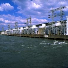
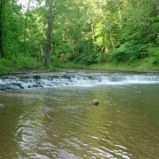
The G.T. Wilburn Grist Mill sits on Clear Creek and harnesses water power from a dam to grind grain into flour and cornmeal. The mill features traditional millstones and mechanical equipment that continue to process grain today.

The original mill was destroyed by Union forces in 1862 and rebuilt in 1865. The building changed hands several times before G.T. Wilburn acquired it in 1924.

The mill functioned as a central gathering point for the Fall River community, housing both a post office and a voting location for local residents.

The site is accessible on foot and offers good views of the water system from outside. The mill operates most actively during warmer months, though water flow becomes reduced during drier periods.

The mill was engineered with a custom-built dam designed to maintain steady water flow even during dry seasons. This water management system allows operations to continue functioning despite seasonal variations in stream flow.

The community of curious travelers

AroundUs brings together thousands of curated places, local tips, and hidden gems, enriched daily by 60,000 contributors worldwide.
Start exploring
GPS coordinates
35.13050,-87.21780
Latest update
September 11, 2026 21:58
Around this place
McKamey Manor
United States of America

McKamey Manor

20 mi
Wheeler Dam
United States of America

Wheeler Dam

24.9 mi
Wheeler
United States of America

Wheeler

33.5 mi
Milky Way Farm
United States of America

Milky Way Farm

16.1 mi
David Crockett State Park
United States of America

David Crockett State Park

12.5 mi
Stillhouse Hollow Falls State Natural Area
United States of America

Stillhouse Hollow Falls State Natural Area

23.3 mi
Sulphur Trestle Fort Site
United States of America

Sulphur Trestle Fort Site

20.7 mi
Bridgeforth High School
United States of America

Bridgeforth High School

12.2 mi
Wilkinson-Martin House
United States of America

Wilkinson-Martin House

12.1 mi
First Presbyterian Church of Pulaski
United States of America

First Presbyterian Church of Pulaski

11.4 mi
Sacred Heart of Jesus Church
United States of America

Sacred Heart of Jesus Church

10.4 mi
Campbell Chapel African Methodist Episcopal Church
United States of America

Campbell Chapel African Methodist Episcopal Church

12.1 mi
Pisgah United Methodist Church and Cemetery
United States of America

Pisgah United Methodist Church and Cemetery

17.6 mi
Church of the Messiah
United States of America

Church of the Messiah

11.5 mi
Mount Zion Methodist Episcopal Church South
United States of America

Mount Zion Methodist Episcopal Church South

4.6 mi
Lairdland Farm House
United States of America

Lairdland Farm House

20.6 mi
Austin Hewitt Home
United States of America

Austin Hewitt Home

11.8 mi
Olivet United Methodist Church, Parsonage and School
United States of America

Olivet United Methodist Church, Parsonage and School

15.7 mi
Garrett House
United States of America

Garrett House

10.2 mi
Elisha White House
United States of America

Elisha White House

19.8 mi
Copeland Whitfield House
United States of America

Copeland Whitfield House

11.8 mi
Reveille
United States of America

Reveille

11.4 mi
Joseph Elliston House
United States of America

Joseph Elliston House

20 mi
Andrew Scott House
United States of America

Andrew Scott House

25.2 mi
Brown-Daly-Horne House
United States of America

Brown-Daly-Horne House

11.5 mi
United States of America

Hallehurst

11.2 mi
George W. Tillery House
United States of America

George W. Tillery House

12.3 mi
United States of America

Dr. Benjamin Franklin Smith House

20.1 mi
Show the full map
Reviews
Share your experience

No review yet

Discussions
Start a discussion...

No discussion yet

« G.T. Wilburn Grist Mill - Historic watermill in Fall River, Leoma, Tennessee, US » is provided by Around Us (aroundus.com). Images and texts are derived from Wikimedia project under a Creative Commons license. You are allowed to copy, distribute, and modify copies of this page, under the conditions set by the license, as long as this note is clearly visible.

Discover hidden gems everywhere you go!

From secret cafés to breathtaking viewpoints, skip the crowded tourist spots and find places that match your style. Our app makes it easy with voice search, smart filtering, route optimization, and insider tips from travelers worldwide. Download now for the complete mobile experience.

Around Us App Screenshot

A unique approach to discovering new places

Le Figaro

All the places worth exploring

France Info

A tailor-made excursion in just a few clicks

20 Minutes

Around Us
Travel Guide & Maps
Download

Send to your phone

QR Code
1

Open the camera app on your mobile.

2

Point at the QR code with your camera. A notification will appear.

3

Tap the notification to open the link.