Enable Location

We need your location to show you interesting places around you

Discover nearby places

Find interesting locations and hidden gems around you

Precise directions

Get accurate directions and distances to places

Your location is never shared with other users. It's only used when you tap the location button.

Log in to your account

Start exploring — it's free

Trusted by 63,714 travelers worldwide

Continue with Google
Continue with Apple
or

We will send you a code to connect

By continuing, you accept our Terms and Conditions and our Privacy Policy

Check your inbox

We've sent a pincode in your inbox. Please enter the code below.

Villa Place Historic District
Discussion Reviews Photo
1.1k Popularity

Villa Place Historic District, historic district in North Carolina, United States

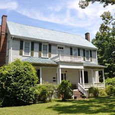
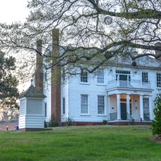
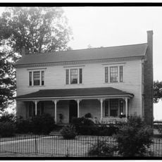
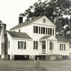
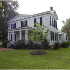
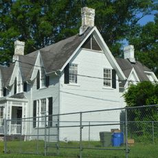
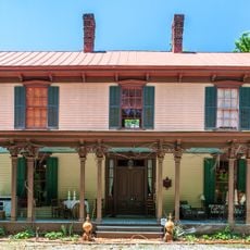
Villa Place Historic District is a residential neighborhood in Rocky Mount with more than 300 buildings built mostly between 1900 and 1950. The homes display varied styles including Queen Anne, Colonial Revival, Craftsman, and Bungalow, many featuring high hipped roofs and broad front porches.

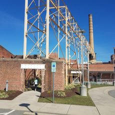
Villa Place developed starting in 1891 as a planned neighborhood to house railroad and tobacco industry workers driving Rocky Mount's rapid growth. The district gained National Register status in 1999 and expanded its boundaries in 2002 to protect more of the original settlement.

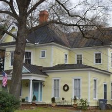
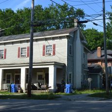
The neighborhood grew around railroad and tobacco workers who built modest homes alongside wealthier professionals with larger residences. Walking through the district today, you can see how different social groups shaped their surroundings through the homes they chose and the streets they shared.

The neighborhood is flat and walkable on foot, with tree-lined streets that provide shade and are pleasant to explore. Visit during fair weather when you can clearly see the architectural details and character of the homes.

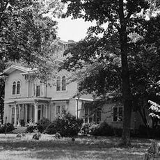
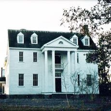
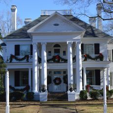
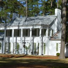
Machaven, a large brick mansion from 1908 in Neoclassical style, stands as a landmark that showcases the craftsmanship brought by architects from the region. The building gained separate protection and represents the finest residential architecture created during the neighborhood's peak development period.

The community of curious travelers

AroundUs brings together thousands of curated places, local tips, and hidden gems, enriched daily by 60,000 contributors worldwide.

Start exploring
Location
GPS coordinates
35.94111,-77.80389
Latest update
February 9, 2026 07:43
Around this place
Rocky Mount Mills
United States of America

Rocky Mount Mills

2 km
Coolmore Plantation
United States of America

Coolmore Plantation

18.8 km
Imagination Station Science Museum
United States of America

Imagination Station Science Museum

26 km
Bellamy's Mill
United States of America

Bellamy's Mill

24.4 km
Rose Hill
United States of America

Rose Hill

21 km
The Cellar
United States of America

The Cellar

29.6 km
Rocky Mount Mills Village Historic District
United States of America

Rocky Mount Mills Village Historic District

1.8 km
Shell Castle
United States of America

Shell Castle

28.7 km
Bissette-Cooley House
United States of America

Bissette-Cooley House

15.1 km
Cotton Press
United States of America

Cotton Press

24.4 km
Andrews-Moore House
United States of America

Andrews-Moore House

35.2 km
Rocky Mount Central City Historic District
United States of America

Rocky Mount Central City Historic District

1.4 km
Davis-Whitehead-Harriss House
United States of America

Davis-Whitehead-Harriss House

25.4 km
Whitaker's Chapel
United States of America

Whitaker's Chapel

29.2 km
Dortch House
United States of America

Dortch House

9.2 km
West Haven Historic District
United States of America

West Haven Historic District

1.7 km
Braswell Memorial Library
United States of America

Braswell Memorial Library

1.2 km
Nash County Courthouse
United States of America

Nash County Courthouse

15.3 km
Samuel Warren Branch House
United States of America

Samuel Warren Branch House

32.7 km
Branch Banking & Trust Company Building
United States of America

Branch Banking & Trust Company Building

25.9 km
Kenansville Historic District
United States of America

Kenansville Historic District

14.5 km
Falls Road Historic District
United States of America

Falls Road Historic District

1.2 km
Moses Rountree House
United States of America

Moses Rountree House

25.2 km
Enfield Graded School
United States of America

Enfield Graded School

29.4 km
Old Wilson Historic District
United States of America

Old Wilson Historic District

25.3 km
Wilson County Courthouse
United States of America

Wilson County Courthouse

25.4 km
James H. Parker House
United States of America

James H. Parker House

29.7 km
The Imperial Centre for the Arts & Sciences
United States of America

The Imperial Centre for the Arts & Sciences

907 m
Show the full map
Reviews
Share your experience

No review yet

Discussions
Start a discussion...

No discussion yet

« Villa Place Historic District - historic district in North Carolina, United States » is provided by Around Us (aroundus.com). Images and texts are derived from Wikimedia project under a Creative Commons license. You are allowed to copy, distribute, and modify copies of this page, under the conditions set by the license, as long as this note is clearly visible.

Discover hidden gems everywhere you go!

From secret cafés to breathtaking viewpoints, skip the crowded tourist spots and find places that match your style. Our app makes it easy with voice search, smart filtering, route optimization, and insider tips from travelers worldwide. Download now for the complete mobile experience.

Around Us App Screenshot

A unique approach to discovering new places

Le Figaro

All the places worth exploring

France Info

A tailor-made excursion in just a few clicks

20 Minutes

Around Us
Travel Guide & Maps
Download

Send to your phone

QR Code
1

Open the camera app on your mobile.

2

Point at the QR code with your camera. A notification will appear.

3

Tap the notification to open the link.