Chest opened
+${chestReward.xp} XP
Explorer
NOUVEAU ×${chestReward.collectible.quantity}
tapez pour fermer
Chest locked

Open chests in the app

Around Us is built for your phone — chests unlock when you walk, explore and capture nearby places.

Enable Location

We need your location to show you interesting places around you

Discover nearby places

Find interesting locations and hidden gems around you

Precise directions

Get accurate directions and distances to places

Your location is never shared with other users. It's only used when you tap the location button.

Log in to your account

Start exploring — it's free

Trusted by 72,886 travelers worldwide

Continue with Google
Continue with Apple
or

We will send you a code to connect

By continuing, you accept our Terms and Conditions and our Privacy Policy

Check your inbox

We've sent a pincode in your inbox. Please enter the code below.

Gene Letourneau
Discussion Reviews Photo
1.3k Popularity

Gene Letourneau, Protected wildlife area in Waldo County, Maine.

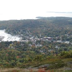
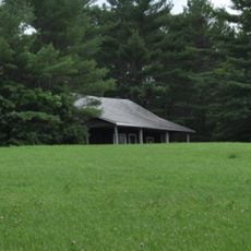
Gene Letourneau is a protected wildlife area in Waldo County, Maine, covering about 5,200 acres of mixed forest. The land includes second-growth spruce and white pine woods alongside abandoned farm fields and oak groves spread across rolling terrain.

The land was acquired by the federal government in the late 1930s through the Bankhead Jones Farm Tenant Act, converting former farmland into protected conservation space. This shift transformed how the territory was managed and used for decades to come.

Four hundred residents signed a petition opposing the 1985 name change from Frye Mountain to Gene Letourneau, considering it disrespectful to original farming families.

Access is possible on foot or with basic gear, as the area offers open forest trails and field paths throughout its grounds. The best time to visit is from May through October, when conditions are most comfortable.

A fire lookout tower once stood on the summit for decades monitoring forest fires but was relocated in the early 2000s to a different site. The structure now sits on an island in the Kennebec River, marking a noteworthy chapter in the region's fire management history.

The community of curious travelers

AroundUs brings together thousands of curated places, local tips, and hidden gems, enriched daily by 60,000 contributors worldwide.

Start exploring
GPS coordinates
44.47611,-69.21694
Latest update
December 14, 2025 17:41
Around this place
Camden Hills State Park
United States of America

Camden Hills State Park

27 km
United States of America

Moose Point State Park

21.8 km
Lake St. George State Park
United States of America

Lake St. George State Park

13.7 km
Swan Lake State Park
United States of America

Swan Lake State Park

21.3 km
Timberwind
United States of America

Timberwind

17.6 km
Penobscot Marine Museum
United States of America

Penobscot Marine Museum

23.3 km
Masonic Temple
United States of America

Masonic Temple

17.6 km
James P. White House
United States of America

James P. White House

18.3 km
First Church of Belfast
United States of America

First Church of Belfast

17.6 km
Stockton Springs Community Church
United States of America

Stockton Springs Community Church

28.6 km
Whitney Farm
United States of America

Whitney Farm

16.1 km
Belfast Historic District
United States of America

Belfast Historic District

17.7 km
Capt. William McGilvery House
United States of America

Capt. William McGilvery House

24.1 km
Gushee Family House
United States of America

Gushee Family House

21.2 km
Capt. John McGilvery House
United States of America

Capt. John McGilvery House

23.9 km
Eli and Sybil Jones House
United States of America

Eli and Sybil Jones House

25.3 km
Belfast National Bank
United States of America

Belfast National Bank

17.6 km
Church Street Historic District
United States of America

Church Street Historic District

17.9 km
Pond Meeting House
United States of America

Pond Meeting House

24.6 km
Searsport Historic District
United States of America

Searsport Historic District

23.2 km
East Main Street Historic District
United States of America

East Main Street Historic District

24.1 km
James G. Pendleton House
United States of America

James G. Pendleton House

22.7 km
Capt. John P. Nichols House
United States of America

Capt. John P. Nichols House

24 km
Nathan G. Hichborn House
United States of America

Nathan G. Hichborn House

28.5 km
Pendle Hill
United States of America

Pendle Hill

28.5 km
Lincolnville Center Meeting House
United States of America

Lincolnville Center Meeting House

21.5 km
Carver Memorial Library
United States of America

Carver Memorial Library

23.4 km
Union Hall
United States of America

Union Hall

23.3 km
Show the full map
Reviews
Share your experience

No review yet

Discussions
Start a discussion...

No discussion yet

« Gene Letourneau - Protected wildlife area in Waldo County, Maine » is provided by Around Us (aroundus.com). Images and texts are derived from Wikimedia project under a Creative Commons license. You are allowed to copy, distribute, and modify copies of this page, under the conditions set by the license, as long as this note is clearly visible.

Discover hidden gems everywhere you go!

From secret cafés to breathtaking viewpoints, skip the crowded tourist spots and find places that match your style. Our app makes it easy with voice search, smart filtering, route optimization, and insider tips from travelers worldwide. Download now for the complete mobile experience.

Around Us App Screenshot

A unique approach to discovering new places

Le Figaro

All the places worth exploring

France Info

A tailor-made excursion in just a few clicks

20 Minutes

Around Us
Travel Guide & Maps
Download

Send to your phone

QR Code
1

Open the camera app on your mobile.

2

Point at the QR code with your camera. A notification will appear.

3

Tap the notification to open the link.