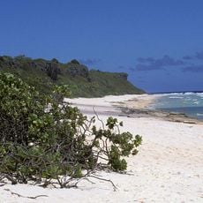
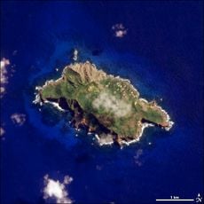
Ducie Island, Coral atoll in Pitcairn Islands.
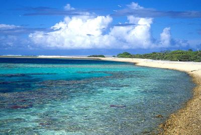
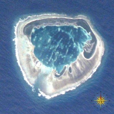
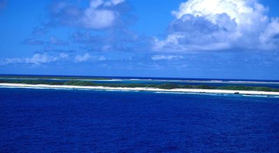
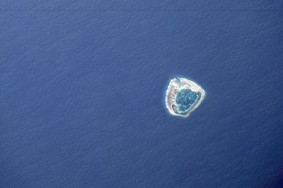
Ducie Island is a coral atoll in the Pitcairn Islands formed by four small islets called Acadia, Pandora, Westward and Edwards that encircle an inner lagoon. The combined land area of these islets totals just over 70 hectares, while the lagoon covers up to 340 hectares at high tide and contains shallow coral formations.
British Captain Edward Edwards came upon the atoll in 1791 while hunting for the Bounty mutineers and named it after Baron Francis Ducie, a member of the British Admiralty. The atoll remained uninhabited and later became part of the British territory of the Pitcairn Islands, where it remains today.
The atoll provides nesting grounds for Murphy's petrels, which return each year to raise their young between October and May in burrows dug into the sandy soil. During breeding season, thousands of these seabirds fill the air with their calls, creating a soundscape that defines this remote corner of the Pacific.
The only way to reach the lagoon is through a narrow passage between Pandora and Westward islets, which can be navigated by small boats in calm weather. Because of the exposed location and strong currents, careful planning is necessary and visitors should attempt landing only when conditions are favorable.
The reef and surrounding waters host several species of fish and sharks whose flesh contains toxins that can cause severe health problems if consumed. This natural feature makes both swimming and fishing risky activities for the few people who manage to reach this remote location.
The community of curious travelers
AroundUs brings together thousands of curated places, local tips, and hidden gems, enriched daily by 60,000 contributors worldwide.