Pitcairn Islands, British archipelago in the South Pacific Ocean.
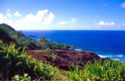
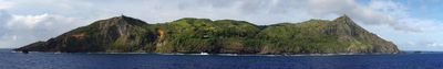
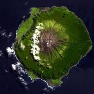
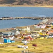
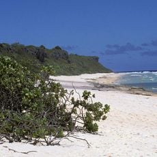
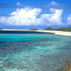
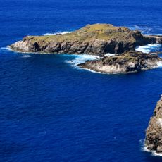
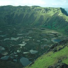
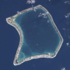
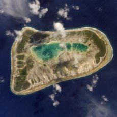
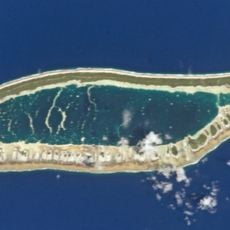
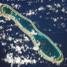
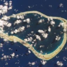
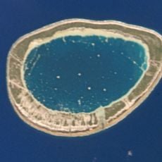
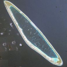
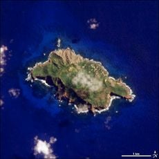
Pitcairn Islands is a British overseas territory in the southern Pacific and comprises four volcanic islands with steep cliffs and little flat ground. Only one island is inhabited, and its coastline offers few natural anchorages while vegetation consists of dense ferns and low trees.
The islands remained unnoticed by the outside world for nearly two decades after mutineers from HMS Bounty settled there in 1790. After an American ship discovered the colony in 1808, the territory was formally placed under British jurisdiction in 1838.
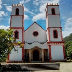
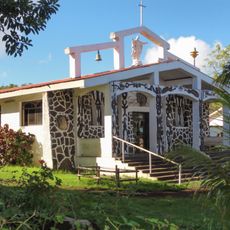
Residents maintain small gardens where tropical fruits grow alongside imported plants, and many families still practice traditional needlework and wood carving. On weekends the entire community gathers for worship at the church, which has stood at the center of social life for generations.
Entry permits must be requested months in advance, and visitors should expect limited communication options and no regular internet access. Most travelers arrive via Mangareva, with crossings dependent on weather conditions and sea state.
The post office issues its own stamps, which are sought after by collectors worldwide and represent an important revenue source for the small community. New designs appear each year, often showing local animal and plant species or historical themes.
Location: British overseas territory
Inception: 1838
Capital city: Adamstown
Address: Pitcairn Islands
Website: https://government.pn
GPS coordinates: -25.06577,-130.10178
Latest update: December 4, 2025 17:20
This collection covers places in remote deserts, isolated islands, and inaccessible mountain regions where human settlement is limited to a minimum. They range from research stations in Antarctica such as McMurdo Station and the Amundsen-Scott South Pole Station to the French Kerguelen Islands in the southern Indian Ocean. The collection includes settlements without road access like the village of Supai deep in the Grand Canyon of Arizona, reachable only on foot, by helicopter, or by mule, as well as Ittoqqortoormiit on the eastern coast of Greenland. Other locations are Easter Island in the Pacific, located over 2300 miles (3700 kilometers) from mainland Chile, and Tristan da Cunha, an inhabited island group in the middle of the South Atlantic. Extreme locations include Alert in Nunavut, Canada, the northernmost permanently inhabited settlement in the world, the Siberian village of Oymyakon with its exceptionally low winter temperatures, and the Yemeni island of Socotra with its peculiar flora. The collection also includes the Siwa Oasis in the Egyptian desert, Motuo County in Tibet, and the Scottish island of Foula.
Some places on Earth feel so far removed from the rest of the world that reaching them requires real commitment. This collection brings together research stations in Antarctica, villages in Siberia where winter temperatures drop to brutal lows, communities tucked deep inside canyons, and islands separated from any mainland by thousands of miles of open ocean. Each location shows how people manage to live and work where nature pushes against the limits of human presence. You will find weather stations near the North Pole, remote Greenlandic settlements reachable only by boat or helicopter, and secret military facilities hidden in desert expanses. Some of these places host scientists studying glaciers and wildlife in the southern seas. Others are home to indigenous communities who have adapted their way of life to freezing temperatures and months of darkness. Whether it is a research base on a subantarctic island or a Siberian village that holds the record for the coldest inhabited spot in the Northern Hemisphere, these locations offer a glimpse into how humans establish roots in the most challenging corners of the planet.
This collection encompasses the world's smallest countries and territories by land area, measured including lakes and rivers within their borders. The list features both independent sovereign states and dependent territories with varying political statuses. From Vatican City at 0.4 square kilometers to Monaco and San Marino in Europe, and island nations in the Caribbean such as Saint Kitts and Nevis, this selection demonstrates the geographic diversity of compact territories. The European microstates offer medieval fortifications, princely palaces, and modern financial districts within limited spaces. Pacific atolls like Nauru and Tuvalu present coral formations and tropical coastlines, while Caribbean islands combine volcanic mountains, rainforests, and colonial architecture. Despite their limited size, these countries and territories maintain their own governmental systems, cultures, and economic models ranging from tourism and financial services to fishing and agriculture.
Moai
2083.4 km
Henderson Island
195.4 km
Motu Nui
2074.9 km
Rapa Nui National Park
2084.8 km
Rano Kau
2077.1 km
Fangataufa
935.6 km
Ahu Akivi
2080.3 km
Puka-Puka
1459.4 km
Ahu Vinapu
2079.4 km
Terevaka
2081.7 km
Tatakoto
1216.9 km
Hare paenga
2084.3 km
Reao
974.7 km
Tahai
2077.2 km
Nengonengo
1387 km
Ana Kai Tangata
2075.8 km
Fakahina
1453.4 km
Pukarua
1036.9 km
Morane
744.9 km
Maria Est
707.3 km
St. Michael's Cathedral
539.8 km
Estadio de Hanga Roa
2077 km
Pawala Valley Ridge
1.2 km
Matureivavao
757.3 km
Tenararo
798.9 km
Haraiki
1621.1 km
Father Sebastian Englert Anthropological Museum
2077.5 km
Holy Cross Church, Hanga Roa
2077.5 kmReviews
Visited this place? Tap the stars to rate it and share your experience / photos with the community! Try now! You can cancel it anytime.
Discover hidden gems everywhere you go!
From secret cafés to breathtaking viewpoints, skip the crowded tourist spots and find places that match your style. Our app makes it easy with voice search, smart filtering, route optimization, and insider tips from travelers worldwide. Download now for the complete mobile experience.
A unique approach to discovering new places❞
— Le Figaro
All the places worth exploring❞
— France Info
A tailor-made excursion in just a few clicks❞
— 20 Minutes