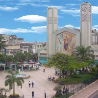
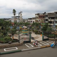
Los Ríos Province, Coastal province in central Ecuador.
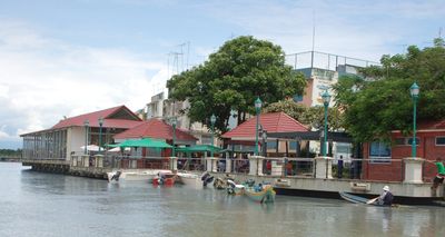
Los Ríos is a province on the central coast of Ecuador, where numerous waterways flow through a mostly flat landscape. The area consists of wide fields crossed by river branches and smaller canals that give the view an open and green expanse.
The administrative unit came into being in 1860, when it separated from the former district of Guayaquil and Babahoyo was named the administrative seat. Since then the region has reinforced its economic role by expanding the cultivation of export products on the fertile alluvial soils.
The region takes its name from the abundance of rivers that flow through broad farmland and shape the work of many farms. In rural towns you often meet roadside stands where residents offer freshly harvested fruit and grain from the surrounding fields.
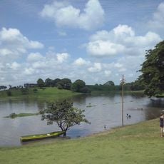
Travelers through the province often encounter roads that run between fields and connect smaller towns. Conditions become wetter during the rainy season, when paths turn muddy in places and rivers carry more water.
The rivers host several fish species that are caught year-round by anglers, including some that are also sold at local markets. Some farms near the banks use the water not only for irrigation but also for transporting smaller harvests on flat boats.
Location: Ecuador
Inception: October 6, 1860
Capital city: Babahoyo
Elevation above the sea: 30 m
Shares border with: Manabí Province, Guayas Province, Bolívar Province, Cotopaxi Province, Santo Domingo de los Tsáchilas Province
Website: http://losrios.gob.ec
GPS coordinates: -1.30000,-79.50000
Latest update: December 14, 2025 20:55
Abras de Mantequilla
33.4 km
Our Lady of Mercy Cathedral, Babahoyo
55.7 km
Catedral de San Jacinto
91.3 kmEmbalse Daule-Peripa
50.7 kmRio Palenque Science Center
80.8 kmPk. 153 sector la Brasilia
29.8 kmPk. 149 sector la Guayaquil
30.8 kmPk. 170
40 kmPK.169 San Vicente.
39.3 kmPK. 157 sector la yuca
31.2 kmCentro Turistico El Palmar
33 kmPK. 158 Sector Armando Mera
31.9 kmPK. 171 sector el guasmo
40.6 kmPk. 155 sector santa Elena
30.7 kmMocoli Golf Club
98.3 kmPk. 151 sector el zapallo
30.3 kmParque Balsapamba
62.8 kmPk. 146 sector
30.3 kmPk. 142 sector canales
29.5 kmPk. 147 H. La Clemencia
30.6 kmPk. 145
29.5 kmPk. 143 sector San Perico
29.6 kmPlaza Lagos
98.2 kmCascada Angas
66.7 kmPlaza Lagos
98.1 kmMirador La Juliana
48.6 kmPLAYA DE SALITRE
67.1 kmPLAYA DE SALITRE
67.2 kmVisited this place? Tap the stars to rate it and share your experience / photos with the community! Try now! You can cancel it anytime.
Discover hidden gems everywhere you go!
From secret cafés to breathtaking viewpoints, skip the crowded tourist spots and find places that match your style. Our app makes it easy with voice search, smart filtering, route optimization, and insider tips from travelers worldwide. Download now for the complete mobile experience.
A unique approach to discovering new places❞
— Le Figaro
All the places worth exploring❞
— France Info
A tailor-made excursion in just a few clicks❞
— 20 Minutes