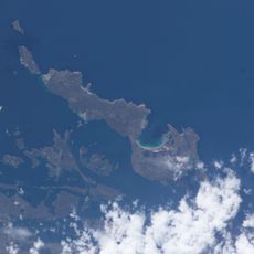
Brenton Loch, Sea inlet and fjord in East Falkland, United Kingdom.
This narrow sea inlet runs between steep rock walls separating the Lafonia peninsula from northern East Falkland. The waterway connects to Grantham Sound at its mouth and runs near the isthmus linking Darwin and Goose Green settlements. Surrounding cliffs form a natural barrier between the island's geographic regions, with the inlet providing sheltered waters that extend inland from the Atlantic coast.
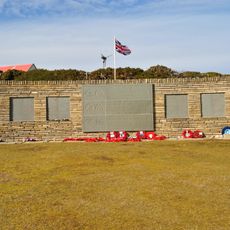
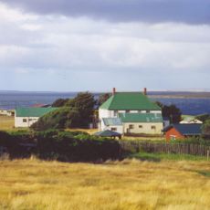
Scottish entrepreneur Samuel Lafone founded Hope Place settlement on the southern shores in 1846, bringing South American gauchos to develop the surrounding territory for livestock ranching. During the 1982 Falklands War, HMS Arrow took position in these waters to provide naval gunfire support for British ground forces during the Battle of Goose Green, one of the conflict's most significant land engagements fought near the settlements at the inlet's landward end.
The name preserves Scottish heritage brought by 19th-century settlers at Goose Green, who applied their homeland's geographic vocabulary to the new environment. Residents still pronounce it like the Scottish word for inland lake, maintaining a linguistic tradition that reflects the cultural origins of early farming families who established stations across this part of East Falkland and shaped the region's pastoral economy.
Access is via unpaved roads from nearby Darwin and Goose Green settlements, located roughly 60 miles (100 kilometers) west of capital Stanley. The area is best visited from November through March when Falklands weather conditions are most stable. Accommodation is available in the mentioned settlements, and visitors should bring warm, weatherproof clothing for the region's strong winds. Advance planning is recommended as visitor facilities are limited in this remote section of the archipelago.
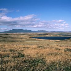
The waters host diverse seabird populations including black-browed albatrosses and imperial cormorants nesting on cliffs along the shores. Leopard seals and orcas occasionally visit the inlet while hunting, particularly during penguin breeding seasons at surrounding colonies. Marine archaeologists continue surveying the seabed for artifacts from the 1982 conflict, documenting the region's military history through remnants that remain in the protected waters where naval vessels operated during the war.
The community of curious travelers
AroundUs brings together thousands of curated places, local tips, and hidden gems, enriched daily by 60,000 contributors worldwide.