Cerro Azul Formation, Geological formation in La Pampa and Buenos Aires provinces, Argentina
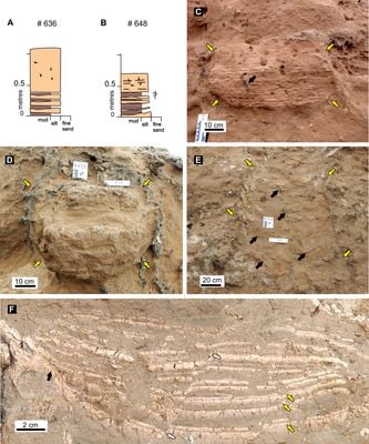
The Cerro Azul Formation is a geological layer in northeastern Argentina spanning La Pampa and Buenos Aires provinces. It consists of river deposits with siltstone, sandstone, and volcanic ash layers that together reach several hundred meters in depth.
This layer formed after the retreat of the Parana Sea roughly 10 million years ago and was first systematically documented by scientists in the 1980s. The deposits reveal important environmental changes across Argentina over extended geological time periods.
Researchers from multiple scientific institutions study this formation to understand Argentina's prehistoric environments through its extensive fossil collection.
Researchers reach this layer via country roads connecting various study sites including Barrancas Coloradas, Cerro Patagua, and Estancia Re. The locations require good planning since they are spread out and clear orientation is necessary.
The layer contains fossils of Argentavis, the largest flying bird in Earth's history, alongside many bones from extinct mammals and reptiles. These discoveries offer glimpses into the wildlife of a vanished landscape.
GPS coordinates: -35.70000,-64.70000
Latest update: December 12, 2025 17:46
Estadio Único de Villa Mercedes
235.8 km
Lihué Calel National Park
264.4 km
Parque Luro
140.7 km
Laguna Don Tomás
108 km
Centro cívico de Santa Rosa
109.3 km
Laguna La Arocena
90.4 km
General Pico Station
85.9 km
Isla La Sistina
246.4 km
Estacion de Ferrocarril General Pinto
275.5 km
Adolfo Alsina town hall
239.4 km
Matadero de Villa Epecuén
235.1 km
Palacio Municipal de Guaminí
251 km
Cruz del Cementerio de Carhué
237.1 km
Cathedral of St. Rose of Lima
108.8 km
Plaza General José de San Martín
152.1 km
Museo Regional Dr. Adolfo Alsina
239.4 km
Biblioteca Popular Municipal José Manuel Estrada
85.4 km
Matadero de Tres Lomas
186.2 km
Delegación municipal de Tres Lomas
185.7 km
Almafuerte Civic Museum
180.6 km
Biblioteca Popular Juan Bautista Alberdi
212.4 km
Iglesia Parroquial de Villa Reducción
288.4 km
Matadero de Pellegrini
150.8 km
Cruz de ingreso a la ciudad de Guaminí
252 km
Biblioteca Popular Joaquín V. González
85.7 km
Plaza Leandro N. Alem
185.7 km
Museo Regional Maracó
85.4 km
Matadero Municipal de Salliquelo
196 kmVisited this place? Tap the stars to rate it and share your experience / photos with the community! Try now! You can cancel it anytime.
Discover hidden gems everywhere you go!
From secret cafés to breathtaking viewpoints, skip the crowded tourist spots and find places that match your style. Our app makes it easy with voice search, smart filtering, route optimization, and insider tips from travelers worldwide. Download now for the complete mobile experience.
A unique approach to discovering new places❞
— Le Figaro
All the places worth exploring❞
— France Info
A tailor-made excursion in just a few clicks❞
— 20 Minutes