Enable Location

We need your location to show you interesting places around you

Discover nearby places

Find interesting locations and hidden gems around you

Precise directions

Get accurate directions and distances to places

Your location is never shared with other users. It's only used when you tap the location button.

Lomas de Zamora

Log in to your account

Start exploring — it's free

Trusted by 63,179 travelers worldwide

Continue with Google
Continue with Apple
or

We will send you a code to connect

By continuing, you accept our Terms and Conditions and our Privacy Policy

Check your inbox

We've sent a pincode in your inbox. Please enter the code below.

Discussion Reviews 6 Photos
49.4k Popularity

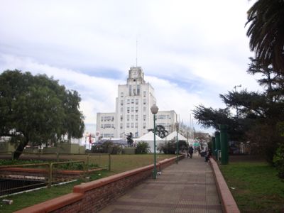
Lomas de Zamora, Government seat and urban center in Buenos Aires Province, Argentina

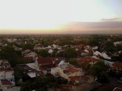
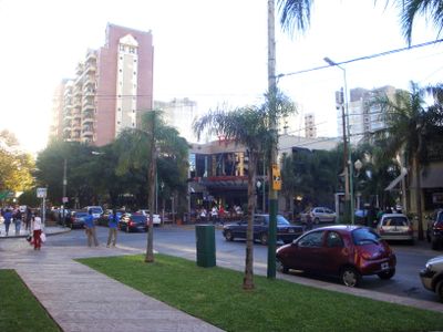
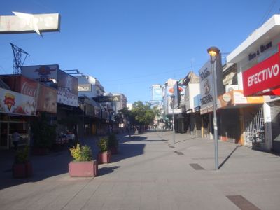
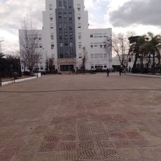
Lomas de Zamora is a city in Buenos Aires Province located south of the capital and serves as the administrative center for its district. The urban area combines residential neighborhoods with industrial and commercial zones spread across gently rolling terrain.

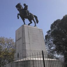
The area was granted to Juan de Zamora in the late 16th century, and his name remains part of the city's identity today. Formal settlement began in the mid-19th century, establishing the foundation for its growth into a regional administrative hub.

The National University draws thousands of students daily, shaping the city's character with academic activity and youthful energy. Walking through the areas near campus, you notice bookstores, cafes, and study spaces that cater to this student population.

The city is easily accessible from downtown Buenos Aires by public transport, with several bus routes and train connections available. Daytime visits are recommended when administrative offices and shops are operating.

The city is home to several factories and industrial facilities that have been established for decades, with their architecture shaping the urban landscape. These industrial structures reflect an earlier period of economic development and often go unnoticed as historical markers.

The community of curious travelers

AroundUs brings together thousands of curated places, local tips, and hidden gems, enriched daily by 60,000 contributors worldwide.

Start exploring
Inception
1864
Elevation above the sea
20 m
GPS coordinates
-34.76667,-58.40000
Latest update
December 14, 2025 18:54
Around this place
Villa Grampa
Argentina

Villa Grampa

955 m
Biblioteca Popular Antonio Mentruyt
Argentina

Biblioteca Popular Antonio Mentruyt

623 m
Iglesiа Оrtоdоxа Rusа de lа Virgen del Аmраrо, Temperley
Argentina

Iglesiа Оrtоdоxа Rusа de lа Virgen del Аmраrо, Temperley

1.9 km
St. Andrew's Presbyterian Church, Temperley
Argentina

St. Andrew's Presbyterian Church, Temperley

775 m
Museo Pio Collivadino
Argentina

Museo Pio Collivadino

2.1 km
Museo Americanista
Argentina

Museo Americanista

1.1 km
Monumento ecuestre al Gral. San Martín
Argentina

Monumento ecuestre al Gral. San Martín

1.1 km
Quinta Los Leones
Argentina

Quinta Los Leones

2.1 km
Conjunto formado por la Iglesia Catedral y Basílica de Nuestra Señora de la Paz, la sede Parroquial (ex Instituto "Presbítero Dr. Antonio Sáenz") y la casa Parroquial
Argentina

Conjunto formado por la Iglesia Catedral y Basílica de Nuestra Señora de la Paz, la sede Parroquial (ex Instituto "Presbítero Dr. Antonio Sáenz") y la casa Parroquial

978 m
Argentina

Museo De Artes Plásticas Pío Collivadino

2.1 km
Argentina

Museo Americanista

1.1 km
Argentina

Palacio Municipal de Lomas de Zamora

1.1 km
Argentina

Escuela N° 1 "Bartolomé Mitre" (ex escuela común N° 1)

1 km
Argentina

Sector del trazado urbano comprendido entre las calles Azara, Portela, Rivera, Manuel Castro, Portela, Av. H. Yrigoyen, Boedo y Manuel Castro.

1 km
Argentina

Plaza Victorio Grigera

1.1 km

Teatro y centro cultural municipal

1.1 km
Argentina

Banfield Village (Casa de Sandro)

2.6 km
Argentina

Teatro Coliseo

595 m
Argentina

Teatro Nueva Roma

1.6 km
Argentina

Monumento al General José de San Martín

1.1 km

Teatro Otromundo, sala Roberto Uriona

1.5 km
Argentina

Teatro Maipu

2.7 km
Argentina

Teatro Ensamble

1.7 km
Argentina

Anfiteatro Finky

2.3 km
Argentina

Una niña con legos y un globo

2.7 km
Argentina

Escudo Club Temperley

3.1 km
Argentina

Work of art, installation artwork, streetlight

1.1 km
Argentina

Un niño que intenta remontar su globo pinchado en forma de corazón es un mural de 30 metros de alto sobre la medianera de un edificio de 15 pisos.

2.9 km
Show the full map
Reviews
Share your experience

No review yet

Discussions
Start a discussion...

No discussion yet

« Lomas de Zamora - Government seat and urban center in Buenos Aires Province, Argentina » is provided by Around Us (aroundus.com). Images and texts are derived from Wikimedia project under a Creative Commons license. You are allowed to copy, distribute, and modify copies of this page, under the conditions set by the license, as long as this note is clearly visible.

Discover hidden gems everywhere you go!

From secret cafés to breathtaking viewpoints, skip the crowded tourist spots and find places that match your style. Our app makes it easy with voice search, smart filtering, route optimization, and insider tips from travelers worldwide. Download now for the complete mobile experience.

Around Us App Screenshot

A unique approach to discovering new places

Le Figaro

All the places worth exploring

France Info

A tailor-made excursion in just a few clicks

20 Minutes

Around Us
Travel Guide & Maps
Download

Send to your phone

QR Code
1

Open the camera app on your mobile.

2

Point at the QR code with your camera. A notification will appear.

3

Tap the notification to open the link.