Los Molinos Dam, Hydroelectric power station in Santa María Department, Argentina
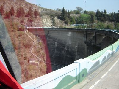
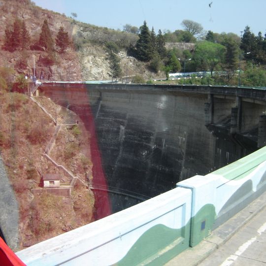
Los Molinos Dam is a concrete arch-gravity wall 60 m high from its foundations and 240 m long at the crest, standing at 769 m above sea level on the Los Molinos River in Córdoba Province. Its dark grey face is seamed by vertical joints, with a pale concrete crest and low railing above a shadowed basin; a reddish-brown rock face rises on the left bank.
Construction began in 1949 and the dam was inaugurated in October 1953, with the main works concluded in 1951. The Compensador La Quintana was added downstream in 1954, followed by the Los Molinos I powerhouse in 1957 and Los Molinos II in 1958. Together the two dams and two stations form the Los Molinos hydroelectric complex.
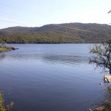
The reservoir is fished for pejerrey and used for swimming, water skiing and sailing. Three provincial routes border it: S-495 to the north, Route 5 to the east and S-271 to the west. The Costa Los Molinos green lung, 20 hectares at Tres Bahías, was inaugurated on 28 October 2024 to protect native flora and fauna, including the black woodpecker.
The reservoir is bordered by three provincial routes: S-495 along the north shore, Route 5 to the east and S-271 to the west. The dam crest is a flat concrete walkway with a low railing, reached from the road; the white barrier with the green wave pattern marks the pedestrian edge. The water is used for swimming, water skiing, sailing and silverside fishing.
The reservoir stores 307 hm³ drawn from a 980 km² catchment and covers 24.5 km², with a maximum depth of 57 m. Four rivers feed it from the west: San Pedro, Espinillos, del Medio and Los Reartes. Its outflow, the Los Molinos River, cuts through the low Cumbres de los Hinojos range before joining the Anisacate.
The community of curious travelers
AroundUs brings together thousands of curated places, local tips, and hidden gems, enriched daily by 92,713 contributors worldwide.