Río de la Plata Basin, Drainage basin in South America.
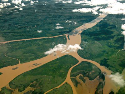
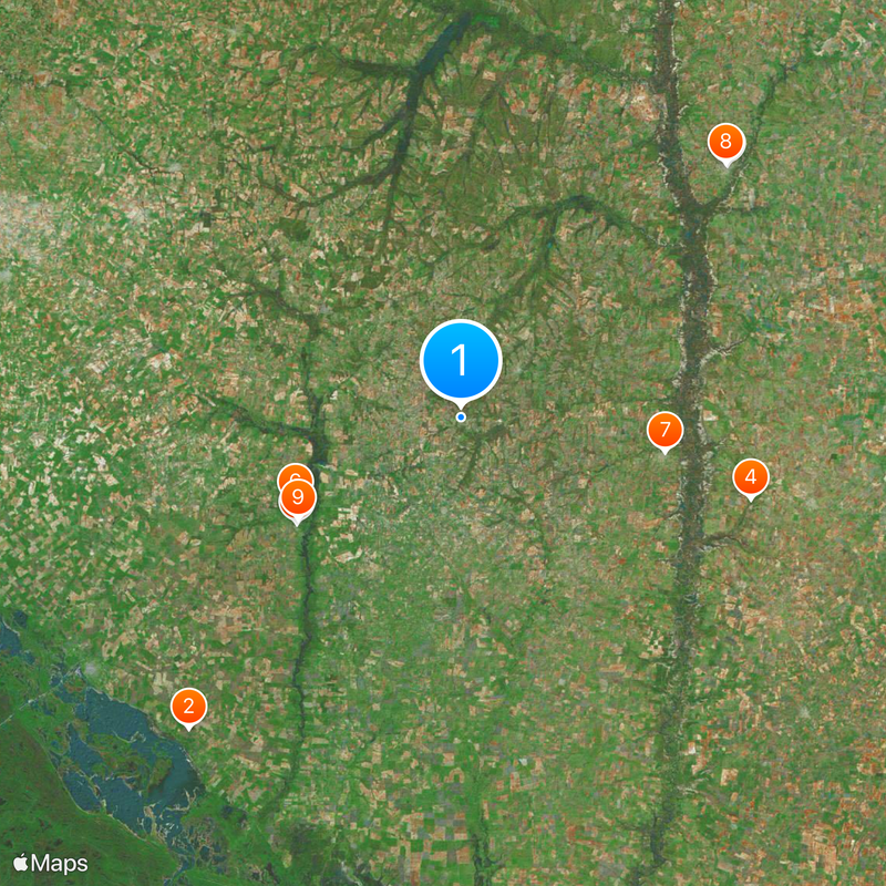
The Río de la Plata Basin is a network of rivers and tributaries that spreads across five South American countries, collecting water from highland regions and tropical forests before reaching the Atlantic coast. The Paraguay, Paraná, and Uruguay rivers form the main channels, converging near the wide estuary that gives the system its name.
Sebastián Caboto explored the region between 1526 and 1529, following the river routes in search of silver pathways into the interior. Later, the river network connected colonial trading posts and enabled transport of goods between the Atlantic and inland settlements.
The basin's rivers connect multiple indigenous territories and support traditional fishing communities that maintain centuries-old practices along its waterways.
The river areas are accessible through public paths and harbor facilities in major cities along the banks. Rainy season can raise water levels significantly, so checking local information about currents and ferry conditions is advisable.
The water cycle carries large amounts of fine sediment each year, helping to sustain the Guaraní Aquifer, one of the world's largest underground freshwater reserves. This hidden reservoir lies beneath four countries and supplies drinking water to millions of people.
The community of curious travelers
AroundUs brings together thousands of curated places, local tips, and hidden gems, enriched daily by 60,000 contributors worldwide.