Paranavaí, Agricultural municipality in Northwest Paraná, Brazil
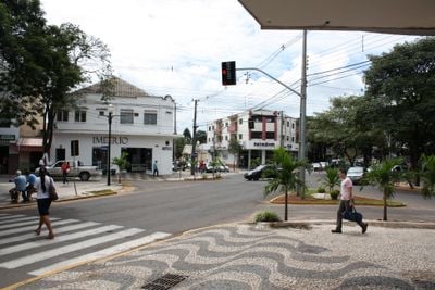
Paranavaí is an agricultural municipality in Northwest Paraná situated at approximately 425 meters elevation across fertile land spanning about 1,200 square kilometers. The region focuses primarily on cassava cultivation, citrus farming, and poultry production.
The municipality was officially established on December 14, 1952, during a period of major agricultural expansion in the region. This growth was connected to the influence of coffee cultivation from São Paulo that drove settlement northward.
The annual Music and Poetry Festival draws performers and artists from across Brazil to celebrate creative expression and regional talent. The event has become a gathering point for cultural exchange and artistic dialogue in the community.
The Edu Chaves Airport provides general aviation services while multiple highways connect the municipality to major economic centers throughout the state. Road access is straightforward for visitors traveling by car or bus.
The State College of Education, Science and Letters offers specialized programs in agricultural sciences and business management. The institution has become an important training center for vocational education in the region.
Location: Paraná
Inception: December 14, 1952
Elevation above the sea: 425 m
Shares border with: Alto Paraná, Amaporã, Euclides da Cunha Paulista, Guairaçá, Mirador, Nova Aliança do Ivaí, Santo Antônio do Caiuá, São João do Caiuá, Tamboara, Teodoro Sampaio, Terra Rica
Website: http://paranavai.pr.gov.br
GPS coordinates: -23.07278,-52.46500
Latest update: December 14, 2025 21:11
Morro do Diabo State Park
63.3 km
Morro do Diabo
64 km
Mico Leão Preto Ecological Station
40.9 kmCaiuá Ecological Station
65.7 kmParque Estadual de Amaporã
33.1 kmSítio Arqueológico da Redução Jesuítica de Nossa Senhora de Loreto
74.6 km
Encontro dos Rios
79 kmCachoeira da Serra do Diabo
52.1 kmMuseu Histórico, Antropológico e Etnográfico de Paranavaí
1.1 kmMuseu da Memória Regional
78.1 kmCasa da Cultura José Gonçalves de Queiroz
73.1 kmMuseu Municipal de Colorado
56.4 kmFundação Museu Histórico e Centro Cultural Professora Maria Aparecida da Silva Ayres
31.5 kmRecinto de Exposições de Loanda
72.3 kmEstatuas igreja catolica.
49.8 kmParque de Rodeio Benedito Ignácio Ribeiro
54.9 kmTeatro Municipal Dr. Altino Afonso Costa
1.4 kmAnfiteatro Avelino Antonio Colla
63.2 kmNossa Senhora
16.2 kmCasa da Cultura
32.2 kmBalneário Bono
64.2 kmGraffiti, Work of art
31.7 kmGraffiti, Work of art
31.7 kmWaterfall
59.3 kmWaterfall
50.7 kmWaterfall
45.5 kmWaterfall
44.4 kmCachoeira de Nova Aliança
16.6 kmVisited this place? Tap the stars to rate it and share your experience / photos with the community! Try now! You can cancel it anytime.
Discover hidden gems everywhere you go!
From secret cafés to breathtaking viewpoints, skip the crowded tourist spots and find places that match your style. Our app makes it easy with voice search, smart filtering, route optimization, and insider tips from travelers worldwide. Download now for the complete mobile experience.
A unique approach to discovering new places❞
— Le Figaro
All the places worth exploring❞
— France Info
A tailor-made excursion in just a few clicks❞
— 20 Minutes