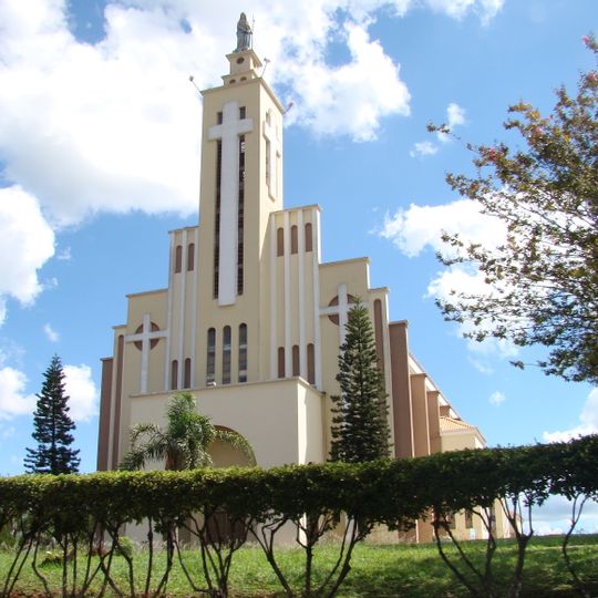
Laranjeiras do Sul, Municipality in central-western Paraná, Brazil
Laranjeiras do Sul extends across 671 square kilometers of land at an elevation of 817 meters in the state of Paraná.
The territory served as the capital of Iguaçu during a period of regional administrative reorganization in the Brazilian southern states.
The House of Memory and Culture Federal Territory of Iguassu contains furniture and artifacts from the 1940s within its heritage-listed structure.
The city connects to major urban centers through BR-277 and BR-158 highways, with a distance of 360 kilometers from the state capital Curitiba.
The Tigre River Waterfall offers opportunities for rappelling activities while maintaining a moderate water flow that permits safe exploration of the area.
Location: Paraná
Elevation above the sea: 817 m
Shares border with: Porto Barreiro, Rio Bonito do Iguaçu, Cantagalo, Marquinho, Nova Laranjeiras, Virmond
Website: http://laranjeirasdosul.pr.gov.br
GPS coordinates: -25.40778,-52.41583
Latest update: May 27, 2025 11:43
Iguazú National Park
173.1 km
Iguaçu National Park
204.9 km
Estádio Olímpico Regional Arnaldo Busatto
119.6 km
Reserva natural estricta San Antonio
153.6 km
Puente Internacional Comandante Rosales
188.2 km
Metropolitan Cathedral of Our Lady of Apparition, Cascavel
116.2 km
Araucárias National Park
157.6 km
Perobas Biological Reserve
176.2 km
Sierra de la Victoria
161.1 km
Our Lady of Bethlehem Cathedral, Guarapuava
95.6 km
Geoparque Horacio Foerster
157.6 km
Teatro Municipal de Toledo
154.1 km
Christ the King Cathedral, Toledo
153.2 km
Mata Preta Ecological Station
121.8 km
Casa-Sede da Fazenda Florestal
184.2 km
Museu Municipal Visconde de Guarapuava
95.6 km
Floresta Nacional de Irati
185 km
Parque Estadual Bosque das Araucárias
162.2 km
Casa do Visconde de Guarapuava
95.6 km
Igreja Nossa Senhora de Fátima
114.1 km
Iguazu National Park
189.7 km
Igreja do Arcanjo Miguel
172.4 km
Cathedral of St. Joseph, Campo Mourão
151.9 km
Cine Gracher Havan Porto União
162.4 km
Salto Sete
150.6 km
Obras de Poty Lazarotto - Painéis e Murais - Tibagi
201.1 km
Capela Santa Pastorina
202.9 km
Cathedral of the Sacred Heart of Jesus, União da Vitória
161.5 kmReviews
Visited this place? Tap the stars to rate it and share your experience / photos with the community! Try now! You can cancel it anytime.
Discover hidden gems everywhere you go!
From secret cafés to breathtaking viewpoints, skip the crowded tourist spots and find places that match your style. Our app makes it easy with voice search, smart filtering, route optimization, and insider tips from travelers worldwide. Download now for the complete mobile experience.
A unique approach to discovering new places❞
— Le Figaro
All the places worth exploring❞
— France Info
A tailor-made excursion in just a few clicks❞
— 20 Minutes