Enable Location

We need your location to show you interesting places around you

Discover nearby places

Find interesting locations and hidden gems around you

Precise directions

Get accurate directions and distances to places

Your location is never shared with other users. It's only used when you tap the location button.

Umuarama

Log in to your account

Start exploring — it's free

Trusted by 63,118 travelers worldwide

Continue with Google
Continue with Apple
or

We will send you a code to connect

By continuing, you accept our Terms and Conditions and our Privacy Policy

Check your inbox

We've sent a pincode in your inbox. Please enter the code below.

Discussion Reviews 1 Photos
54.2k Popularity

Umuarama, Regional administrative center in Paraná, Brazil

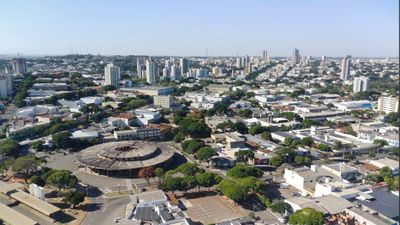
Umuarama is a large administrative center in the Paraná region of southern Brazil with multiple residential and commercial neighborhoods spread across its territory. The city sits at about 430 meters in elevation and houses various industrial, financial, and educational facilities that shape its economic life.

The Companhia Melhoramentos Norte do Paraná founded Umuarama on July 4, 1955 as part of its initiative to develop the Paraná region. This planned urban development shaped the city's structure and growth from its early days.

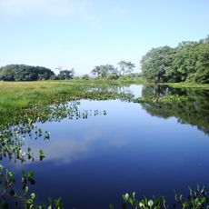
The city preserves its agricultural roots through regular street markets where local producers sell regional products, keeping the area's heritage alive.

The city is well-equipped for visitors with banks, hospitals, and schools distributed across different neighborhoods. The best time to explore is during warmer months when street markets are most active.

Estância Paris holds a surprising architectural feature: a scaled reproduction of the Eiffel Tower that stands among local structures. This unexpected element brings European design into the city's landscape.

The community of curious travelers

AroundUs brings together thousands of curated places, local tips, and hidden gems, enriched daily by 60,000 contributors worldwide.

Start exploring
Location
Inception
July 4, 1955
Elevation above the sea
430 m
Shares border with
Cruzeiro do Oeste, Maria Helena, Xambrê, Perobal, Alto Paraíso, Cafezal do Sul, Douradina, Icaraíma, Ivaté, Mariluz
GPS coordinates
-23.76583,-53.32500
Latest update
December 14, 2025 17:37
Reviews
Share your experience

No review yet

Discussions
Start a discussion...

No discussion yet

« Umuarama - Regional administrative center in Paraná, Brazil » is provided by Around Us (aroundus.com). Images and texts are derived from Wikimedia project under a Creative Commons license. You are allowed to copy, distribute, and modify copies of this page, under the conditions set by the license, as long as this note is clearly visible.

Discover hidden gems everywhere you go!

From secret cafés to breathtaking viewpoints, skip the crowded tourist spots and find places that match your style. Our app makes it easy with voice search, smart filtering, route optimization, and insider tips from travelers worldwide. Download now for the complete mobile experience.

Around Us App Screenshot

A unique approach to discovering new places

Le Figaro

All the places worth exploring

France Info

A tailor-made excursion in just a few clicks

20 Minutes

Around Us
Travel Guide & Maps
Download

Send to your phone

QR Code
1

Open the camera app on your mobile.

2

Point at the QR code with your camera. A notification will appear.

3

Tap the notification to open the link.