Enable Location

We need your location to show you interesting places around you

Discover nearby places

Find interesting locations and hidden gems around you

Precise directions

Get accurate directions and distances to places

Your location is never shared with other users. It's only used when you tap the location button.

Mineiros

Log in to your account

Start exploring — it's free

Trusted by 62,842 travelers worldwide

Continue with Google
Continue with Apple
or

We will send you a code to connect

By continuing, you accept our Terms and Conditions and our Privacy Policy

Check your inbox

We've sent a pincode in your inbox. Please enter the code below.

Mineiros, Agricultural municipality in southwestern Goiás, Brazil.

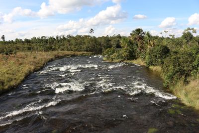
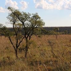
Mineiros is a municipality in southwestern Goiás, Brazil, spanning a large territory at an elevation of around 766 meters. The area is primarily agricultural and serves as a regional center for surrounding rural communities.

The municipality was founded in 1873 when explorers from Minas Gerais established the first settlements. It gained official municipal status in 1939, becoming administratively independent.

The city is shaped by farming traditions, where soybeans and corn are grown and cattle raising remains central to community life. These practices are woven into how people work and live together.

The municipality is accessible via BR-364 highway, located about 420 kilometers from the state capital Goiânia. Basic services are available on-site, including medical facilities for emergencies and routine care.

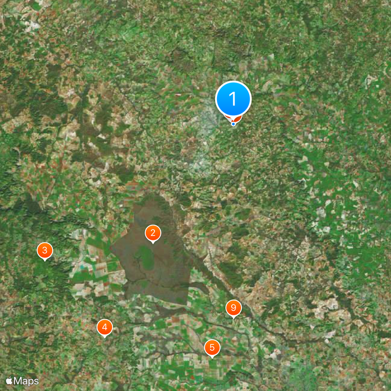
The municipal boundaries contain an unusual territorial feature where the municipality of Portelândia sits completely surrounded by Mineiros. This geographic arrangement is uncommon and makes the area distinctive on regional maps.

The community of curious travelers

AroundUs brings together thousands of curated places, local tips, and hidden gems, enriched daily by 60,000 contributors worldwide.

Start exploring
Location
Inception
1939
Elevation above the sea
766 m
Shares border with
Jataí, Chapadão do Céu, Alto Taquari, Araguainha, Caiapônia, Chapadão do Sul, Costa Rica, Doverlândia, Perolândia, Ponte Branca, Portelândia, Santa Rita do Araguaia, Serranópolis
GPS coordinates
-17.56889,-52.55083
Latest update
December 17, 2025 11:04
« Mineiros - Agricultural municipality in southwestern Goiás, Brazil » is provided by Around Us (aroundus.com). Images and texts are derived from Wikimedia project under a Creative Commons license. You are allowed to copy, distribute, and modify copies of this page, under the conditions set by the license, as long as this note is clearly visible.

Discover hidden gems everywhere you go!

From secret cafés to breathtaking viewpoints, skip the crowded tourist spots and find places that match your style. Our app makes it easy with voice search, smart filtering, route optimization, and insider tips from travelers worldwide. Download now for the complete mobile experience.

Around Us App Screenshot

A unique approach to discovering new places

Le Figaro

All the places worth exploring

France Info

A tailor-made excursion in just a few clicks

20 Minutes

Around Us
Travel Guide & Maps
Download

Send to your phone

QR Code
1

Open the camera app on your mobile.

2

Point at the QR code with your camera. A notification will appear.

3

Tap the notification to open the link.