Antonina, Historical port municipality in Paraná, Brazil
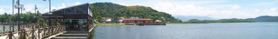
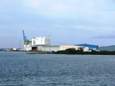
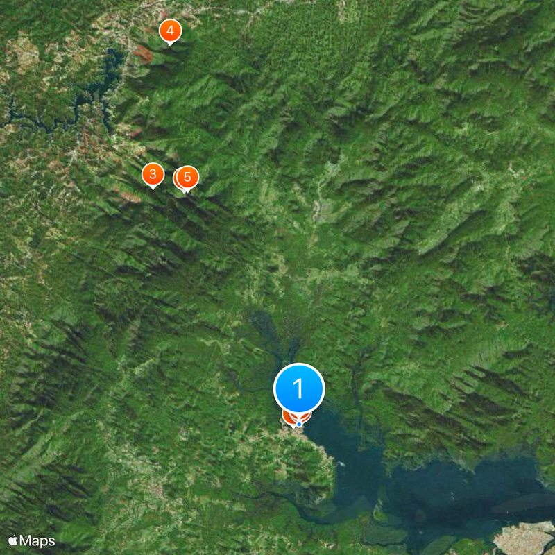
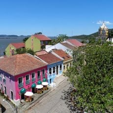
Antonina is a port municipality on Paraná's coast with a mix of built-up areas and protected natural reserves. The territory includes coastal land where urban neighborhoods sit alongside substantial protected ecosystems.
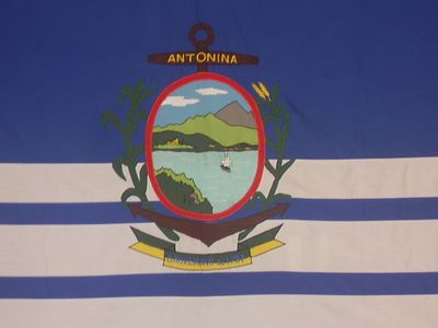
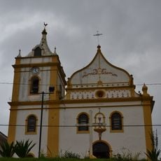
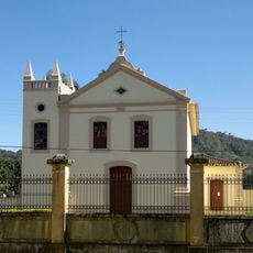
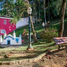
The town was founded in 1714 by Portuguese settlers and originally called Capela, reflecting its early religious importance. Over time, the port grew into a key trading point for the region.
The name Antonina honors a saint and reflects the religious roots of the settlement. Residents and visitors move through the coastal streets and squares where port traditions and daily maritime rhythms shape how the place feels.
The town sits about 80 kilometers from Curitiba and has basic services including hospitals, schools, and port facilities. Its coastal location means weather and tidal conditions affect travel planning, while proximity to the regional capital makes it reasonably accessible.
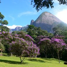
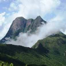
A large portion of the municipal territory is covered by a state protected area that preserves one of the region's most important forest ecosystems. This proximity between urban settlement and protected forest makes the place especially interesting for visitors interested in nature.
Location: Paraná
Inception: September 12, 1714
Elevation above the sea: 5 m
Shares border with: Paranaguá, Guaraqueçaba, Morretes, Campina Grande do Sul
Website: http://antonina.pr.gov.br
GPS coordinates: -25.42889,-48.71194
Latest update: December 20, 2025 13:46
Serra do Mar
22.2 kmPico Itapiroca
23.8 kmPico Capivari Grande
34.4 km
Pico Paraná State Park
22.1 km
Igreja do Nossa Senhora do Pilar
489 m
Igreja do Bom Jesus do Saivá
507 mAcervo da Farmácia Internacional de Antonina
157 m
Fonte da Carioca
203 mÁrea de Proteção Ambiental Guaraqueçaba (reserbasyon sa kinaiyahan sa Brasil, lat -25,26, long -48,62)
20.5 kmÁrea de Proteção Ambiental Guaraqueçaba (reserbasyon sa kinaiyahan sa Brasil, lat -25,39, long -48,66)
6.8 km
Historic center of Antonina
456 mPonte de Ferro
13.3 kmDiscoporto
23.3 kmVale do Gigante
22.5 kmLivro da Montanha Itapiroca
23.8 kmPonte Nova
13 kmPonte de Ferro (Ferroviária)
13.5 kmPrainha Bairro Alto
22.6 kmTrem Caiçara
454 mArmazém Macedo
428 mAntigo Abatedouro
1.6 kmCassino Abandonado de Morretes
8.9 kmChácara Colônia Cacatu
11.4 kmPasseio de Catamarã
508 mMirante Capivari Médio
33.5 kmMirante da Pedra
640 mMirante do Valente
341 mScenic viewpoint
24.1 kmVisited this place? Tap the stars to rate it and share your experience / photos with the community! Try now! You can cancel it anytime.
Discover hidden gems everywhere you go!
From secret cafés to breathtaking viewpoints, skip the crowded tourist spots and find places that match your style. Our app makes it easy with voice search, smart filtering, route optimization, and insider tips from travelers worldwide. Download now for the complete mobile experience.
A unique approach to discovering new places❞
— Le Figaro
All the places worth exploring❞
— France Info
A tailor-made excursion in just a few clicks❞
— 20 Minutes