Itumbiara Dam, Embankment dam and hydroelectric power station on the Paranaíba River between Goiás and Minas Gerais, Brazil
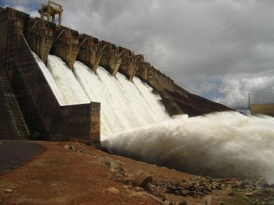
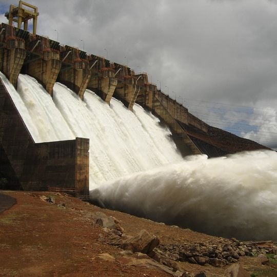
The Itumbiara Dam is a 7,000 m long, 106 m high earth-fill embankment dam on the Paranaíba River, with a concrete spillway and powerhouse section. Its spillway holds six floodgates, each 15 m wide and 9 m high, and the powerhouse is 223 m long and 25 m wide, housing six 347 MW Francis turbine generators. The concrete is grey and weathered, with dark vertical stains on the piers.
Studies from 1963 to 1965 by a US, Canadian and Brazilian consortium chose the site; the original lower design was raised, doubling output and cancelling two upstream dams. Work began in November 1974, the Paranaíba was diverted on 1 September 1976, and the reservoir began filling on 1 October 1979. The dam was finished in April 1980, with 97% of firms and 90% of supplies Brazilian.
The reservoir flooded 778 km² between Itumbiara, Goiás, and Araporã, Minas Gerais, so the plant and its lake sit on a state border. The lake stores 7.89% of the Southeast/Center-West system's reservable volume, per the national grid operator ONS. The name Itumbiara comes from the Tupi for a waterfall or rapids, the feature the dam replaced.
The dam lies on the Paranaíba River between Itumbiara, Goiás, and Araporã, Minas Gerais, reached from either municipality. The concrete spillway carries six floodgates, each 15 m wide and 9 m high, with a discharge capacity of 16,000 m³/s; the crest stands 106 m above the riverbed. The reservoir covers up to 778 km².
The facility switched to remote control operation in 1997, with a central control room hundreds of kilometers away monitoring power generation. This system allows the dam to be managed more efficiently with fewer staff stationed on-site.
The community of curious travelers
AroundUs brings together thousands of curated places, local tips, and hidden gems, enriched daily by 92,864 contributors worldwide.