Enable Location

We need your location to show you interesting places around you

Discover nearby places

Find interesting locations and hidden gems around you

Precise directions

Get accurate directions and distances to places

Your location is never shared with other users. It's only used when you tap the location button.

Rio Verde

Log in to your account

Start exploring — it's free

Trusted by 62,859 travelers worldwide

Continue with Google
Continue with Apple
or

We will send you a code to connect

By continuing, you accept our Terms and Conditions and our Privacy Policy

Check your inbox

We've sent a pincode in your inbox. Please enter the code below.

Rio Verde, Agricultural municipality in Goiás, Brazil.

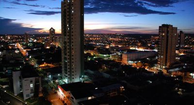
Rio Verde is a municipality in the state of Goiás, Brazil, covering broad plains and open farmland. The city sits in the southwest part of the state and serves as a center for agricultural activity in one of the most productive regions of the country.

The settlement formed in 1838 when the Brazilian government offered tax exemptions to attract new residents. The town received city status in 1882 and grew over the following decades into a trading hub for surrounding farms.

The municipal educational system supports 32,000 students through multiple institutions, including universities and vocational schools focused on agricultural sciences.

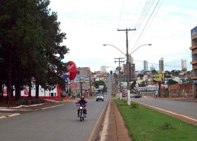
The city is accessible via highway BR-060, which connects it to the state capital Goiânia and other towns in the southwest. An airport outside the center offers connections to larger Brazilian cities for business travelers and visitors.

The area around the city saw gold discoveries in the 18th century, which drew an early wave of settlers. Today, sprawling fields of grain and oilseeds dominate the view instead, replacing the earlier search for precious metals with large-scale farming.

The community of curious travelers

AroundUs brings together thousands of curated places, local tips, and hidden gems, enriched daily by 60,000 contributors worldwide.

Start exploring
Location
Elevation above the sea
760 m
Shares border with
Aparecida do Rio Doce, Santa Helena de Goiás, Cachoeira Alta, Caiapônia, Castelândia, Jataí, Maurilândia, Montividiu, Paraúna, Quirinópolis, Santo Antônio da Barra
GPS coordinates
-17.79778,-50.92778
Latest update
December 13, 2025 12:31
« Rio Verde - Agricultural municipality in Goiás, Brazil » is provided by Around Us (aroundus.com). Images and texts are derived from Wikimedia project under a Creative Commons license. You are allowed to copy, distribute, and modify copies of this page, under the conditions set by the license, as long as this note is clearly visible.

Discover hidden gems everywhere you go!

From secret cafés to breathtaking viewpoints, skip the crowded tourist spots and find places that match your style. Our app makes it easy with voice search, smart filtering, route optimization, and insider tips from travelers worldwide. Download now for the complete mobile experience.

Around Us App Screenshot

A unique approach to discovering new places

Le Figaro

All the places worth exploring

France Info

A tailor-made excursion in just a few clicks

20 Minutes

Around Us
Travel Guide & Maps
Download

Send to your phone

QR Code
1

Open the camera app on your mobile.

2

Point at the QR code with your camera. A notification will appear.

3

Tap the notification to open the link.