Enable Location

We need your location to show you interesting places around you

Discover nearby places

Find interesting locations and hidden gems around you

Precise directions

Get accurate directions and distances to places

Your location is never shared with other users. It's only used when you tap the location button.

Sumidouro

Log in to your account

Start exploring — it's free

Trusted by 62,834 travelers worldwide

Continue with Google
Continue with Apple
or

We will send you a code to connect

By continuing, you accept our Terms and Conditions and our Privacy Policy

Check your inbox

We've sent a pincode in your inbox. Please enter the code below.

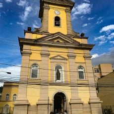
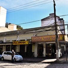
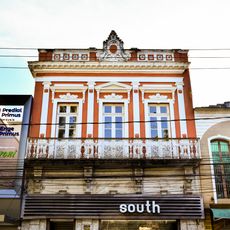
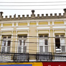
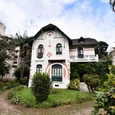
Sumidouro, Municipal district in Rio de Janeiro State, Brazil

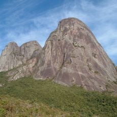
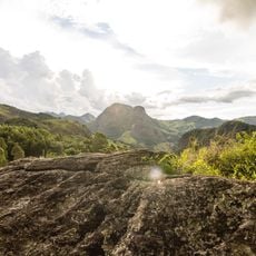
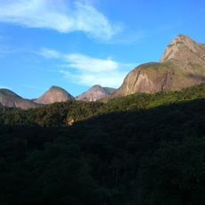
Sumidouro is a municipality in Rio de Janeiro State that encompasses mountainous terrain with numerous waterfalls and streams. The landscape is bounded by several neighboring communities and features forests alongside agricultural lands.

The municipality was officially founded on June 10, 1890, establishing itself as an independent administrative division. This creation was part of the inland development of Rio de Janeiro State during Brazil's early republican period.

The municipality is known for its farming heritage, with local producers cultivating vegetables and fruits that feed regional markets. This activity shapes the daily rhythm and identity of those who live here.

The area lies in hilly terrain and is best reached via local roads connecting Rio de Janeiro to the interior. Visitors should prepare for mountain terrain and bring sturdy footwear for outdoor exploration.

The Conde d'Eu Waterfall is a remarkable natural wonder that draws both locals and visitors seeking outdoor exploration. This cascade offers a hidden retreat for those wanting to experience the region's natural water features.

The community of curious travelers

AroundUs brings together thousands of curated places, local tips, and hidden gems, enriched daily by 60,000 contributors worldwide.

Start exploring
Location
Inception
1890
Elevation above the sea
355 m
Shares border with
Carmo, Duas Barras, Nova Friburgo, São José do Vale do Rio Preto, Sapucaia, Teresópolis
GPS coordinates
-22.05000,-42.67500
Latest update
December 7, 2025 20:25
Around this place
Três Picos State Park
Brazil

Três Picos State Park

42.1 km
Montanhas de Teresópolis Municipal Nature Park
Brazil

Montanhas de Teresópolis Municipal Nature Park

47.2 km
Praça Getúlio Vargas
Brazil

Praça Getúlio Vargas

29.6 km
Central Rio de Janeiro Atlantic Forest Mosaic
Brazil

Central Rio de Janeiro Atlantic Forest Mosaic

41 km
Macaé de Cima Environmental Protection Area
Brazil

Macaé de Cima Environmental Protection Area

46.2 km
Bacia do Rio Macacu Environmental Protection Area
Brazil

Bacia do Rio Macacu Environmental Protection Area

50.8 km
Bacia dos Frades Environmental Protection Area
Brazil

Bacia dos Frades Environmental Protection Area

34.1 km
Antiga Residência do Barão de Nova Friburgo
Brazil

Antiga Residência do Barão de Nova Friburgo

29.7 km
Cúria Metropolitana de Nova Friburgo
Brazil

Cúria Metropolitana de Nova Friburgo

29.6 km
Catedral Metropolitana de São João Batista
Brazil

Catedral Metropolitana de São João Batista

29.8 km
Prefeitura Municipal de Nova Friburgo
Brazil

Prefeitura Municipal de Nova Friburgo

30.3 km
Imóvel à Praça Demerval Barbosa Moreira, nº 45
Brazil

Imóvel à Praça Demerval Barbosa Moreira, nº 45

29.7 km
Imóvel à Praça Getúlio Vargas, nº 55
Brazil

Imóvel à Praça Getúlio Vargas, nº 55

29.7 km
Faculdade de Odontologia de Nova Friburgo
Brazil

Faculdade de Odontologia de Nova Friburgo

28.9 km
Correios
Brazil

Correios

29.6 km
Imóvel à Praça Getúlio Vargas, nº 126,128 e 130
Brazil

Imóvel à Praça Getúlio Vargas, nº 126,128 e 130

29.6 km
Sede da Legião Brasileira de Assistência
Brazil

Sede da Legião Brasileira de Assistência

29.8 km
Imóvel à Praça Demerval Barbosa Moreira, nº 36
Brazil

Imóvel à Praça Demerval Barbosa Moreira, nº 36

29.8 km
Imóvel à Praça Getúlio Vargas, nº 116 e 120
Brazil

Imóvel à Praça Getúlio Vargas, nº 116 e 120

29.6 km
Imóvel à Praça Getúlio Vargas, nº 84
Brazil

Imóvel à Praça Getúlio Vargas, nº 84

29.7 km
Imóvel à Praça Getúlio Vargas, nº 102
Brazil

Imóvel à Praça Getúlio Vargas, nº 102

29.6 km
Edifício Spinelli
Brazil

Edifício Spinelli

29.5 km
Imóvel à Praça Demerval Barbosa Moreira, nº 30
Brazil

Imóvel à Praça Demerval Barbosa Moreira, nº 30

29.8 km
Imóvel à Praça Getúlio Vargas, nº 88
Brazil

Imóvel à Praça Getúlio Vargas, nº 88

29.7 km
Imóvel à Praça Getúlio Vargas, nº 96
Brazil

Imóvel à Praça Getúlio Vargas, nº 96

29.6 km
Residência de Galdino do Valle Filho
Brazil

Residência de Galdino do Valle Filho

29.9 km
Coreto da praça João XXIII
Brazil

Coreto da praça João XXIII

32.6 km
Cine Show Cadima
Brazil

Cine Show Cadima

30.4 km
Show the full map
« Sumidouro - Municipal district in Rio de Janeiro State, Brazil » is provided by Around Us (aroundus.com). Images and texts are derived from Wikimedia project under a Creative Commons license. You are allowed to copy, distribute, and modify copies of this page, under the conditions set by the license, as long as this note is clearly visible.

Discover hidden gems everywhere you go!

From secret cafés to breathtaking viewpoints, skip the crowded tourist spots and find places that match your style. Our app makes it easy with voice search, smart filtering, route optimization, and insider tips from travelers worldwide. Download now for the complete mobile experience.

Around Us App Screenshot

A unique approach to discovering new places

Le Figaro

All the places worth exploring

France Info

A tailor-made excursion in just a few clicks

20 Minutes

Around Us
Travel Guide & Maps
Download

Send to your phone

QR Code
1

Open the camera app on your mobile.

2

Point at the QR code with your camera. A notification will appear.

3

Tap the notification to open the link.