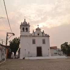
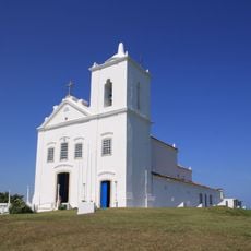
Rio Bonito, Municipality in Rio de Janeiro state, Brazil
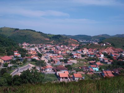
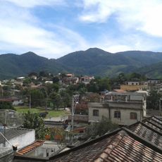
Rio Bonito is a municipality in Rio de Janeiro state located in southeastern Brazil amid rolling terrain and river valleys. The landscape features forests, farmland, and scattered residential areas connected by local roads that wind through the region.
Rio Bonito was established to support agricultural development in the region and became a local economic center over time. Its growth reflects the broader economic shifts that shaped the state of Rio de Janeiro.
Rio Bonito Atlético Clube represents the municipality in regional football competitions, bringing together local sports enthusiasts throughout the season.
The area is served by local roads connecting different neighborhoods and surrounding communities. Most services and facilities are centered in town and accessible by foot or local transportation.
The area contains forest sections that are part of a larger protection network in the Atlantic Forest ecosystem. These green spaces shape the landscape and support habitat for regional wildlife and plant species.
Location: Rio de Janeiro
Elevation above the sea: 40 m
Shares border with: Cachoeiras de Macacu, Araruama, Itaboraí, Saquarema, Silva Jardim, Tanguá
Website: http://riobonito.rj.gov.br
GPS coordinates: -22.70778,-42.62583
Latest update: December 6, 2025 22:09
Fazenda Colubandê
42.5 km
Três Picos State Park
37.2 km
Poço das Antas Biological Reserve
39.3 km
Costa do Sol State Park
52.4 km
Serra da Tiririca State Park
44.6 km
Central Rio de Janeiro Atlantic Forest Mosaic
32.7 km
Arraial do Cabo Marine Extractive Reserve
42.2 km
Guapi-Mirim Environmental Protection Area
37.8 km
Igreja de São José da Boa Morte
28.5 km
Guanabara Ecological Station
40 km
Macaé de Cima Environmental Protection Area
44.1 km
Bacia do Rio Macacu Environmental Protection Area
26.3 km
Guapi-Guapiaçú Environmental Protection Area
35 km
Área de Proteção Ambiental da Bacia do Rio São João - Mico Leão
34.5 km
Bacia dos Frades Environmental Protection Area
43.2 km
Serra do Barbosão Municipal Nature Park
12 km
Igreja de São João Batista
47.7 km
Capela de Nosso Senhor do Bonfim
42.7 km
Igreja Imaculada Conceição
43.6 km
Convento de São Boaventura
25.1 km
Igreja de Nossa Senhora da Piedade de Magepe
43.1 km
Igreja Matriz Nossa Senhora do Amparo
30.9 km
Fazenda do Engenho Novo
34.3 km
Casa de Câmara e Cadeia
30.8 km
Igreja Matriz de São João Batista
24.2 km
Igreja Matriz de Nossa Senhora de Nazaré
29 km
Cinemagic Araruama
34.7 km
Morro do Segredo
38.8 kmReviews
Visited this place? Tap the stars to rate it and share your experience / photos with the community! Try now! You can cancel it anytime.
Discover hidden gems everywhere you go!
From secret cafés to breathtaking viewpoints, skip the crowded tourist spots and find places that match your style. Our app makes it easy with voice search, smart filtering, route optimization, and insider tips from travelers worldwide. Download now for the complete mobile experience.
A unique approach to discovering new places❞
— Le Figaro
All the places worth exploring❞
— France Info
A tailor-made excursion in just a few clicks❞
— 20 Minutes