Enable Location

We need your location to show you interesting places around you

Discover nearby places

Find interesting locations and hidden gems around you

Precise directions

Get accurate directions and distances to places

Your location is never shared with other users. It's only used when you tap the location button.

Planaltina

Log in to your account

Start exploring — it's free

Trusted by 61,993 travelers worldwide

Continue with Google
Continue with Apple
or

We will send you a code to connect

By continuing, you accept our Terms and Conditions and our Privacy Policy

Check your inbox

We've sent a pincode in your inbox. Please enter the code below.

Planaltina, Administrative region in Federal District, Brazil.

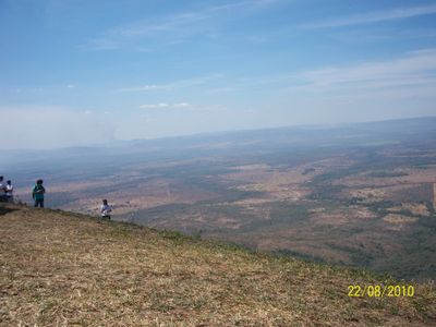
Planaltina is an administrative region covering roughly 1,500 square kilometers in eastern Goiás. The area includes both urban and rural zones, bordered by several neighboring settlements and serving as home to a growing population.

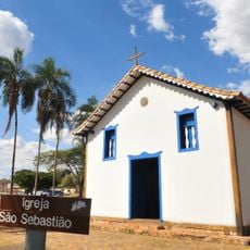
Settlement began in the late 18th century when José Gomes Rabelo founded a community near Lagoa Bonita lake and built a chapel dedicated to Saint Sebastian. This early foundation shaped the region's development into what it is today.

Multiple religious centers are found here, including the Vale do Amanhecer complex, which represents a distinct Brazilian spiritual movement. These places shape how residents experience their community and reflect the local spiritual diversity.

The region has a regional hospital offering multiple medical services and numerous schools serving different educational levels. Visitors will find more amenities and facilities in the urban areas, while rural sections are less developed.

In 1922, the Founding Stone marking the site of Brazil's future capital was placed near the region. This moment demonstrates the important connection between this area and the nation's expansion into the interior.

The community of curious travelers

AroundUs brings together thousands of curated places, local tips, and hidden gems, enriched daily by 60,000 contributors worldwide.

Start exploring
Location
Elevation above the sea
874 m
Shares border with
Água Fria de Goiás, Formosa, Mimoso de Goiás, Padre Bernardo
GPS coordinates
-15.45278,-47.61389
Latest update
December 20, 2025 14:34
« Planaltina - Administrative region in Federal District, Brazil » is provided by Around Us (aroundus.com). Images and texts are derived from Wikimedia project under a Creative Commons license. You are allowed to copy, distribute, and modify copies of this page, under the conditions set by the license, as long as this note is clearly visible.

Discover hidden gems everywhere you go!

From secret cafés to breathtaking viewpoints, skip the crowded tourist spots and find places that match your style. Our app makes it easy with voice search, smart filtering, route optimization, and insider tips from travelers worldwide. Download now for the complete mobile experience.

Around Us App Screenshot

A unique approach to discovering new places

Le Figaro

All the places worth exploring

France Info

A tailor-made excursion in just a few clicks

20 Minutes

Around Us
Travel Guide & Maps
Download

Send to your phone

QR Code
1

Open the camera app on your mobile.

2

Point at the QR code with your camera. A notification will appear.

3

Tap the notification to open the link.