Enable Location

We need your location to show you interesting places around you

Discover nearby places

Find interesting locations and hidden gems around you

Precise directions

Get accurate directions and distances to places

Your location is never shared with other users. It's only used when you tap the location button.

Uruaçu

Log in to your account

Start exploring — it's free

Trusted by 61,993 travelers worldwide

Continue with Google
Continue with Apple
or

We will send you a code to connect

By continuing, you accept our Terms and Conditions and our Privacy Policy

Check your inbox

We've sent a pincode in your inbox. Please enter the code below.

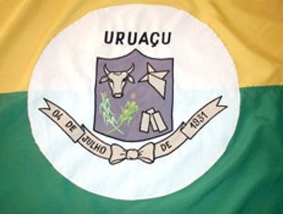
Uruaçu, Brazilian municipality in northern Goiás, Brazil.

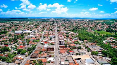
Uruaçu is a municipality in northern Goiás, located approximately 269 kilometers from the state capital of Goiânia along federal highway BR-153. The town sits at an elevation of 520 meters and contains residential areas, commercial establishments, and educational facilities distributed throughout the community.

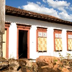
The settlement began in 1910 at the Passa Três ranch, where the Fernandes family built a chapel dedicated to Saint Anne in 1913. This religious structure marked the official start of organized settlement in the area.

The name comes from the Tupi-Guaraní language and means "large bird," connecting the place to the indigenous peoples who once inhabited this region. This linguistic heritage remains part of how locals understand their community's roots.

The municipality has schools and hospitals providing services to residents and visitors. Travel is generally easier during the drier months when local roads are in better condition.

Agriculture is a significant part of local life, with extensive farming and cattle raising across the countryside surrounding the municipality. These agricultural activities shape much of what visitors see when traveling through the region.

The community of curious travelers

AroundUs brings together thousands of curated places, local tips, and hidden gems, enriched daily by 60,000 contributors worldwide.

Start exploring
Location
Inception
1931
Elevation above the sea
520 m
Shares border with
Campinorte
GPS coordinates
-14.52500,-49.14083
Latest update
December 20, 2025 12:31
« Uruaçu - Brazilian municipality in northern Goiás, Brazil » is provided by Around Us (aroundus.com). Images and texts are derived from Wikimedia project under a Creative Commons license. You are allowed to copy, distribute, and modify copies of this page, under the conditions set by the license, as long as this note is clearly visible.

Discover hidden gems everywhere you go!

From secret cafés to breathtaking viewpoints, skip the crowded tourist spots and find places that match your style. Our app makes it easy with voice search, smart filtering, route optimization, and insider tips from travelers worldwide. Download now for the complete mobile experience.

Around Us App Screenshot

A unique approach to discovering new places

Le Figaro

All the places worth exploring

France Info

A tailor-made excursion in just a few clicks

20 Minutes

Around Us
Travel Guide & Maps
Download

Send to your phone

QR Code
1

Open the camera app on your mobile.

2

Point at the QR code with your camera. A notification will appear.

3

Tap the notification to open the link.