Ceres, Agricultural municipality in Goiás, Brazil
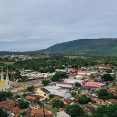
Ceres is a municipality in Goiás situated in a valley where farming dominates the landscape. The town serves as a hub for agricultural communities spread across the surrounding region.
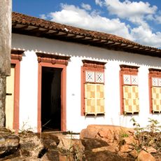
The settlement started in the 1940s as a planned agricultural colony to develop farming in the region. It later became a recognized municipality after a stable farming community took root here.
Farming families are woven into daily life here, with their work and knowledge shaping how the community functions. You can see this connection to the land everywhere, from how people spend their time to the food that appears in local markets.
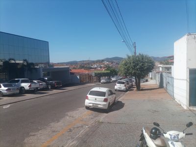
The town has shops, markets, and basic services for visitors and residents. You can experience everyday rural life by walking through the streets and exploring the local markets.
A river separates this town from a neighboring city while also joining them together, creating a unified urban area. This geographic feature shapes how the two communities relate to one another.
Location: Goiás
Inception: 1953
Elevation above the sea: 748 m
Shares border with: Rialma, Carmo do Rio Verde, Ipiranga de Goiás, Nova Glória, Rubiataba, São Patrício
GPS coordinates: -15.30778,-49.59778
Latest update: December 7, 2025 10:05
Historic Centre of the Town of Goiás
90.3 km
Parish Church of Our Lady of the Rosary
91.5 km
Museu Casa de Cora Coralina
90.6 km
Count of Arcos Palace
90.8 km
Museu das Bandeiras
91.1 km
Church of Our Lady of the Good Death
90.8 km
Historic center of Pirenópolis
91.5 km
Church of Our Lord of Bonfim
91.9 km
Church of Our Lady of Carmo
91.2 km
House of the Babilónia Estate
96 km
Church of Saint Francis of Paola
90.9 km
Parque Estadual da Serra de Jaraguá
61.7 km
Casa de Câmara e Cadeia
91.3 km
Museum of Sacred Art
90.8 km
Church of Saint John the Baptist
86.4 km
Largo do Chafariz
91 km
Church of Saint Barbara
90.6 km
Igreja de Nossa Senhora da Conceição
57.6 km
Conjunto arquitetônico e urbanístico da Rua João Pessoa, antiga da Fundição
90.8 km
Casa de Câmara e Cadeia
91.1 km
Igreja de Nossa Senhora do Rosário
57.6 km
Church of Our Lady of the Abbey
90.7 km
Cachoeira das Araras
76.8 km
Conjunto Arquitetônico e Urbanístico da Rua Sebastião Fleury Curado
90.7 km
Roman Catholic Cathedral of Goiás
90.8 km
Cachoeira do Abade
96.7 km
Fazenda Gleba Vargem I Private Natural Heritage Reserve
92.7 km
Casa com Janelas de Rótulas e Forro Pintado, na Rua da Cadeia
60.9 kmVisited this place? Tap the stars to rate it and share your experience / photos with the community! Try now! You can cancel it anytime.
Discover hidden gems everywhere you go!
From secret cafés to breathtaking viewpoints, skip the crowded tourist spots and find places that match your style. Our app makes it easy with voice search, smart filtering, route optimization, and insider tips from travelers worldwide. Download now for the complete mobile experience.
A unique approach to discovering new places❞
— Le Figaro
All the places worth exploring❞
— France Info
A tailor-made excursion in just a few clicks❞
— 20 Minutes