Bananal Island

Log in to your account

AroundUs is a community-driven map of interesting places, built by curious explorers like you. It grows with every review, story, and photo you share.
Connect to save your favorite spots, contribute locations, and create personalized routes.
Continue with Google
Continue with Apple
Continue with X
Continue with Facebook
Continue with email
By continuing, you accept our Terms and Conditions and our Privacy Policy
Create an account
Add to collection
Map
Suggest a change
Share

Bananal Island, River island in Tocantins, Brazil

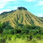
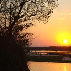
Bananal Island is an expansive river island in the Araguaia River in central Brazil, measuring roughly 400 kilometers long and 120 kilometers wide. Its landscape contains numerous lakes and sits between two river channels.

Araguaia National Park was established in 1959 to protect the northern section and its natural resources. This designation marked a key step in safeguarding the island's river environment.

Indigenous groups including the Javaés and Karajá have established settlements here and continue their traditional practices within this landscape. Their presence shapes how the island is inhabited and used by those who live there today.

Access typically requires boat transportation, except during the dry season when vehicles can cross the river. Visitors should expect changing conditions and check seasonal information before traveling.

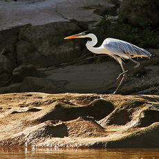
The island experiences around six months of annual flooding, creating a natural environment for fishing. This makes it a noted destination for both commercial and recreational anglers.

Location: Tocantins

Elevation above the sea: 189 m

GPS coordinates: -11.33333,-50.41667

Latest update: December 21, 2025 16:05

Photos
Natural wonders and heritage sites in northern Brazil

Northern Brazil holds a range of natural areas and historical sites away from the usual tourist paths. The region stretches from the Amazon basin to the wide plateaus of the Cerrado, offering waterfalls, clear springs, sand dunes, canyons, and caves. Protected areas such as Jalapão State Park and...

Natural areas of central west Brazil: waterfalls, caves, national parks

The central west region of Brazil encompasses states including Goiás, Mato Grosso and Mato Grosso do Sul. These areas contain national parks with hiking trails, waterfalls and cave systems. Chapada dos Veadeiros National Park near Alto Paraíso de Goiás displays cerrado vegetation and rock...

Reviews

Visited this place? Tap the stars to rate it and share your experience / photos with the community! Try now! You can cancel it anytime.

« Bananal Island - River island in Tocantins, Brazil » is provided by Around Us (aroundus.com). Images and texts are derived from Wikimedia project under a Creative Commons license. You are allowed to copy, distribute, and modify copies of this page, under the conditions set by the license, as long as this note is clearly visible.

Discover hidden gems everywhere you go!

From secret cafés to breathtaking viewpoints, skip the crowded tourist spots and find places that match your style. Our app makes it easy with voice search, smart filtering, route optimization, and insider tips from travelers worldwide. Download now for the complete mobile experience.

Around Us App Screenshot

A unique approach to discovering new places

Le Figaro

All the places worth exploring

France Info

A tailor-made excursion in just a few clicks

20 Minutes