Catimbau National Park, National park in Pernambuco, Brazil
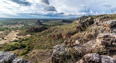
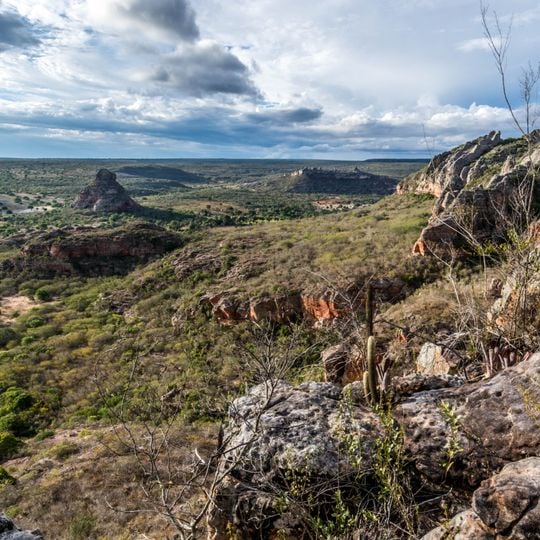
Catimbau National Park covers 62,294 hectares across Buíque, Ibimirim and Tupanatinga in Pernambuco, between the agreste and sertão zones. Its landscape mixes flat-topped sandstone tablelands, canyons and more than 2,000 caves, with elevations from 350 to 1,100 metres. The sandstone of the Tacaratu Formation shows bands of white, red, ochre, lilac and yellow.
The park was created on 13 December 2002 with an area of 62,294.14 hectares, administered by ICMBio. Its more than 42 catalogued archaeological sites, including Alcobaça's amphitheatre-shaped rock wall, hold paintings of the Nordeste Tradition dated to at least 6,000 years ago; IPHAN lists the area as national archaeological heritage. In May 2006 it joined the Caatinga Ecological Corridor.
The name Catimbau is usually linked to catimbó, a ritual of shamans and healers of indigenous descent, so the valley's name is read as Valley of Prayer and Healing. The park adjoins the Kapinawá Indigenous Territory to the south, and some indigenous communities in the west lost land when the park was created in 2002.
Hikes usually start early in the morning to avoid the heat and take several hours depending on the route, with breaks in shaded spots. Sturdy footwear and plenty of water are necessary, as the paths are rocky and shade is rare.
Some caves have temperature differences of several degrees compared to the outside air and offer natural cooling during the hottest hours. The reddish color of the rock changes throughout the day depending on the light, creating shifting hues.
The community of curious travelers
AroundUs brings together thousands of curated places, local tips, and hidden gems, enriched daily by 92,827 contributors worldwide.