Enable Location

We need your location to show you interesting places around you

Discover nearby places

Find interesting locations and hidden gems around you

Precise directions

Get accurate directions and distances to places

Your location is never shared with other users. It's only used when you tap the location button.

Afogados da Ingazeira

Log in to your account

Join the adventure

Create your free account and start exploring (like 60k+ others)

We will send you a code to connect

or
Continue with Google
Continue with Apple
By continuing, you accept our Terms and Conditions and our Privacy Policy

Check your inbox

We've sent a pincode in your inbox. Please enter the code below.

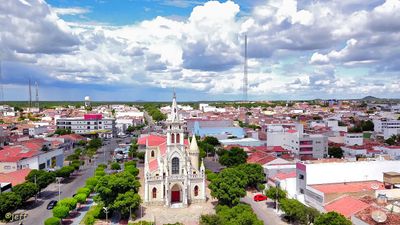
Afogados da Ingazeira, Administrative municipality in Pernambuco, Brazil

Description

Afogados da Ingazeira is a Brazilian municipality in Pernambuco situated at 554 meters (1,820 feet) elevation in the semi-arid Sertão region of the northeast. The territory covers roughly 377 square kilometers in an area marked by rural settlements and agricultural traditions.

History

The municipality was established on July 1, 1909, emerging from a settlement near the Pajeú River in the interior. It grew to become a significant administrative hub that has shaped the region's development.

Culture

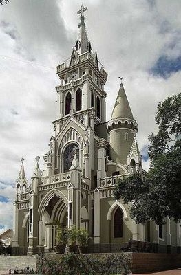
The Cathedral of Senhor Bom Jesus dos Remedios anchors the spiritual life of the town as the seat of its Roman Catholic Diocese. It reflects the deep Catholic tradition that shapes how the community comes together and celebrates.

Practical

The municipal administration provides public services through its City Council, with information available through the local government portal. The best time to visit is outside the dry season when the landscape is greener and the climate is more manageable.

Did you know?

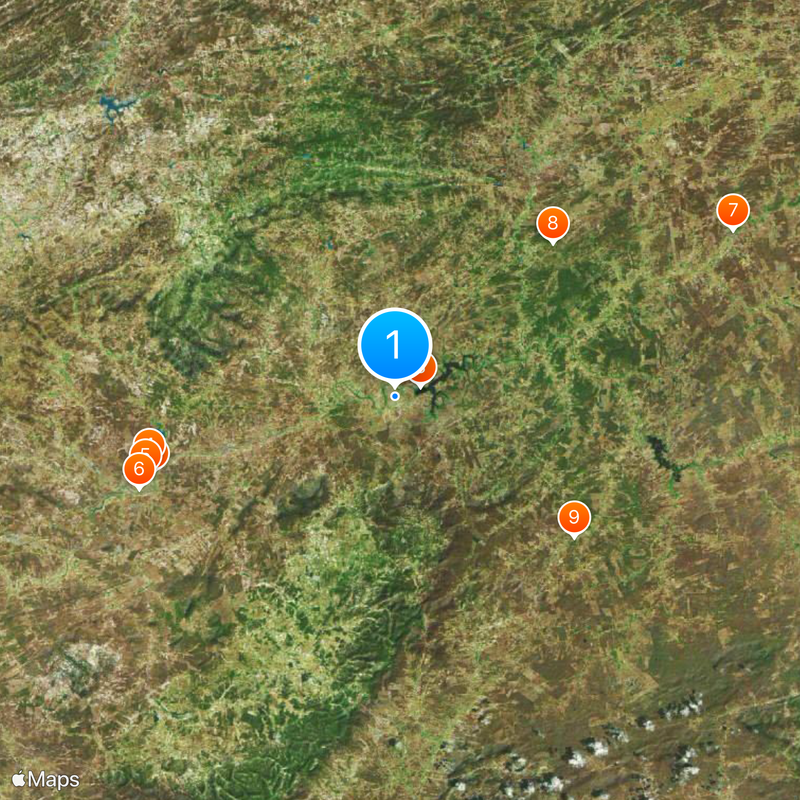
The region maintains one of the highest development indices in the Alto do Pajeú area, standing out as a relatively prosperous zone within the arid Sertão. This level of wellbeing is surprising for such a remote corner of the northeast.

Location
Elevation above the sea
554 m
Shares border with
Solidão, Carnaíba, Iguaraci, Tabira
GPS coordinates
-7.75083,-37.63417
Latest update
December 19, 2025 22:21

AroundUs brings together thousands of curated places, local tips, and hidden gems, enriched daily by 60,000 contributors worldwide. Discover all places nearby (Pernambuco).

« Afogados da Ingazeira - Administrative municipality in Pernambuco, Brazil » is provided by Around Us (aroundus.com). Images and texts are derived from Wikimedia project under a Creative Commons license. You are allowed to copy, distribute, and modify copies of this page, under the conditions set by the license, as long as this note is clearly visible.

Discover hidden gems everywhere you go!

From secret cafés to breathtaking viewpoints, skip the crowded tourist spots and find places that match your style. Our app makes it easy with voice search, smart filtering, route optimization, and insider tips from travelers worldwide. Download now for the complete mobile experience.

Around Us App Screenshot

A unique approach to discovering new places

Le Figaro

All the places worth exploring

France Info

A tailor-made excursion in just a few clicks

20 Minutes

Around Us
Travel Guide & Maps
Download

Send to your phone

QR Code
1

Open the camera app on your mobile.

2

Point at the QR code with your camera. A notification will appear.

3

Tap the notification to open the link.