Enable Location

We need your location to show you interesting places around you

Discover nearby places

Find interesting locations and hidden gems around you

Precise directions

Get accurate directions and distances to places

Your location is never shared with other users. It's only used when you tap the location button.

Guaramiranga

Log in to your account

Start exploring — it's free

Trusted by 62,031 travelers worldwide

Continue with Google
Continue with Apple
or

We will send you a code to connect

By continuing, you accept our Terms and Conditions and our Privacy Policy

Check your inbox

We've sent a pincode in your inbox. Please enter the code below.

Guaramiranga, Mountain municipality in Serra de Baturité, Brazil

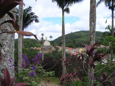
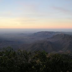
Guaramiranga is a mountain municipality in Serra de Baturité located approximately 110 kilometers from Fortaleza at an elevation of 865 meters. The region benefits from moderate temperatures ranging between 15 and 23 degrees Celsius year-round, creating a cool climate compared to the coastal areas below.

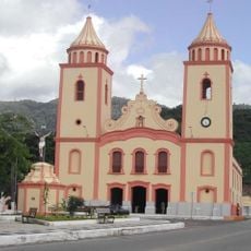
The area was originally inhabited by the Tarariús indigenous people before being officially established as a municipality on September 1, 1890. This founding marked the beginning of formal administrative organization in the state of Ceará.

The town hosts a Jazz & Blues Festival during Carnival season and the Ceará Fest Flores in November, bringing together musicians and artists from various backgrounds. These gatherings shape the local cultural rhythm and give visitors a chance to experience the music and art that matter to the community.

Several hotels and guesthouses operate in town, including Hotel Vale das Nuvens and Pousada Raízes, offering comfortable lodging for visitors. The elevated location brings cooler temperatures, so bringing a light jacket or sweater is sensible, especially in the evening hours.

An aeronautic museum at the entrance displays an Embraer AT-26 Xavante aircraft, a rare military plane from a unit that operated from 1973 to 2018. This unusual centerpiece tells a chapter of Brazilian aviation history that few visitors expect to find in this mountain town.

The community of curious travelers

AroundUs brings together thousands of curated places, local tips, and hidden gems, enriched daily by 60,000 contributors worldwide.

Start exploring
Location
Elevation above the sea
865 m
Shares border with
Baturité, Caridade, Mulungu, Pacoti
GPS coordinates
-4.26278,-38.93278
Latest update
December 17, 2025 11:23
« Guaramiranga - Mountain municipality in Serra de Baturité, Brazil » is provided by Around Us (aroundus.com). Images and texts are derived from Wikimedia project under a Creative Commons license. You are allowed to copy, distribute, and modify copies of this page, under the conditions set by the license, as long as this note is clearly visible.

Discover hidden gems everywhere you go!

From secret cafés to breathtaking viewpoints, skip the crowded tourist spots and find places that match your style. Our app makes it easy with voice search, smart filtering, route optimization, and insider tips from travelers worldwide. Download now for the complete mobile experience.

Around Us App Screenshot

A unique approach to discovering new places

Le Figaro

All the places worth exploring

France Info

A tailor-made excursion in just a few clicks

20 Minutes

Around Us
Travel Guide & Maps
Download

Send to your phone

QR Code
1

Open the camera app on your mobile.

2

Point at the QR code with your camera. A notification will appear.

3

Tap the notification to open the link.