Chest opened
+${chestReward.xp} XP
Explorer
NOUVEAU ×${chestReward.collectible.quantity}
tapez pour fermer
Chest locked

Open chests in the app

Around Us is built for your phone — chests unlock when you walk, explore and capture nearby places.

Enable Location

We need your location to show you interesting places around you

Discover nearby places

Find interesting locations and hidden gems around you

Precise directions

Get accurate directions and distances to places

Your location is never shared with other users. It's only used when you tap the location button.

Saint Helena Airport

Log in to your account

Start exploring — it's free

Trusted by 73,008 travelers worldwide

Continue with Google
Continue with Apple
or

We will send you a code to connect

By continuing, you accept our Terms and Conditions and our Privacy Policy

Check your inbox

We've sent a pincode in your inbox. Please enter the code below.

Discussion Reviews 1 Photos
119k Popularity

Saint Helena Airport, International airport in Saint Helena, South Atlantic Ocean

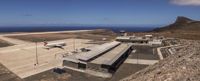
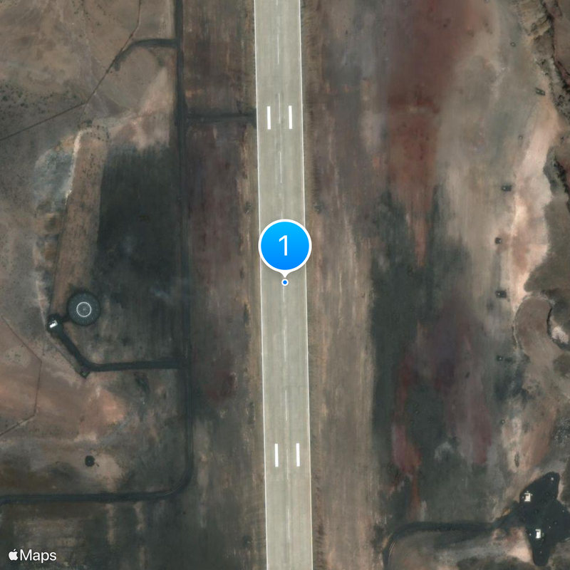
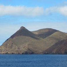
Saint Helena Airport sits on a plateau about 1,000 feet (300 meters) above sea level and features a concrete runway that runs along steep cliffs. The runway measures nearly 2 kilometers in length and offers open views over the South Atlantic.

Planning for the project began in the early 2000s, and construction started in 2011 through a South African contractor. Regular commercial operations only commenced in 2017 after pilots spent several years studying local wind conditions.

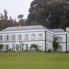
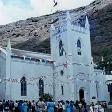
Residents can now greet friends and family after a flight of a few hours instead of a voyage lasting several days by ship. Many older inhabitants still remember when the arrival of a mail ship represented a social event for the entire community.

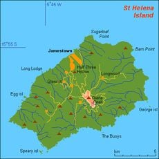
A weekly flight service connects the island with Johannesburg, with some flights also including Cape Town or Ascension Island during certain months. The drive from Jamestown to the terminal takes about half an hour on winding roads.

Engineers had to fill an entire valley with rock and earth to create a level surface for construction. This terrain was formerly known as Dry Gut and formed a deep ravine between two ridges in the island interior.

The community of curious travelers

AroundUs brings together thousands of curated places, local tips, and hidden gems, enriched daily by 60,000 contributors worldwide.

Start exploring
Location
Inception
May 2016
Official opening
October 14, 2017
Elevation above the sea
309 m
Operator
Saint Helena Airport Ltd
GPS coordinates
-15.95906,-5.64592
Latest update
December 16, 2025 14:15
Around this place
Longwood House
Saint Helena, Ascension and Tristan da Cunha

Longwood House

4.1 km
Jacob's Ladder
United Kingdom

Jacob's Ladder

8.7 km
Valley of the Tomb
United Kingdom

Valley of the Tomb

5.6 km
Briars, Saint Helena
Saint Helena, Ascension and Tristan da Cunha

Briars, Saint Helena

7.1 km
Plantation House
United Kingdom

Plantation House

8 km
Diana's Peak
Saint Helena, Ascension and Tristan da Cunha

Diana's Peak

6 km
Museum of St Helena
Saint Helena, Ascension and Tristan da Cunha

Museum of St Helena

8.7 km
Saint Paul's Cathedral
United Kingdom

Saint Paul's Cathedral

8 km
The Castle
United Kingdom

The Castle

8.6 km
Saint James, Jamestown
United Kingdom

Saint James, Jamestown

8.6 km
Saint John's Church
United Kingdom

Saint John's Church

7.6 km
Sandy Bay Chapel
United Kingdom

Sandy Bay Chapel

8 km
Saint Helena, Ascension and Tristan da Cunha

Cuckholds Point

6 km
Saint Helena, Ascension and Tristan da Cunha

James Bay Range Front Lighthouse

8.8 km
Saint Helena, Ascension and Tristan da Cunha

The Haystack

4.7 km
Sugarloaf Crack
Saint Helena, Ascension and Tristan da Cunha

Sugarloaf Crack

8.2 km
Saint Helena, Ascension and Tristan da Cunha

James Bay Range Rear Lighthouse

8.7 km
Saint Helena, Ascension and Tristan da Cunha

Tortoise viewing corridor

8.1 km
Saint Helena, Ascension and Tristan da Cunha

Turks Cap

3.3 km
Saint Helena, Ascension and Tristan da Cunha

Arco

8.6 km
Saint Helena, Ascension and Tristan da Cunha

Lot

8.7 km
Saint Helena, Ascension and Tristan da Cunha

Cenotaph

8.7 km
Saint Helena, Ascension and Tristan da Cunha

Bank's Battery

8.4 km
Saint Helena, Ascension and Tristan da Cunha

Ruins

2.1 km
Saint Helena, Ascension and Tristan da Cunha

Ruins

2.1 km
Saint Helena, Ascension and Tristan da Cunha

Waterfall

1.2 km
Saint Helena, Ascension and Tristan da Cunha

Waterfall

1.1 km
Saint Helena, Ascension and Tristan da Cunha

The Heart Shaped Waterfall

7.6 km
Show the full map
Reviews
Share your experience

No review yet

Discussions
Start a discussion...

No discussion yet

« Saint Helena Airport - International airport in Saint Helena, South Atlantic Ocean » is provided by Around Us (aroundus.com). Images and texts are derived from Wikimedia project under a Creative Commons license. You are allowed to copy, distribute, and modify copies of this page, under the conditions set by the license, as long as this note is clearly visible.

Discover hidden gems everywhere you go!

From secret cafés to breathtaking viewpoints, skip the crowded tourist spots and find places that match your style. Our app makes it easy with voice search, smart filtering, route optimization, and insider tips from travelers worldwide. Download now for the complete mobile experience.

Around Us App Screenshot

A unique approach to discovering new places

Le Figaro

All the places worth exploring

France Info

A tailor-made excursion in just a few clicks

20 Minutes

Around Us
Travel Guide & Maps
Download

Send to your phone

QR Code
1

Open the camera app on your mobile.

2

Point at the QR code with your camera. A notification will appear.

3

Tap the notification to open the link.