Great Escarpment, Geological escarpment in Southern Africa.
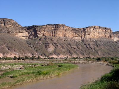
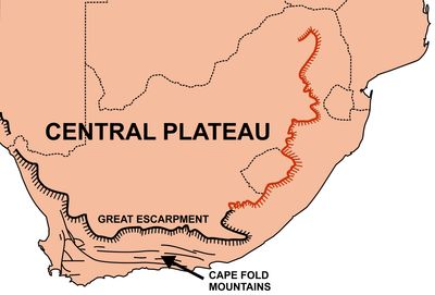
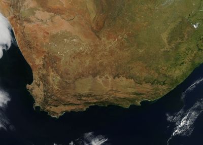
The Great Escarpment is a steep cliff face and mountain ridge system stretching over 1000 kilometers along South Africa's coastal regions, marking a dramatic shift in elevation. The formation transitions between sheer drops, rocky ridges, and sloped terrain as it traces a line from east to west across the landscape.
The formation emerged roughly 180 million years ago when deep heat from Earth's interior caused the continental crust to dome upward across southern Africa. This geological shift created the foundational structure that continues to shape the land today.
Different sections carry names rooted in the languages and histories of South African communities who have lived alongside these cliffs for generations. Travelers encounter these regional names on maps and signposts, showing how the land remains woven into local life and identity.
Multiple hiking trails cross different sections, offering visitors various entry points and levels of difficulty to explore the terrain and native plants. The best seasons for walking are spring and fall, when weather conditions are favorable and views reach across the widest distances.
The highest points of the formation reach about 3000 meters elevation, creating a natural barrier between lowlands and interior plateaus, and visitors can experience rapid weather shifts as they climb. Within a short distance, the climate can change from warm and humid to cool and windy, revealing how dramatically the altitude affects local conditions.
The community of curious travelers
AroundUs brings together thousands of curated places, local tips, and hidden gems, enriched daily by 60,000 contributors worldwide.